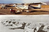
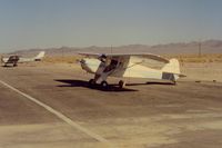
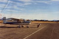
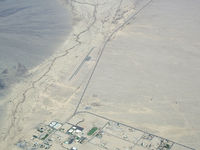
Latest photos of Baker Airport (0O2)
-
 by S B J
-
 by S B J
-
 by S B J
-
 by COOL LAST SAMURAI
Location & QuickFacts
| FAA Information Effective: | 2013-12-12 |
| Airport Identifier: | 0O2 |
| Airport Status: | Operational |
| Longitude/Latitude: | 116-04-52.9000W/35-17-10.6000N
-116.081361/35.286278 (Estimated) |
| Elevation: | 922 ft / 281.03 m (Surveyed) |
| Land: | 240 acres |
| From nearest city: | 2 nautical miles NW of Baker, CA |
| Location: | San Bernardino County, CA |
| Magnetic Variation: | 14E (1985) |
Owner & Manager
| Ownership: | Publicly owned |
| Owner: | Us Dept Of Interior-blm
ON LEASE TO COUNTY OF SAN BERNARDINO. |
| Address: | Barstow Field Office, 2601 Barstow Road
Barstow, CA 92311 |
| Phone number: | 619-256-3591 |
| Manager: | Terry Stover
AMGR OFFICE LCTD AT APPLE VALLEY AIRPORT. |
| Address: | 21600 Corwin Road
Apple Valley, CA 92307 |
| Phone number: | 760-247-2371 |
Airport Operations and Facilities
| Airport Use: | Open to public |
| Wind indicator: | Yes |
| Segmented Circle: | Yes |
| Control Tower: | No |
| Lighting Schedule: | SEE RMK
ACTIVATE MIRL RY 15/33 CTAF. |
| Beacon Color: | Clear-Green (lighted land airport) |
| Landing fee charge: | No |
| Sectional chart: | Los Angeles |
| Region: | AWP - Western-Pacific |
| Traffic Pattern Alt: | 1000 ft |
| Boundary ARTCC: | ZLA - Los Angeles |
| Tie-in FSS: | RAL - Riverside |
| FSS on Airport: | No |
| FSS Toll Free: | 1-800-WX-BRIEF |
| NOTAMs Facility: | RAL (NOTAM-d service avaliable) |
Airport Services
| Airframe Repair: | NONE |
| Power Plant Repair: | NONE |
| Bottled Oxygen: | NONE |
| Bulk Oxygen: | NONE |
Runway Information
Runway 15/33
| Dimension: | 3157 x 50 ft / 962.3 x 15.2 m |
| Surface: | ASPH, Poor Condition |
| Edge Lights: | Medium |
| |
Runway 15 |
Runway 33 |
| Longitude: | 116-04-57.6284W | 116-04-48.1234W |
| Latitude: | 35-17-25.7305N | 35-16-55.4871N |
| Alignment: | 127 | 127 |
| Traffic Pattern: | Left | Right |
| Markings: | Basic, Good Condition | Basic, Good Condition |
| Runway End Identifier: | No | No |
| Centerline Lights: | No | No |
| Touchdown Lights: | No | No |
| Obstruction: | , 50:1 slope to clear | 80 ft pline, 1925.0 ft from runway, 94 ft left of centerline, 21:1 slope to clear |
Radio Navigation Aids
| ID |
Type |
Name |
Ch |
Freq |
Var |
Dist |
| DAG | VORTAC | Daggett | 079X | 113.20 | 15E | 31.2 nm |
| HEC | VORTAC | Hector | 074X | 112.70 | 15E | 34.9 nm |
| GFS | VORTAC | Goffs | 091X | 114.40 | 15E | 45.4 nm |