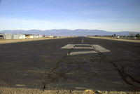
Latest photos of Los Alamos Airport (LAM)
-
 by K Gross
-
 by K Gross
Location & QuickFacts
| FAA Information Effective: | 2013-12-12 |
| Airport Identifier: | LAM |
| Airport Status: | Operational |
| Longitude/Latitude: | 106-16-07.2700W/35-52-46.8700N
-106.268686/35.879686 (Estimated) |
| Elevation: | 7171 ft / 2185.72 m (Surveyed) |
| Land: | 89 acres |
| From nearest city: | 1 nautical miles E of Los Alamos, NM |
| Location: | Los Alamos County, NM |
| Magnetic Variation: | 10E (2005) |
Owner & Manager
| Ownership: | Publicly owned |
| Owner: | County Of Los Alamos |
| Address: | 133 Central Park Square
Los Alamos, NM 87544 |
| Phone number: | 505-663-1750 |
| Manager: | Peter Soderquist |
| Address: | 1040 Airport Rd
Los Alamos, NM 87544 |
| Phone number: | 505-662-8420 |
Airport Operations and Facilities
| Airport Use: | Open to public |
| Wind indicator: | Yes |
| Segmented Circle: | Yes |
| Control Tower: | No |
| Lighting Schedule: | SEE RMK
ACTVT MIRL RY 09/27 & REIL RY 27 - CTAF. |
| Beacon Color: | Clear-Green (lighted land airport) |
| Landing fee charge: | No |
| Sectional chart: | Denver |
| Region: | ASW - Southwest |
| Boundary ARTCC: | ZAB - Albuquerque |
| Tie-in FSS: | ABQ - Albuquerque |
| FSS on Airport: | No |
| FSS Toll Free: | 1-800-WX-BRIEF |
| NOTAMs Facility: | LAM (NOTAM-d service avaliable) |
| Federal Agreements: | N |
Airport Communications
| CTAF: | 123.000 |
| Unicom: | 123.000 |
Airport Services
| Fuel available: | 100LL |
| Airframe Repair: | MINOR |
| Power Plant Repair: | MINOR |
Runway Information
Runway 09/27
| Dimension: | 6000 x 120 ft / 1828.8 x 36.6 m |
| Surface: | ASPH, Fair Condition |
| Surface Treatment: | Porous Friction Course |
| Weight Limit: | Single wheel: 43000 lbs. |
| Edge Lights: | Medium |
| |
Runway 09 |
Runway 27 |
| Longitude: | 106-16-42.8810W | 106-15-31.6670W |
| Latitude: | 35-52-53.2370N | 35-52-40.4920N |
| Elevation: | 7171.00 ft | 7080.00 ft |
| Alignment: | 102 | 127 |
| Traffic Pattern: | Left | Right |
| Markings: | Basic, Good Condition | Non-precision instrument, Good Condition |
| Crossing Height: | 0.00 ft | 45.00 ft |
| VASI: | | 2-light PAPI on left side |
| Visual Glide Angle: | 0.00° | 3.00° |
| Runway End Identifier: | | Yes |
| Obstruction: | 60 ft tree, 324.0 ft from runway, 2:1 slope to clear
+7 FT FENCE 135 FT FM RY END; +8 FT BLAST FENCE 85 FT FM RY END. | , 50:1 slope to clear |
Radio Navigation Aids
| ID |
Type |
Name |
Ch |
Freq |
Var |
Dist |
| SKX | NDB | Ski | | 414.00 | 11E | 45.1 nm |
| SAF | VORTAC | Santa Fe | 043X | 110.60 | 13E | 22.7 nm |
| TAS | VORTAC | Taos | 123X | 117.60 | 13E | 47.2 nm |