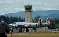
Latest photos of Olympia Regional Airport (OLM)
-
 by RAFOHunter
-
 by Wolf Kotenberg
-
 by Wolf Kotenberg
-
 by Jill England
Location & QuickFacts
| FAA Information Effective: | 2013-12-12 |
| Airport Identifier: | OLM |
| Airport Status: | Operational |
| Longitude/Latitude: | 122-54-09.1610W/46-58-09.8560N
-122.902545/46.969404 (Estimated) |
| Elevation: | 209 ft / 63.70 m (Estimated) |
| Land: | 1632 acres |
| From nearest city: | 4 nautical miles S of Olympia, WA |
| Location: | Thurston County, WA |
| Magnetic Variation: | 19E (1995) |
Owner & Manager
| Ownership: | Publicly owned |
| Owner: | Port Of Olympia |
| Address: | 915 Washington Street
Olympia, WA 98507-0827 |
| Phone number: | 360-528-8000 |
| Manager: | Rudy Rudolph |
| Address: | 7643 Old Hwy 99 Se
Olympia, WA 98501 |
| Phone number: | 360-528-8074 |
Airport Operations and Facilities
| Airport Use: | Open to public |
| Wind indicator: | Yes |
| Segmented Circle: | Yes |
| Control Tower: | Yes |
| Lighting Schedule: | SEE RMK
WHEN ATCT CLSD ACTVT HIRL RY 17/35; MALSR 17; REIL RY 35, TWY LGTS & DIRECTIONAL SIGNAGE - CTAF. PAPI RYS 17 & 35 OPER CONT. |
| Beacon Color: | Clear-Green (lighted land airport) |
| Landing fee charge: | Yes |
| Sectional chart: | Seattle |
| Region: | ANM - Northwest Mountain |
| Boundary ARTCC: | ZSE - Seattle |
| Tie-in FSS: | SEA - Seattle |
| FSS on Airport: | No |
| FSS Toll Free: | 1-800-WX-BRIEF |
| NOTAMs Facility: | OLM (NOTAM-d service avaliable) |
| Federal Agreements: | NGPY3 |
Airport Communications
| CTAF: | 124.400 |
| Unicom: | 122.950 |
Airport Services
| Fuel available: | 100LLA |
| Airframe Repair: | MAJOR |
| Power Plant Repair: | MAJOR |
| Bottled Oxygen: | HIGH/LOW |
| Bulk Oxygen: | HIGH |
Runway Information
Runway 08/26
| Dimension: | 4157 x 150 ft / 1267.1 x 45.7 m |
| Surface: | ASPH, Good Condition |
| Weight Limit: | Single wheel: 30000 lbs. |
| |
Runway 08 |
Runway 26 |
| Longitude: | 122-54-28.7370W | 122-53-30.4950W |
| Latitude: | 46-58-16.7640N | 46-58-07.0640N |
| Elevation: | 194.00 ft | 204.00 ft |
| Alignment: | 104 | 127 |
| Traffic Pattern: | Right | Left |
| Markings: | Basic, Good Condition | Basic, Good Condition |
| Obstruction: | , 20:1 slope to clear | 114 ft tree, 2950.0 ft from runway, 150 ft left of centerline, 24:1 slope to clear |
Runway 17/35
| Dimension: | 5500 x 150 ft / 1676.4 x 45.7 m |
| Surface: | ASPH, Good Condition |
| Surface Treatment: | Saw-cut or plastic Grooved |
| Weight Limit: | Single wheel: 75000 lbs.
Dual wheel: 94000 lbs.
Dual tandem wheel: 142000 lbs. |
| Edge Lights: | High |
| |
Runway 17 |
Runway 35 |
| Longitude: | 122-54-08.6000W | 122-54-24.1500W |
| Latitude: | 46-58-34.9200N | 46-57-41.6800N |
| Elevation: | 197.00 ft | 203.00 ft |
| Alignment: | 127 | 11 |
| ILS Type: | ILS
| |
| Traffic Pattern: | Left | Right |
| Markings: | Precision instrument, Good Condition
RUNWAY 17/35 MKGS FADED. | Non-precision instrument, Good Condition |
| Crossing Height: | 54.00 ft | 50.00 ft |
| VASI: | 4-light PAPI on left side | 4-light PAPI on left side |
| Visual Glide Angle: | 3.00° | 3.00° |
| Approach lights: | MALSR | |
| Runway End Identifier: | | Yes |
Radio Navigation Aids
| ID |
Type |
Name |
Ch |
Freq |
Var |
Dist |
| LAC | NDB | Lacomas | | 328.00 | 18E | 14.4 nm |
| GR | NDB | Graye | | 216.00 | 18E | 16.3 nm |
| MNC | NDB | Mason County | | 348.00 | 19E | 18.4 nm |
| CAN | NDB | Carney | | 274.00 | 20E | 26.6 nm |
| TDO | NDB | Toledo | | 219.00 | 20E | 29.9 nm |
| PWT | NDB | Kitsap | | 206.00 | 20E | 32.0 nm |
| ODD | NDB | Dondo | | 224.00 | 19E | 33.9 nm |
| RNT | NDB | Renton | | 353.00 | 20E | 42.3 nm |
| LSO | NDB | Kelso | | 256.00 | 21E | 48.9 nm |
| OLM | VORTAC | Olympia | 081X | 113.40 | 19E | 0.1 nm |
| TCM | VORTAC | Mcchord | 033X | 109.60 | 22E | 20.5 nm |
| SEA | VORTAC | Seattle | 115X | 116.80 | 19E | 37.0 nm |
| SEA | VOT | Seattle-tacoma | | 117.50 | | 37.6 nm |
| BFI | VOT | Boeing Field | | 108.60 | | 41.5 nm |