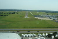
Latest photos of Augusta Municipal Airport (3AU)
-
 by Rob Kuhns
-
 by Rob Kuhns
Location & QuickFacts
| FAA Information Effective: | 2013-12-12 |
| Airport Identifier: | 3AU |
| Airport Status: | Operational |
| Longitude/Latitude: | 097-04-40.3000W/37-40-17.9000N
-97.077861/37.671639 (Estimated) |
| Elevation: | 1328 ft / 404.77 m (Surveyed) |
| Land: | 140 acres |
| From nearest city: | 5 nautical miles W of Augusta, KS |
| Location: | Butler County, KS |
| Magnetic Variation: | 04E (2010) |
Owner & Manager
| Ownership: | Publicly owned |
| Owner: | City Of Augusta |
| Address: | 6th & School Box 486
Augusta, KS 67010 |
| Phone number: | 316-775-4510 |
| Manager: | Lloyd Partin |
| Address: | 4800 W Beech Suite 1
Augusta, KS 67010 |
| Phone number: | 316-733-1326 |
Airport Operations and Facilities
| Airport Use: | Open to public |
| Wind indicator: | Yes |
| Segmented Circle: | Yes |
| Control Tower: | No |
| Lighting Schedule: | SEE RMK
ACTVT HIRL RY 18/36; REIL RYS 18 & 36; VASI RY 36; PAPI RY 18 - CTAF. |
| Beacon Color: | Clear-Green (lighted land airport) |
| Landing fee charge: | No |
| Sectional chart: | Wichita |
| Region: | ACE - Central |
| Boundary ARTCC: | ZKC - Kansas City |
| Tie-in FSS: | ICT - Wichita |
| FSS on Airport: | No |
| FSS Toll Free: | 1-800-WX-BRIEF |
| NOTAMs Facility: | ICT (NOTAM-d service avaliable) |
| Federal Agreements: | NGY |
Airport Communications
| CTAF: | 122.800 |
| Unicom: | 122.800 |
Airport Services
| Fuel available: | 100LLA |
| Airframe Repair: | MAJOR |
| Power Plant Repair: | MAJOR |
| Bottled Oxygen: | LOW |
| Bulk Oxygen: | NONE |
Runway Information
Runway 18/36
| Dimension: | 4201 x 60 ft / 1280.5 x 18.3 m |
| Surface: | ASPH, Good Condition |
| Weight Limit: | Single wheel: 12000 lbs. |
| Edge Lights: | High |
| |
Runway 18 |
Runway 36 |
| Longitude: | 097-04-38.3924W | 097-04-42.2061W |
| Latitude: | 37-40-38.5674N | 37-39-57.1520N |
| Elevation: | 1328.00 ft | 1306.00 ft |
| Alignment: | 127 | 4 |
| Traffic Pattern: | Left | Right |
| Markings: | Non-precision instrument, Good Condition | Non-precision instrument, Good Condition |
| Crossing Height: | 0.00 ft | 43.00 ft |
| VASI: | 4-light PAPI on left side | 2-box on left side |
| Visual Glide Angle: | 0.00° | 3.00° |
| Runway End Identifier: | Yes | Yes |
| Obstruction: | 31 ft bldg, 1100.0 ft from runway, 29:1 slope to clear | , 50:1 slope to clear |
Radio Navigation Aids
| ID |
Type |
Name |
Ch |
Freq |
Var |
Dist |
| EQA | NDB | El Dorado | | 383.00 | 05E | 14.0 nm |
| IC | NDB | Piche | | 332.00 | 07E | 18.8 nm |
| EWK | NDB | Newton | | 281.00 | 06E | 25.3 nm |
| EGT | NDB | Wellington | | 414.00 | 07E | 25.7 nm |
| MPR | NDB | Mc Pherson | | 227.00 | 06E | 49.9 nm |
| IAB | TACAN | Mc Connell | 112X | | 07E | 9.5 nm |
| HUT | VOR/DME | Hutchinson | 115X | 116.80 | 09E | 45.1 nm |
| ICT | VORTAC | Wichita | 085X | 113.80 | 07E | 24.5 nm |
| ICT | VOT | Wichita | | 114.00 | | 17.1 nm |