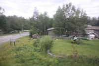
Latest photo of Flying Crown Airport (AK12)
-
 by Timothy Aanerud
Location & QuickFacts
| FAA Information Effective: | 2013-12-12 |
| Airport Identifier: | AK12 |
| Airport Status: | Operational |
| Longitude/Latitude: | 149-51-51.3700W/61-06-23.7600N
-149.864269/61.106600 (Estimated) |
| Elevation: | 150 ft / 45.72 m (Estimated) |
| Land: | 6 acres |
| From nearest city: | 6 nautical miles S of Anchorage, AK |
| Location: | Anchorage County, AK |
| Magnetic Variation: | 25E (1985) |
Owner & Manager
| Ownership: | Privately owned |
| Owner: | Flying Crown/oceanview North |
| Address: | 910 Harbor Circle
Anchorage, AK 99515 |
| Phone number: | 907-245-1932 |
| Manager: | Charles Fryer |
| Address: | 910 Harbor Circle
Anchorge, AK 99515 |
| Phone number: | 907-245-1932 |
Airport Operations and Facilities
| Airport Use: | Private |
| Wind indicator: | Yes |
| Segmented Circle: | No |
| Control Tower: | No |
| Sectional chart: | Anchorage |
| Region: | AAL - Alaska |
| Boundary ARTCC: | ZAN - Anchorage |
| Tie-in FSS: | ENA - Kenai |
| FSS Phone: | 800-478-3576 |
| FSS Toll Free: | 1-866-864-1737 |
Runway Information
Runway 13/31
| Dimension: | 1078 x 50 ft / 328.6 x 15.2 m |
| Surface: | TURF, Poor Condition |
| |
Runway 13 |
Runway 31 |
| Traffic Pattern: | Left | Right |
| Displaced threshold: | 30.00 ft | 798.00 ft |
Radio Navigation Aids
| ID |
Type |
Name |
Ch |
Freq |
Var |
Dist |
| CMQ | NDB | Campbell Lake | | 338.00 | 21E | 6.6 nm |
| BOB | NDB | Bruck | | 387.00 | 21E | 9.8 nm |
| GRP | NDB | Granite Point | | 356.00 | 24E | 43.7 nm |
| IWW | NDB | Wildwood | | 379.00 | 20E | 49.9 nm |
| OLT | NDB/DME | Soldotna | 106X | 346.00 | 24E | 48.2 nm |
| EDF | TACAN | Elmendorf | 081X | | 21E | 9.3 nm |
| ANC | VOR/DME | Anchorage | 090X | 114.30 | 25E | 10.3 nm |
| ENA | VOR/DME | Kenai | 123X | 117.60 | 25E | 48.9 nm |
| BGQ | VORTAC | Big Lake | 072X | 112.50 | 25E | 28.0 nm |
| ANC | VOT | Anchorage | | 108.40 | | 5.4 nm |
| MRI | VOT | Merrill | | 111.00 | | 6.5 nm |