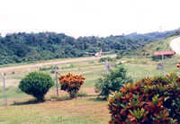
Latest photo of Beluga Airport (BLG)
-
 by Henk Geerlings
Location & QuickFacts
| FAA Information Effective: | 2013-12-12 |
| Airport Identifier: | BLG |
| Airport Status: | Operational |
| Longitude/Latitude: | 151-02-43.4987W/61-10-22.6628N
-151.045416/61.172962 (Estimated) |
| Elevation: | 87 ft / 26.52 m (Estimated) |
| Land: | 0 acres |
| From nearest city: | 0 nautical miles of Beluga, AK |
| Location: | Kenai-cook Inlet County, AK |
| Magnetic Variation: | 19E (2010) |
Owner & Manager
| Ownership: | Privately owned |
| Owner: | Conoco Phillips Alaska |
| Address: | 700 G Street
Anchorage, AK 99501 |
| Phone number: | 907-276-1215 |
| Manager: | Cook Inlet Operations Manager
OR PROCUREMENT SPECIALIST - 907-263-4658 OR BRV SUPERVISOR - 907-263-3930 |
| Address: | Po Box 66
Kenai, AK 99661 |
| Phone number: | 907-776-2021 |
Airport Operations and Facilities
| Airport Use: | Private |
| Wind indicator: | Yes |
| Segmented Circle: | No |
| Control Tower: | No |
| Lighting Schedule: | SEE RMK
ACTVT MIRL RY 09/27 & 01/19 - CTAF. |
| Landing fee charge: | No |
| Sectional chart: | Anchorage |
| Region: | AAL - Alaska |
| Boundary ARTCC: | ZAN - Anchorage |
| Tie-in FSS: | ENA - Kenai |
| FSS on Airport: | No |
| FSS Phone: | 800-478-3576 |
| FSS Toll Free: | 1-866-864-1737 |
Airport Communications
| CTAF: | 122.700 |
| Unicom: | 122.800 |
Airport Services
| Airframe Repair: | NONE |
| Power Plant Repair: | NONE |
| Bottled Oxygen: | NONE |
| Bulk Oxygen: | NONE |
Runway Information
Runway 01/19
| Dimension: | 5002 x 100 ft / 1524.6 x 30.5 m |
| Surface: | GRVL, Good Condition |
| Edge Lights: | Medium |
| |
Runway 01 |
Runway 19 |
| Longitude: | 151-02-58.8700W | 151-02-10.1000W |
| Latitude: | 61-10-00.2000N | 61-10-43.4600N |
| Elevation: | 76.00 ft | 71.00 ft |
| Alignment: | 29 | 127 |
| Traffic Pattern: | Left | Left |
| Runway End Identifier: | No | No |
| Centerline Lights: | No | No |
| Touchdown Lights: | No | No |
Runway 09/27
| Dimension: | 2505 x 60 ft / 763.5 x 18.3 m |
| Surface: | GRVL, |
| Edge Lights: | Medium |
| |
Runway 09 |
Runway 27 |
| Longitude: | 151-03-25.7800W | 151-02-37.2000W |
| Latitude: | 61-10-28.1300N | 61-10-20.5200N |
| Elevation: | 87.00 ft | 74.00 ft |
| Alignment: | 108 | 127 |
| Traffic Pattern: | Left | Left |
Radio Navigation Aids
| ID |
Type |
Name |
Ch |
Freq |
Var |
Dist |
| GRP | NDB | Granite Point | | 356.00 | 24E | 15.2 nm |
| BOB | NDB | Bruck | | 387.00 | 21E | 25.2 nm |
| CMQ | NDB | Campbell Lake | | 338.00 | 21E | 28.9 nm |
| IWW | NDB | Wildwood | | 379.00 | 20E | 34.9 nm |
| DRF | NDB | Drift River | | 368.00 | 24E | 47.3 nm |
| OLT | NDB/DME | Soldotna | 106X | 346.00 | 24E | 42.2 nm |
| EDF | TACAN | Elmendorf | 081X | | 21E | 37.3 nm |
| ANC | VOR/DME | Anchorage | 090X | 114.30 | 25E | 24.4 nm |
| ENA | VOR/DME | Kenai | 123X | 117.60 | 25E | 33.8 nm |
| BGQ | VORTAC | Big Lake | 072X | 112.50 | 25E | 39.1 nm |
| ANC | VOT | Anchorage | | 108.40 | | 30.8 nm |
| MRI | VOT | Merrill | | 111.00 | | 34.8 nm |