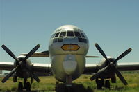
Latest photos of South Big Horn County Airport (GEY)
-
 by Florida Metal
-
 by Daniel Ihde
-
 by Daniel Ihde
-
 by Daniel Ihde
Location & QuickFacts
| FAA Information Effective: | 2013-12-12 |
| Airport Identifier: | GEY |
| Airport Status: | Operational |
| Longitude/Latitude: | 108-04-58.8000W/44-31-04.6000N
-108.083000/44.517944 (Estimated) |
| Elevation: | 3941 ft / 1201.22 m (Surveyed) |
| Land: | 655 acres |
| From nearest city: | 2 nautical miles NW of Greybull, WY |
| Location: | Big Horn County, WY |
| Magnetic Variation: | 14E (1985) |
Owner & Manager
| Ownership: | Publicly owned |
| Owner: | Big Horn County |
| Address: | Box 29
Basin, WY 82426 |
| Phone number: | 307-568-2467 |
| Manager: | Carl Meyer |
| Address: | P.o. Box 29
Basin, WY 82426 |
| Phone number: | 307-568-2551
CELL: 307-431-1464 |
Airport Operations and Facilities
| Airport Use: | Open to public |
| Wind indicator: | Yes |
| Segmented Circle: | Yes |
| Control Tower: | No |
| Lighting Schedule: | SEE RMK
ACTVT MIRL RY 16/34; PAPI RY 16 & 34; REILS RY 16 & 34 -CTAF. |
| Beacon Color: | Clear-Green (lighted land airport) |
| Landing fee charge: | No |
| Sectional chart: | Billings |
| Region: | ANM - Northwest Mountain |
| Boundary ARTCC: | ZLC - Salt Lake City |
| Tie-in FSS: | CPR - Casper |
| FSS on Airport: | No |
| FSS Toll Free: | 1-800-WX-BRIEF |
| NOTAMs Facility: | GEY (NOTAM-d service avaliable) |
| Federal Agreements: | NGSY |
Airport Services
| Fuel available: | 100LLA
JET A AVBL DURING ATTENDANCE HRS. AFTER HRS CALL NUMBERS POSTED ON NORTH SIDE OF TERMINAL BUILDING.. |
| Airframe Repair: | MAJOR |
| Power Plant Repair: | MAJOR |
| Bottled Oxygen: | NONE |
| Bulk Oxygen: | HIGH |
Runway Information
Runway 07/25
| Dimension: | 3953 x 75 ft / 1204.9 x 22.9 m |
| Surface: | ASPH, Good Condition |
| Weight Limit: | Single wheel: 12500 lbs. |
| |
Runway 07 |
Runway 25 |
| Longitude: | 108-05-52.3672W | 108-04-57.9357W |
| Latitude: | 44-30-48.3073N | 44-30-50.7508N |
| Elevation: | 3942.00 ft | 3919.00 ft |
| Alignment: | 87 | 127 |
| Traffic Pattern: | Left | Left |
| Markings: | Basic, Fair Condition | Basic, Fair Condition |
Runway 16/34
| Dimension: | 7003 x 150 ft / 2134.5 x 45.7 m |
| Surface: | ASPH, |
| Weight Limit: | Single wheel: 85000 lbs.
Dual wheel: 150000 lbs.
Dual tandem wheel: 290000 lbs. |
| Edge Lights: | Medium |
| |
Runway 16 |
Runway 34 |
| Longitude: | 108-04-52.8009W | 108-04-35.1273W |
| Latitude: | 44-31-47.1563N | 44-30-39.1823N |
| Elevation: | 3905.00 ft | 3916.00 ft |
| Alignment: | 127 | 127 |
| Traffic Pattern: | Left | Left |
| Markings: | Non-precision instrument, Good Condition | Non-precision instrument, Good Condition |
| Crossing Height: | 50.00 ft | 50.00 ft |
| VASI: | 4-light PAPI on left side | 4-light PAPI on left side |
| Visual Glide Angle: | 3.00° | 3.00° |
| Runway End Identifier: | Yes | Yes |
Radio Navigation Aids
| ID |
Type |
Name |
Ch |
Freq |
Var |
Dist |
| GEY | NDB | Greybull | | 275.00 | 14E | 0.4 nm |
| HCY | NDB | Cowley | | 257.00 | 14E | 28.3 nm |
| POY | NDB | Powell | | 344.00 | 15E | 36.6 nm |
| RLY | VOR/DME | Worland | 095X | 114.80 | 13E | 33.8 nm |
| COD | VOR/DME | Cody | 055X | 111.80 | 14E | 38.3 nm |
| SHR | VORTAC | Sheridan | 100X | 115.30 | 13E | 47.8 nm |