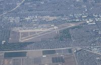
Latest photos of Los Alamitos Aaf Airport (SLI)
-
 by Florida Metal
-
 by Florida Metal
Location & QuickFacts
| FAA Information Effective: | 2013-12-12 |
| Airport Identifier: | SLI |
| Airport Status: | Operational |
| Longitude/Latitude: | 118-03-05.1451W/33-47-24.1159N
-118.051429/33.790032 (Estimated) |
| Elevation: | 32 ft / 9.75 m (Estimated) |
| Land: | 0 acres |
| From nearest city: | 1 nautical miles SE of Los Alamitos, CA |
| Location: | Orange County, CA |
| Magnetic Variation: | 15E (1975) |
Owner & Manager
| Ownership: | Army owned |
| Owner: | Us Army |
| Address: | Aasf, Caarng, 4612 Doolittle Ave
Los Alamitos, CA 90720 |
| Phone number: | 562-795-2571 |
| Address: |
|
Airport Operations and Facilities
| Airport Use: | Private |
| Segmented Circle: | No |
| Control Tower: | Yes |
| Beacon Color: | Split-Clear-Green (lighted military airport) |
| Sectional chart: | Los Angeles |
| Region: | AWP - Western-Pacific |
| Boundary ARTCC: | ZLA - Los Angeles |
| Tie-in FSS: | HHR - Hawthorne |
| FSS Toll Free: | 1-800-WX-BRIEF |
| NOTAMs Facility: | SLI (NOTAM-d service avaliable) |
Runway Information
Runway 04L/22R
| Dimension: | 5900 x 150 ft / 1798.3 x 45.7 m |
| Surface: | PEM, |
| Pavement Class: | 36 /F/C/W/T |
| Edge Lights: | Medium
HIRL ELEV 1' AND LCTD 5' FR EDGE OF RWY. |
| |
Runway 04L |
Runway 22R |
| Longitude: | 118-03-43.4569W | 118-02-46.1669W |
| Latitude: | 33-47-07.1101N | 33-47-40.5912N |
| Elevation: | 17.00 ft | 24.00 ft |
| Traffic Pattern: | Left | Left |
| Centerline Lights: | No | No |
Runway 04R/22L
| Dimension: | 8000 x 200 ft / 2438.4 x 61.0 m |
| Surface: | ASPH-CONC, |
| Pavement Class: | 36 /R/C/W/T |
| Edge Lights: | High
HIRL ELEV 1' AND LCTD 5' FR EDGE OF RWY. |
| |
Runway 04R |
Runway 22L |
| Longitude: | 118-03-36.8456W | 118-02-19.1860W |
| Latitude: | 33-47-01.6163N | 33-47-47.0066N |
| Elevation: | 18.00 ft | 32.00 ft |
| Traffic Pattern: | Left | Left |
| Crossing Height: | 0.00 ft | 75.00 ft |
| VASI: | | 4-light PAPI on left side |
| Visual Glide Angle: | 0.00° | 3.00° |
| Approach lights: | | SALSF |
| Runway End Identifier: | No | No |
| Centerline Lights: | Yes | Yes |
Radio Navigation Aids
| ID |
Type |
Name |
Ch |
Freq |
Var |
Dist |
| CPM | NDB | Compton | | 378.00 | 15E | 11.4 nm |
| EMT | NDB | El Monte | | 359.00 | 15E | 18.0 nm |
| PAI | NDB | Pacoima | | 370.00 | 15E | 33.5 nm |
| SB | NDB | Petis | | 397.00 | 14E | 37.7 nm |
| RIV | TACAN | March | 077X | | 14E | 39.4 nm |
| NFG | TACAN | Camp Pendleton | 055X | | 13E | 45.5 nm |
| RAL | VOR | Riverside | | 112.40 | 15E | 31.6 nm |
| HDF | VOR | Homeland | | 113.40 | 14E | 43.3 nm |
| ELB | VOR/DME | El Toro | 119X | 117.20 | 14E | 17.4 nm |
| SMO | VOR/DME | Santa Monica | 045X | 110.80 | 15E | 24.2 nm |
| VNY | VOR/DME | Van Nuys | 078X | 113.10 | 15E | 34.1 nm |
| SLI | VORTAC | Seal Beach | 104X | 115.70 | 15E | 0.4 nm |
| LAX | VORTAC | Los Angeles | 083X | 113.60 | 15E | 20.9 nm |
| POM | VORTAC | Pomona | 041X | 110.40 | 15E | 21.8 nm |
| PDZ | VORTAC | Paradise | 059X | 112.20 | 15E | 27.1 nm |
| SXC | VORTAC | Santa Catalina | 051X | 111.40 | 15E | 31.0 nm |
| OCN | VORTAC | Oceanside | 100X | 115.30 | 15E | 45.8 nm |
| SNA | VOT | Santa Ana | | 110.00 | | 11.3 nm |
| LAX | VOT | San Pedro Hill | | 113.90 | | 14.5 nm |