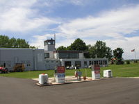
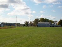
Latest photos of Stanton Airfield Airport (SYN)
-
 by Mitch Sando
-
 by Mark Pasqualino
-
 by Mark Pasqualino
Location & QuickFacts
| FAA Information Effective: | 2013-12-12 |
| Airport Identifier: | SYN |
| Airport Status: | Operational |
| Longitude/Latitude: | 093-00-58.7580W/44-28-31.8800N
-93.016322/44.475522 (Estimated) |
| Elevation: | 920 ft / 280.42 m (Estimated) |
| Land: | 158 acres |
| From nearest city: | 1 nautical miles E of Stanton, MN |
| Location: | Goodhue County, MN |
| Magnetic Variation: | 03E (1985) |
Owner & Manager
| Ownership: | Privately owned |
| Owner: | Stanton Sport Aviation Inc |
| Address: | 1235 Hwy 19
Stanton, MN 55018 |
| Phone number: | 507-645-4030 |
| Manager: | Kent Johnson |
| Address: | 1235 Hwy 19
Stanton, MN 55018 |
| Phone number: | 507-645-4030 |
Airport Operations and Facilities
| Airport Use: | Open to public |
| Wind indicator: | Yes |
| Segmented Circle: | No |
| Control Tower: | No |
| Landing fee charge: | No |
| Sectional chart: | Omaha |
| Region: | AGL - Great Lakes |
| Traffic Pattern Alt: | 800 ft |
| Boundary ARTCC: | ZMP - Minneapolis |
| Tie-in FSS: | PNM - Princeton |
| FSS on Airport: | No |
| FSS Toll Free: | 1-800-WX-BRIEF |
| NOTAMs Facility: | SYN (NOTAM-d service avaliable) |
Airport Communications
| CTAF: | 122.800 |
| Unicom: | 122.800 |
Airport Services
| Fuel available: | 100LLMOGAS |
| Airframe Repair: | MAJOR |
| Power Plant Repair: | MAJOR |
| Bottled Oxygen: | NONE |
| Bulk Oxygen: | NONE |
Runway Information
Runway 09/27
| Dimension: | 1970 x 180 ft / 600.5 x 54.9 m |
| Surface: | TURF, Good Condition |
| |
Runway 09 |
Runway 27 |
| Longitude: | 093-01-12.5200W | 093-00-44.9900W |
| Latitude: | 44-28-31.8700N | 44-28-31.8800N |
| Elevation: | 920.00 ft | 920.00 ft |
| Traffic Pattern: | Left | Left |
| Obstruction: | 35 ft trees, 700.0 ft from runway, 50 ft right of centerline, 20:1 slope to clear
SEASONAL CROPS RYS 09; 27; 18 SLOPE 0:1 WHEN CROPS PRESENT. | , 20:1 slope to clear |
Runway 18/36
| Dimension: | 2550 x 200 ft / 777.2 x 61.0 m |
| Surface: | TURF, Good Condition |
| |
Runway 18 |
Runway 36 |
| Longitude: | 093-00-58.7500W | 093-00-58.7500W |
| Latitude: | 44-28-44.6300N | 44-28-19.1300N |
| Elevation: | 920.00 ft | 920.00 ft |
| Traffic Pattern: | Left | Left |
| Displaced threshold: | 0.00 ft | 300.00 ft |
| Obstruction: | , 20:1 slope to clear | 17 ft road, 50.0 ft from runway, 2:1 slope to clear
APCH SLOPE 20:1 TO DSPLD THLD. |
Radio Navigation Aids
| ID |
Type |
Name |
Ch |
Freq |
Var |
Dist |
| MS | NDB | Narco | | 266.00 | 02E | 21.3 nm |
| PPI | NDB | Hopey | | 400.00 | 03E | 24.1 nm |
| ACQ | NDB | Waseca | | 371.00 | 02E | 33.6 nm |
| RNH | NDB | New Richmond | | 257.00 | 02E | 45.3 nm |
| GYL | NDB | Glencoe | | 407.00 | 03E | 48.9 nm |
| FOW | VOR/DME | Halfway | 049X | 111.20 | 02E | 22.3 nm |
| MSP | VOR/DME | Minneapolis | 100X | 115.30 | 02E | 27.0 nm |
| FCM | VOR/DME | Flying Cloud | 055X | 111.80 | 06E | 28.2 nm |
| MKT | VOR/DME | Mankato | 045X | 110.80 | 07E | 41.5 nm |
| RST | VOR/DME | Rochester | 057X | 112.00 | 05E | 45.4 nm |
| FGT | VORTAC | Farmington | 104X | 115.70 | 06E | 11.7 nm |
| GEP | VORTAC | Gopher | 120X | 117.30 | 06E | 43.1 nm |
| MSP | VOT | Minneapolis St Paul | | 111.00 | | 26.0 nm |
| STP | VOT | St Paul | | 114.40 | | 28.0 nm |