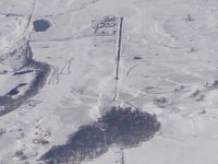
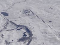
Latest photos of Burkes Garden Airport (VA07)
-
 by Bob Simmermon
-
 by Bob Simmermon
Location & QuickFacts
| FAA Information Effective: | 2013-12-12 |
| Airport Identifier: | VA07 |
| Airport Status: | Operational |
| Longitude/Latitude: | 081-22-09.3760W/37-05-44.4200N
-81.369271/37.095672 (Estimated) |
| Elevation: | 3060 ft / 932.69 m (Estimated) |
| Land: | 0 acres |
| From nearest city: | 12 nautical miles SE of Tazewell, VA |
| Location: | Tazewell County, VA |
| Magnetic Variation: | 05W (1985) |
Owner & Manager
| Ownership: | Privately owned |
| Owner: | Mocomp, Inc |
| Address: | Po Box 920
Verona, VA 24482 |
| Address: |
|
Airport Operations and Facilities
| Airport Use: | Private |
| Segmented Circle: | No |
| Control Tower: | No |
| Sectional chart: | Cincinnati |
| Region: | AEA - Eastern |
| Boundary ARTCC: | ZTL - Atlanta |
| Tie-in FSS: | DCA - Leesburg |
| FSS on Airport: | No |
| FSS Toll Free: | 1-800-WX-BRIEF |
Runway Information
Runway 06/24
| Dimension: | 2500 x 50 ft / 762.0 x 15.2 m |
| Surface: | ASPH, |
| |
Runway 06 |
Runway 24 |
| Traffic Pattern: | Left | Left |
Radio Navigation Aids
| ID |
Type |
Name |
Ch |
Freq |
Var |
Dist |
| MK | NDB | Suzze | | 335.00 | 06W | 12.2 nm |
| HLX | NDB | Hillsville | | 269.00 | 06W | 33.1 nm |
| VJ | NDB | Whine | | 236.00 | 05W | 35.3 nm |
| JU | NDB | Ashee | | 410.00 | 07W | 39.8 nm |
| JJO | NDB | Mountain City | | 396.00 | 04W | 46.3 nm |
| TEC | NDB | Tech | | 368.00 | 06W | 46.8 nm |
| GTC | NDB | Guyandot | | 293.00 | 03W | 48.6 nm |
| GZG | VOR/DME | Glade Spring | 039X | 110.20 | 02W | 37.8 nm |
| BLF | VORTAC | Bluefield | 037X | 110.00 | 03W | 15.2 nm |
| PSK | VORTAC | Pulaski | 115X | 116.80 | 06W | 31.5 nm |
| BKW | VORTAC | Beckley | 124X | 117.70 | 06W | 42.8 nm |