Airport-Data.com
Log in    New user?  Sign up for free
Camarillo Airport (CMA) Photo

Camarillo Airport (CMA) Profile

Links to this page and other related pages
More photos of Camarillo Airport (CMA)
Have a photo of this airport? Share with others.
Photo ID: AP9077

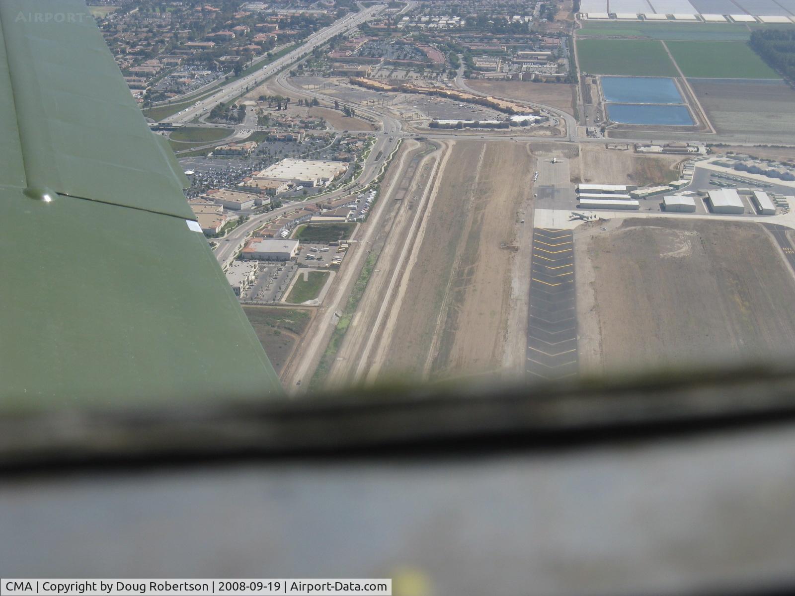
Camarillo Airport (CMA) - Displaced threshold chevron markings to 6,013' Rwy 26. Taken from well overhead runway from Beech 36 BONANZA

Displaced threshold chevron markings to 6,013' Rwy 26. Taken from well overhead runway from Beech 36 BONANZA

Folder: Doug Robertson's photo gallery > AIRPORTS-SEAPORTS > CMA-Camarillo, CA Airport

Photo Info

Airport Camarillo Airport (CMA)
Camarillo, CA
Photographer: Doug Robertson
More photos by Doug Robertson
Contact Doug Robertson
Shot Date: 2008-09-19
Upload Date: 2008-09-19
Views: 1312

Photo MetaData

Device Manufacturer: Canon
Device Model: Canon PowerShot A720 IS
Device Type: Digital Still Camera
Shot Time: 2008:09:19 11:17:10
Original Image Size: 1600 x 1200 pixels
Exposure Time: 1/640 sec
F Number: f/4
Exposure Bias: 0
ISO Speed: 80
Focal Length: 9.954 mm
Flash: No Flash
Exposure Mode: 0
White Balance: 0
Scene Type:
Contrast:
Saturation:
Sharpness:
Total 300 photos. View all photos
More photos of Camarillo Airport (CMA)

  • Camarillo Airport (CMA) - Camarillo Airport Rwy 08-26 looking west from Beech 36 BONANZA N2111Q. Note far-displaced threshold for 26. - by Doug Robertson by Doug Robertson
  • Camarillo Airport (CMA) - 2012 Wings Over Camarillo Airshow, some featured airshow aircraft on the ready ramp including Rob Harrison's N666XC yellow ZLIN 'Tumbling Bear' on the right - by Doug Robertson by Doug Robertson
  • Camarillo Airport (CMA) - Condor Squadron fast pass over Rwy 26 - by Doug Robertson by Doug Robertson
  • Camarillo Airport (CMA) - Refueling 100LL from mobile tanker-CMA has multiple fueling options, including self-serve near the CMA Control Tower - by Doug Robertson by Doug Robertson
  • Camarillo Airport (CMA) - Rwy 08-26 taken from RV-7 over city of Camarillo northeast of field looking southwest. Note greatly displaced threshold-Rwy 26. Oxnard eastern city limits at top of photo. Extensive farmland between the cities. - by Doug Robertson by Doug Robertson