Airport-Data.com
Log in    New user?  Sign up for free
Oxnard Airport (OXR) Photo

Oxnard Airport (OXR) Profile

Links to this page and other related pages
More photos of Oxnard Airport (OXR)
Have a photo of this airport? Share with others.
Photo ID: AP44330

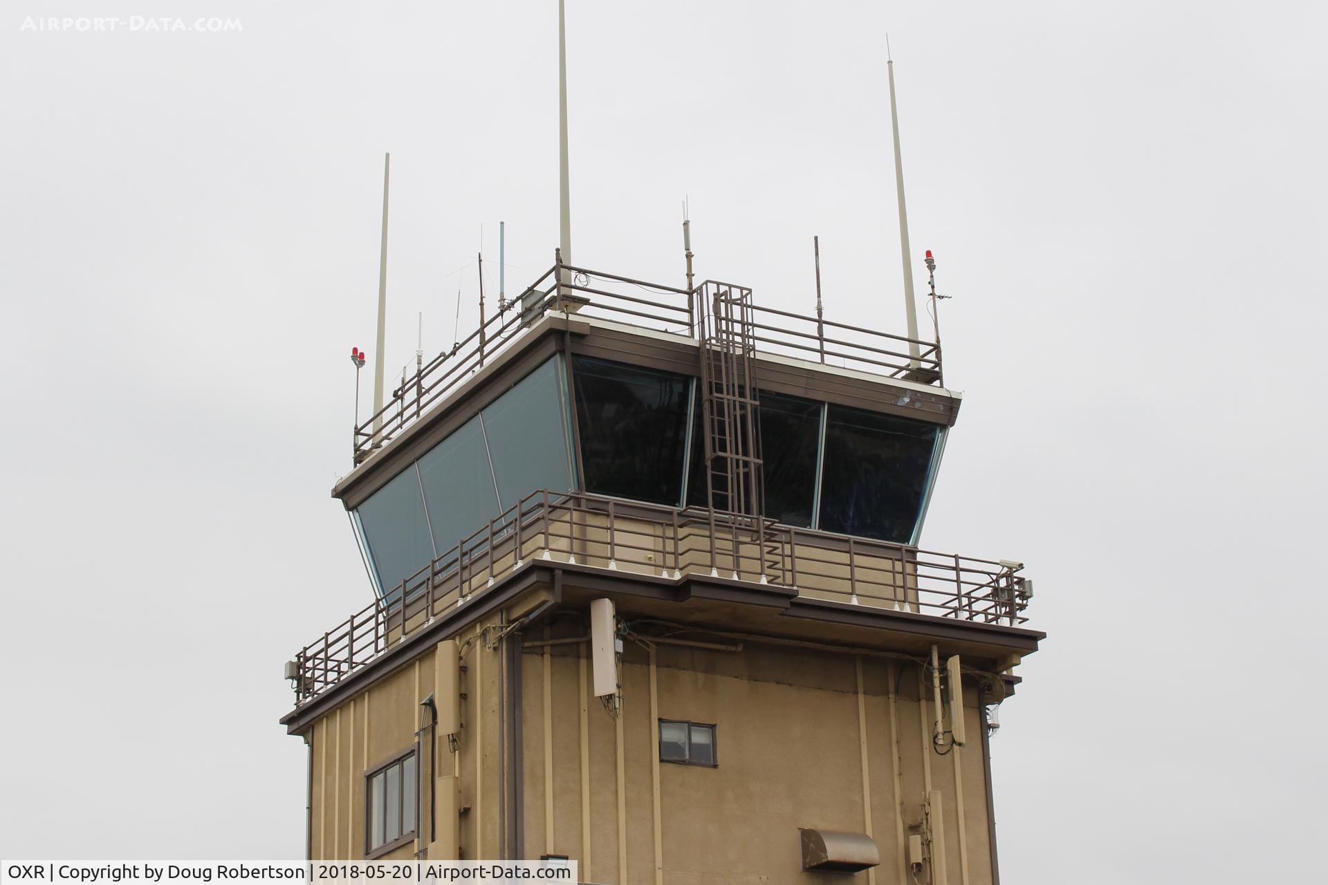
Oxnard Airport (OXR) - OXR Aircraft Control Tower-Closeup. Runway Elevation-45'. Approach/Departure 124.7, ATIS 118.05, CTAF 134.95. Ground control 121.9, Tower 134.95  Rwy 07-25  5,953X100 paved

OXR Aircraft Control Tower-Closeup. Runway Elevation-45'. Approach/Departure 124.7, ATIS 118.05, CTAF 134.95. Ground control 121.9, Tower 134.95 Rwy 07-25 5,953X100 paved

Folder: Doug Robertson's photo gallery > AIRPORTS-SEAPORTS > OXR-Oxnard, CA Airport

Photo Info

Airport Oxnard Airport (OXR)
Oxnard, CA
Photographer: Doug Robertson
More photos by Doug Robertson
Contact Doug Robertson
Shot Date: 2018-05-20
Upload Date: 2018-05-29
Views: 291

Photo MetaData

Device Manufacturer: Canon
Device Model: Canon EOS REBEL SL1
Device Type:
Shot Time: 2018:05:20 12:29:37
Original Image Size: 4148 x 2765 pixels
Exposure Time: 1/200 sec
F Number: f/11
Exposure Bias: 0
ISO Speed: 100
Focal Length: 34 mm
Flash: No Flash
Exposure Mode: 0
White Balance: 0
Scene Type:
Contrast:
Saturation:
Sharpness:
Total 52 photos. View all photos
More photos of Oxnard Airport (OXR)

  • Oxnard Airport (OXR) - TAXIING TO TRANSIENT PARKING - by COOL LAST SAMURAI by COOL LAST SAMURAI
  • Oxnard Airport (OXR) - Oxnard OXR Air Traffic Control Tower undergoing some rehabilitation with scaffolding. - by Doug Robertson by Doug Robertson
  • Oxnard Airport (OXR) - Golden West's General Aviation ramp. Formerly Million Air at this site. Before that-Valenti Aviation Cessna Dealer hangar consumed by fire with loss all aircraft. - by Doug Robertson by Doug Robertson
  • Oxnard Airport (OXR) - Oxnard Aircraft & Jet Center - by Doug Robertson by Doug Robertson
  • Oxnard Airport (OXR) - Oxnard, California FAA Control Tower OXR, School Canyon brushfire smoke North - by Doug Robertson by Doug Robertson