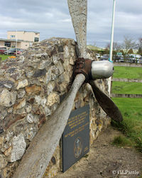
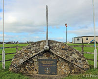
Latest photos of Dunkeswell Aerodrome
-
 by Clive Pattle
-
 by Clive Pattle
-
 by Clive Pattle
-
 by Clive Pattle
Location & QuickFacts
| Airport ICAO Code: | EGTU |
| Longitude/Latitude: | W 003° 14' 05.00"/N 50° 51' 36.00"
-3.234722/50.860000 |
| Elevation: | 850 ft / 259.08 m |
| Location: | Honiton, England, United Kingdom |
| Magnetic Variation: | W 3°02.0' (2008-04) |
| Time Zone: | UTC 0(+1DT) |
Airport Communications
| Type |
Name |
Freq 1 |
Freq 2 |
Freq 3 |
Freq 4 |
Freq 5 |
| Air/Ground | RDO | 123.475 M | | | | |
Runway Information
Runway 05/23
| Dimension: | 3176 x 150 ft / 968.0 x 45.7 m |
| Surface: | Asphalt, asphaltic concrete, tar macadam, or bitumen bound macadam. |
| |
Runway 05 |
Runway 23 |
| Longitude: | -3.238000 / W 003° 14' 16.80" | -3.229000 / W 003° 13' 44.40" |
| Latitude: | 50.856225 / N 50° 51' 22.41" | 50.862778 / N 50° 51' 46.00" |
| End Elevation: | 839.0 ft | 826.0 ft |
| Alignment: | 046.0 | 226.0 |
| Slope: | -0.4 | 0.4 |
| Touchdown Zone Elev.: | Unknown | Unknown |
| Displaced Threshold: | 0 ft | 968 ft |
Runway 09/27
| Dimension: | 2845 x 150 ft / 867.2 x 45.7 m |
| Surface: | Asphalt, asphaltic concrete, tar macadam, or bitumen bound macadam. |
| |
Runway 09 |
Runway 27 |
| Longitude: | -3.240278 / W 003° 14' 25.00" | -3.228056 / W 003° 13' 41.00" |
| Latitude: | 50.864306 / N 50° 51' 51.50" | 50.865278 / N 50° 51' 55.00" |
| Alignment: | 087.0 | 267.0 |
| Slope: | Unknown | Unknown |
| Touchdown Zone Elev.: | Unknown | Unknown |
Runway 17/35
| Dimension: | 2113 x 65 ft / 644.0 x 19.8 m |
| Surface: | Asphalt, asphaltic concrete, tar macadam, or bitumen bound macadam. |
| |
Runway 17 |
Runway 35 |
| Longitude: | -3.235000 / W 003° 14' 06.00" | -3.233333 / W 003° 14' 00.00" |
| Latitude: | 50.864444 / N 50° 51' 52.00" | 50.858611 / N 50° 51' 31.00" |
| End Elevation: | 816.0 ft | 833.0 ft |
| Alignment: | 174.0 | 354.0 |
| Slope: | 0.8 | -0.8 |
| Touchdown Zone Elev.: | Unknown | Unknown |