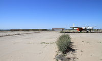
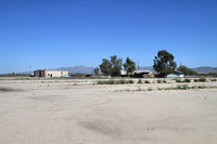
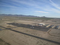
Latest photos of Buckeye Municipal Airport (BXK)
-
 by olivier Cortot
-
 by olivier Cortot
-
 by Michael Tsikalakis
-
 by Nick Taylor Photography
Location & QuickFacts
| FAA Information Effective: | 2013-12-12 |
| Airport Identifier: | BXK |
| Airport Status: | Operational |
| Longitude/Latitude: | 112-41-10.2510W/33-25-13.5000N
-112.686181/33.420417 (Estimated) |
| Elevation: | 1033 ft / 314.86 m (Estimated) |
| Land: | 706 acres |
| From nearest city: | 6 nautical miles NW of Buckeye, AZ |
| Location: | Maricopa County, AZ |
| Magnetic Variation: | 13E (1985) |
Owner & Manager
| Ownership: | Publicly owned |
| Owner: | Town Of Buckeye |
| Address: | 1101 E. Ash Avenue
Buckeye, AZ 85326 |
| Phone number: | 623-349-6650 |
| Manager: | Scott Lowe
DIRECTOR OF PUBLIC WORKS |
| Address: | 3000 S. Palo Verde Road
Buckeye, AZ 85326 |
| Phone number: | 623-349-6815 |
Airport Operations and Facilities
| Airport Use: | Open to public |
| Wind indicator: | Yes |
| Segmented Circle: | Yes |
| Control Tower: | No |
| Lighting Schedule: | SEE RMK
ACTVT MIRL RY 17/35 - CTAF. |
| Beacon Color: | Clear-Green (lighted land airport) |
| Landing fee charge: | No |
| Sectional chart: | Phoenix |
| Region: | AWP - Western-Pacific |
| Traffic Pattern Alt: | 976 ft |
| Boundary ARTCC: | ZAB - Albuquerque |
| Tie-in FSS: | PRC - Prescott |
| FSS on Airport: | No |
| FSS Toll Free: | 1-800-WX-BRIEF |
| NOTAMs Facility: | PRC (NOTAM-d service avaliable) |
| Federal Agreements: | NGPY |
Airport Communications
| CTAF: | 122.800 |
| Unicom: | 122.800 |
Airport Services
| Fuel available: | 100LL
FUEL 24 HR CREDIT CARD SVC AVBL. |
| Bulk Oxygen: | NONE |
Runway Information
Runway 17/35
| Dimension: | 5500 x 75 ft / 1676.4 x 22.9 m |
| Surface: | ASPH, Good Condition |
| Weight Limit: | Single wheel: 12500 lbs. |
| Edge Lights: | Medium |
| |
Runway 17 |
Runway 35 |
| Longitude: | 112-41-09.1010W | 112-41-11.4000W |
| Latitude: | 33-25-48.3240N | 33-24-53.9450N |
| Elevation: | 1033.00 ft | 995.00 ft |
| Alignment: | 127 | 2 |
| Traffic Pattern: | Right | Left |
| Markings: | Basic, Good Condition | Basic, Good Condition |
| Crossing Height: | 40.00 ft | 0.00 ft |
| VASI: | 2-light PAPI on left side | 4-light PAPI on left side |
| Visual Glide Angle: | 3.13° | 3.00° |
| Obstruction: | , 50:1 slope to clear | 6 ft fence, 480.0 ft from runway, 46:1 slope to clear |
Radio Navigation Aids
| ID |
Type |
Name |
Ch |
Freq |
Var |
Dist |
| SDL | NDB | Scottsdale | | 224.00 | 12E | 41.0 nm |
| CHD | NDB | Chandler | | 407.00 | 12E | 45.1 nm |
| FFZ | NDB | Falcon Field | | 281.00 | 12E | 47.9 nm |
| LUF | TACAN | Luke | 077X | | 13E | 16.9 nm |
| BXK | VORTAC | Buckeye | 043X | 110.60 | 14E | 7.2 nm |
| GBN | VORTAC | Gila Bend | 113X | 116.60 | 14E | 27.9 nm |
| PXR | VORTAC | Phoenix | 103X | 115.60 | 12E | 35.9 nm |
| PHX | VOT | Phoenix Sky Harbor | | 109.00 | | 34.0 nm |