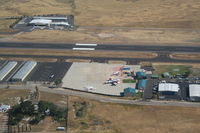
Latest photo of Ramona Airport (RNM)
-
 by Nick Taylor Photography
Location & QuickFacts
| FAA Information Effective: | 2013-12-12 |
| Airport Identifier: | RNM |
| Airport Status: | Operational |
| Longitude/Latitude: | 116-54-54.9000W/33-02-21.0000N
-116.915250/33.039167 (Estimated) |
| Elevation: | 1395 ft / 425.20 m (Surveyed) |
| Land: | 342 acres |
| From nearest city: | 2 nautical miles W of Ramona, CA |
| Location: | San Diego County, CA |
| Magnetic Variation: | 12E (2010) |
Owner & Manager
| Ownership: | Publicly owned |
| Owner: | County Of San Diego |
| Address: | 1960 Joe Crosson Drive
El Cajon, CA 92020-1235 |
| Phone number: | 619-956-4800 |
| Manager: | George Watson
ARPT MGR: GEORGE WATSON CAN ALSO BE REACHED AT FALLBROOK COMMUNITY AIRPARK 760-723-8395. |
| Address: | 2926 Montecito Road
Ramona, CA 92065 |
| Phone number: | 760-788-3366 |
Airport Operations and Facilities
| Airport Use: | Open to public |
| Wind indicator: | Yes |
| Segmented Circle: | Yes |
| Control Tower: | Yes |
| Lighting Schedule: | SEE RMK
ACTVT MIRL RY 09/27; REIL RY 27 & TWY LGTS - CTAF; PAPI RYS 09 & 27 OPER 24 HRS. |
| Beacon Color: | Clear-Green (lighted land airport) |
| Landing fee charge: | No |
| Sectional chart: | Los Angeles |
| Region: | AWP - Western-Pacific |
| Traffic Pattern Alt: | 1000 ft |
| Boundary ARTCC: | ZLA - Los Angeles |
| Tie-in FSS: | SAN - San Diego |
| FSS on Airport: | No |
| FSS Toll Free: | 1-800-WX-BRIEF |
| NOTAMs Facility: | RNM (NOTAM-d service avaliable) |
| Federal Agreements: | NGPY |
Airport Communications
| CTAF: | 119.875 |
| Unicom: | 122.950 |
Airport Services
| Fuel available: | 100LLA |
| Airframe Repair: | MAJOR |
| Power Plant Repair: | MAJOR |
| Bottled Oxygen: | NONE |
| Bulk Oxygen: | NONE |
Runway Information
Runway 09/27
| Dimension: | 5001 x 150 ft / 1524.3 x 45.7 m |
| Surface: | ASPH, Good Condition |
| Weight Limit: | Single wheel: 75000 lbs.
Dual wheel: 95000 lbs.
Dual tandem wheel: 170000 lbs. |
| Edge Lights: | Medium |
| |
Runway 09 |
Runway 27 |
| Longitude: | 116-55-23.8455W | 116-54-25.9941W |
| Latitude: | 33-02-25.2425N | 33-02-16.6840N |
| Elevation: | 1386.00 ft | 1394.00 ft |
| Alignment: | 99 | 127 |
| Traffic Pattern: | Left | Left |
| Markings: | Non-precision instrument, Good Condition | Non-precision instrument, Good Condition |
| Crossing Height: | 50.00 ft | 32.00 ft |
| VASI: | 2-light PAPI on left side | 2-light PAPI on left side |
| Visual Glide Angle: | 3.50° | 3.50° |
| Runway End Identifier: | No | Yes |
| Centerline Lights: | No | No |
| Touchdown Lights: | No | No |
Helipad H1
| Dimension: | 340 x 66 ft / 103.6 x 20.1 m |
| Surface: | ASPH-CONC, |
| |
Runway H1 |
Runway |
| Traffic Pattern: | Left | Left |
Radio Navigation Aids
| ID |
Type |
Name |
Ch |
Freq |
Var |
Dist |
| SAN | FAN MARKER | Encat | | | 15E | 21.7 nm |
| UN | NDB | Tijuana | | 381.00 | 14E | 31.0 nm |
| SJY | NDB | San Jacinto | | 227.00 | 14E | 45.6 nm |
| NKX | TACAN | Miramar | 033X | | 15E | 15.8 nm |
| NZY | TACAN | North Island | 117X | | 14E | 25.3 nm |
| NFG | TACAN | Camp Pendleton | 055X | | 13E | 27.6 nm |
| NRS | TACAN | Imperial Beach | 029X | | 14E | 30.2 nm |
| NKX | UHF/NDB | Miramar | | 352.00 | 15E | 15.1 nm |
| HDF | VOR | Homeland | | 113.40 | 14E | 46.3 nm |
| TIJ | VOR/DME | Tijuana | 112X | 116.50 | 14E | 30.1 nm |
| JLI | VORTAC | Julian | 087X | 114.00 | 15E | 17.7 nm |
| MZB | VORTAC | Mission Bay | 125X | 117.80 | 15E | 22.0 nm |
| PGY | VORTAC | Poggi | 035X | 109.80 | 14E | 26.0 nm |
| OCN | VORTAC | Oceanside | 100X | 115.30 | 15E | 28.0 nm |
| SEE | VOT | Gillespie Field | | 110.00 | | 13.2 nm |
| SAN | VOT | Mount Soledad | | 109.00 | | 20.8 nm |