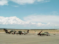
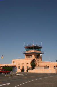
Latest photos of Santa Fe Municipal Airport (SAF)
-
 by Zane Adams
-
 by Zane Adams
-
 by Zane Adams
-
 by Zane Adams
Location & QuickFacts
| FAA Information Effective: | 2013-12-12 |
| Airport Identifier: | SAF |
| Airport Status: | Operational |
| Longitude/Latitude: | 106-05-21.9000W/35-37-01.6000N
-106.089417/35.617111 (Estimated) |
| Elevation: | 6348 ft / 1934.87 m (Surveyed) |
| Land: | 2128 acres |
| From nearest city: | 9 nautical miles SW of Santa Fe, NM |
| Location: | Santa Fe County, NM |
| Magnetic Variation: | 12E (1980) |
Owner & Manager
| Ownership: | Publicly owned |
| Owner: | City Of Santa Fe |
| Address: | Po Box 909
Santa Fe, NM 87504-0909 |
| Phone number: | 505-955-6509 |
| Manager: | Fracey Jesson |
| Address: | Po Box 909
Santa Fe, NM 87504-0909 |
| Phone number: | 505-955-2901 |
Airport Operations and Facilities
| Airport Use: | Open to public |
| Wind indicator: | Yes |
| Segmented Circle: | Yes |
| Control Tower: | Yes |
| Lighting Schedule: | SEE RMK
WHEN ATCT CLSD MIRL RY 02/20 PRESET LOW INTST; TO INCR INTST AND ACTVT MIRL RYS 15/33 AND 10/28 - CTAF. |
| Beacon Color: | Clear-Green (lighted land airport) |
| Landing fee charge: | No |
| Sectional chart: | Albuquerque |
| Region: | ASW - Southwest |
| Boundary ARTCC: | ZAB - Albuquerque |
| Tie-in FSS: | ABQ - Albuquerque |
| FSS on Airport: | No |
| FSS Toll Free: | 1-800-WX-BRIEF |
| NOTAMs Facility: | SAF (NOTAM-d service avaliable) |
| Certification type/date: | I A U 11/2005
PPR 24 HRS FOR ACR OPNS WITH MORE THAN 30 PSGR SEATS CALL AMGR AT 505-955-2900. |
| Federal Agreements: | NGY3 |
Airport Communications
| CTAF: | 119.500 |
| Unicom: | 122.950 |
Airport Services
| Fuel available: | 100LLA1 A1+ |
| Airframe Repair: | MINOR |
| Power Plant Repair: | MAJOR |
| Bottled Oxygen: | HIGH/LOW |
| Bulk Oxygen: | HIGH/LOW |
Runway Information
Runway 02/20
| Dimension: | 8366 x 150 ft / 2550.0 x 45.7 m |
| Surface: | ASPH, Good Condition |
| Surface Treatment: | Porous Friction Course |
| Weight Limit: | Single wheel: 48000 lbs.
Dual wheel: 65000 lbs.
Dual tandem wheel: 105000 lbs. |
| Edge Lights: | Medium |
| |
Runway 02 |
Runway 20 |
| Longitude: | 106-05-46.2274W | 106-04-47.9540W |
| Latitude: | 35-36-30.0540N | 35-37-37.7069N |
| Elevation: | 6273.00 ft | 6348.00 ft |
| Alignment: | 35 | 127 |
| ILS Type: | ILS/DME
| |
| Traffic Pattern: | Left | Left |
| Markings: | Precision instrument, Good Condition | Precision instrument, Good Condition |
| Crossing Height: | 69.00 ft | 54.00 ft |
| VASI: | 4-box on left side | 4-box on left side |
| Visual Glide Angle: | 3.00° | 3.00° |
| Runway End Identifier: | | Yes |
| Obstruction: | 6 ft hill, 225.0 ft from runway, 226 ft left of centerline, 4:1 slope to clear | , 50:1 slope to clear |
Runway 10/28
| Dimension: | 6301 x 75 ft / 1920.5 x 22.9 m |
| Surface: | ASPH, Good Condition |
| Surface Treatment: | Porous Friction Course |
| Weight Limit: | Single wheel: 30000 lbs. |
| Edge Lights: | Medium |
| |
Runway 10 |
Runway 28 |
| Longitude: | 106-06-04.9501W | 106-04-54.0667W |
| Latitude: | 35-37-14.0191N | 35-36-50.9937N |
| Elevation: | 6281.00 ft | 6298.00 ft |
| Alignment: | 112 | 127 |
| Traffic Pattern: | Left | Left |
| Markings: | Non-precision instrument, Good Condition | Non-precision instrument, Good Condition |
| Obstruction: | , 50:1 slope to clear | 11 ft road, 250.0 ft from runway, 260 ft right of centerline, 4:1 slope to clear |
Runway 15/33
| Dimension: | 6316 x 100 ft / 1925.1 x 30.5 m |
| Surface: | ASPH, |
| Surface Treatment: | Saw-cut or plastic Grooved |
| Weight Limit: | Single wheel: 48000 lbs.
Dual wheel: 65000 lbs.
Dual tandem wheel: 105000 lbs. |
| Edge Lights: | Medium |
| |
Runway 15 |
Runway 33 |
| Longitude: | 106-05-29.6160W | 106-05-12.0231W |
| Latitude: | 35-37-27.9551N | 35-36-27.1831N |
| Elevation: | 6319.00 ft | 6273.00 ft |
| Alignment: | 127 | 127 |
| Traffic Pattern: | Left | Left |
| Markings: | Non-precision instrument, Good Condition | Non-precision instrument, Good Condition |
| Crossing Height: | 33.00 ft | 86.00 ft |
| VASI: | pulsating/steady burning on left side | 4-box on right side
VASI OTS INDEFLY. |
| Visual Glide Angle: | 3.00° | 3.00° |
| Runway End Identifier: | Yes | Yes |
Radio Navigation Aids
| ID |
Type |
Name |
Ch |
Freq |
Var |
Dist |
| ILT | NDB | Isleta | | 247.00 | 11E | 46.0 nm |
| OTO | VOR | Otto | | 114.00 | 13E | 33.6 nm |
| SAF | VORTAC | Santa Fe | 043X | 110.60 | 13E | 4.8 nm |
| FTI | VORTAC | Fort Union | 120X | 117.30 | 13E | 46.7 nm |
| ABQ | VORTAC | Albuquerque | 079X | 113.20 | 13E | 49.6 nm |
| ABQ | VOT | Albuquerque Intl | | 111.00 | | 42.9 nm |