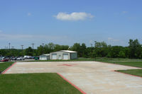
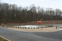
Latest photos of Unalakleet Airport (UNK)
-
 by Zane Adams
-
 by Zane Adams
-
 by J.B. Barbour
Location & QuickFacts
| FAA Information Effective: | 2013-12-12 |
| Airport Identifier: | UNK |
| Airport Status: | Operational |
| Longitude/Latitude: | 160-47-56.8000W/63-53-18.6000N
-160.799111/63.888500 (Estimated) |
| Elevation: | 27 ft / 8.23 m (Surveyed) |
| Land: | 715 acres |
| From nearest city: | 1 nautical miles N of Unalakleet, AK |
| Location: | Nome County, AK |
| Magnetic Variation: | 15E (2010) |
Owner & Manager
| Ownership: | Publicly owned |
| Owner: | State Of Alaska Dot & Pf |
| Address: | Northern Region, 2301 Peger Rd
Fairbanks, AK 99701 |
| Phone number: | 907-451-2200 |
| Manager: | Harry Johnson |
| Address: | Po Box 192
Unalakleet, AK 99684 |
| Phone number: | 907-624-3261 |
Airport Operations and Facilities
| Airport Use: | Open to public |
| Wind indicator: | Yes |
| Segmented Circle: | Yes |
| Control Tower: | No |
| Lighting Schedule: | SEE RMK
ACTVT HIRL RY 15/33 & MIRL RY 08/26, MALSR RY 15, REIL RY 33 - CTAF. VASI RYS 15 & 33 OPERATES 24HRS. |
| Beacon Color: | Clear-Green (lighted land airport) |
| Landing fee charge: | No |
| Sectional chart: | Mc Grath |
| Region: | AAL - Alaska |
| Boundary ARTCC: | ZAN - Anchorage |
| Tie-in FSS: | OME - Nome |
| FSS on Airport: | No |
| FSS Phone: | LC 443-2291 |
| FSS Toll Free: | 1-800-478-8400 |
| Alternate FSS: | FAI - Fairbanks |
| Alt. FSS Toll Free: | 1-866-248-6516 |
| NOTAMs Facility: | UNK (NOTAM-d service avaliable) |
| Federal Agreements: | N |
Airport Services
| Fuel available: | 100LLA
FUEL AVBL 0900-1700; AFT HRS CALL 624-3330. |
| Bottled Oxygen: | NONE |
| Bulk Oxygen: | NONE |
Runway Information
Runway 08/26
| Dimension: | 1900 x 75 ft / 579.1 x 22.9 m |
| Surface: | ASPH, |
| Surface Treatment: | Saw-cut or plastic Grooved |
| Edge Lights: | Medium |
| |
Runway 08 |
Runway 26 |
| Longitude: | 160-47-56.4746W | 160-47-14.4845W |
| Latitude: | 63-53-00.4096N | 63-52-57.7196N |
| Elevation: | 24.00 ft | 19.00 ft |
| Alignment: | 98 | 127 |
| Traffic Pattern: | Left | Left |
| Markings: | Basic, Good Condition | Basic, Good Condition |
Runway 15/33
| Dimension: | 5900 x 150 ft / 1798.3 x 45.7 m |
| Surface: | ASPH, |
| Surface Treatment: | Saw-cut or plastic Grooved |
| Edge Lights: | High |
| |
Runway 15 |
Runway 33 |
| Longitude: | 160-48-21.6858W | 160-47-45.6704W |
| Latitude: | 63-53-52.8255N | 63-52-56.9606N |
| Elevation: | 26.00 ft | 25.00 ft |
| Alignment: | 127 | 127 |
| ILS Type: | LOC/DME | |
| Traffic Pattern: | Right | Left |
| Markings: | Precision instrument, Good Condition | Precision instrument, Good Condition |
| Crossing Height: | 39.00 ft | 48.00 ft |
| VASI: | 4-box on left side | 4-box on left side |
| Visual Glide Angle: | 3.00° | 3.00° |
| Approach lights: | MALSR
MALSR OTS INDEFLY. | |
| Runway End Identifier: | | Yes |
Radio Navigation Aids
| ID |
Type |
Name |
Ch |
Freq |
Var |
Dist |
| JNR | NDB | North River | | 382.00 | 20E | 1.2 nm |
| UNK | VOR/DME | Unalakleet | 116X | 116.90 | 20E | 3.0 nm |