Camarillo Airport Photo
Photo ID: AP19050
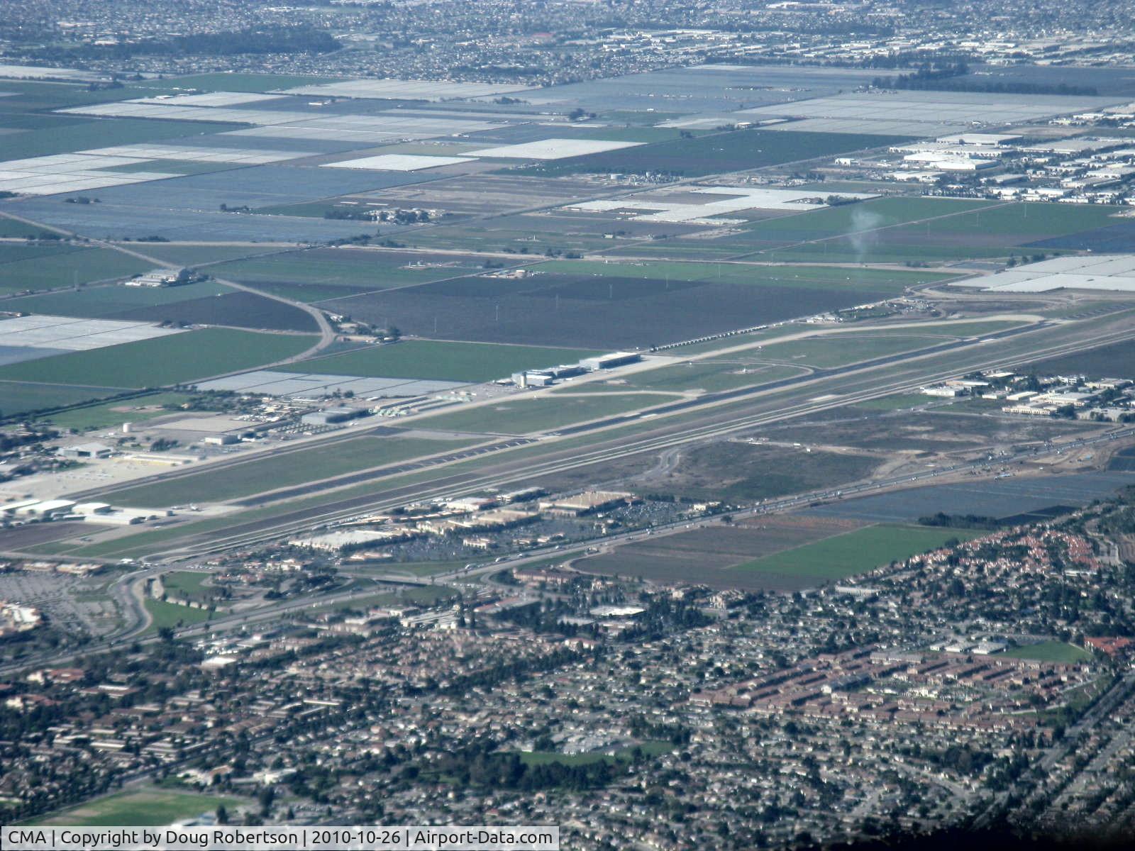
Rwy 08-26 taken from RV-7 over city of Camarillo northeast of field looking southwest. Note greatly displaced threshold-Rwy 26. Oxnard eastern city limits at top of photo. Extensive farmland between the cities.
Photo Info
| Airport | Camarillo Airport |
|---|---|
| Photographer |
Doug Robertson
Contact
|
| Shot Date | 2010-10-26 |
| Upload Date | 2010-10-27 |
| Views | 863 |
EXIF Data
| Camera Make | Canon |
|---|---|
| Camera Model | Canon PowerShot A720 IS |
| Shutter Speed | 1/400 sec |
| Aperture | f/4.8 |
| ISO | 80 |
| Focal Length | 34.8 mm |
| Exposure Bias | 0 EV |
| White Balance | Auto |
| Dimensions | 1600 × 1200 |
| Date Taken | 2010-10-26 10:34:43 |
More photos of Camarillo Airport
Total 345 photos.
View all photos
Doug Robertson
Doug Robertson
Doug Robertson
Doug Robertson
Evans St. Romain