Astoria Regional Airport (AST)
Astoria Regional Airport (AST)
AST
Astoria Regional Airport (AST)
Astoria, OR
Latest photos of Astoria Regional Airport (AST)
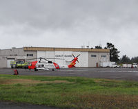
Jack Poelstra
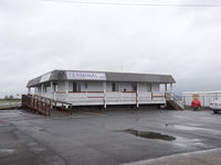
Jack Poelstra
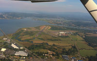
A.Shearer
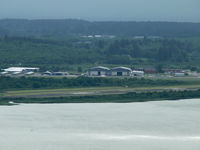
John Meneely
| FAA Information Effective | 2026-07-09 |
| Airport Identifier | AST |
| Airport Status | Operational |
| Longitude/Latitude |
123°52'43.0450"
W /
46°9'28.7220"
N -123.878624 / 46.157978 (Estimated) |
| Elevation | 14.70 ft / 4.48 m (Surveyed) |
| Land | 870 acres |
| From nearest city | 3 nautical miles SW of Astoria, OR |
| Location | Clatsop County, OR |
| Magnetic Variation | 15E (2020) |
| Airport Use | Open to public |
| Wind indicator | Yes |
| Segmented Circle | Yes |
| Control Tower | NON-ATCT |
| Lighting Schedule | SEE RMK |
| Beacon Color | White-Green (lighted land airport) |
| Landing fee charge | No |
| Sectional chart | SEATTLE |
| Region | ANM - Northwest Mountain |
| Responsible ARTCC | ZSE - SEATTLE |
| Tie-in FSS | MMV - MC MINNVILLE |
| FSS on Airport | No |
| FSS Toll Free | 1-800-WX-BRIEF |
| NOTAMs Facility | AST (NOTAM-d service available) |
Runway 08/26
| Dimensions | 5794 x 100 ft (1766 x 30 m) |
| Surface | ASPH |
| Surface treatment | |
| Edge lights | Medium |
| 08 | 26 | |
|---|---|---|
| Alignment | 95° | 275° |
| Physical elevation | 12.20 ft | 11.10 ft |
| Coordinates | 46.159834 / -123.889743 | 46.158314 / -123.866984 |
| Traffic pattern | Left | Left |
| Runway marking | Non-precision instrument , Fair Condition | Precision instrument , Fair Condition |
| ILS type | ILS | |
| VGSI | 4-box on left | |
| Approach light | MALSR | |
| Runway end lights | Yes |
Runway 14/32
| Dimensions | 4467 x 100 ft (1362 x 30 m) |
| Surface | ASPH (EXCELLENT) |
| Surface treatment | |
| Edge lights | Medium |
| 14 | 32 | |
|---|---|---|
| Alignment | 154° | 334° |
| Physical elevation | 11.60 ft | 14.50 ft |
| Coordinates | 46.162043 / -123.882879 | 46.151069 / -123.875045 |
| Traffic pattern | Left | Left |
| Runway marking | Basic , Good Condition | Basic , Good Condition |
| VGSI | 4-box on left | 4-light PAPI on left |
| Runway end lights | Yes |
- SERVICE FUEL: PORT OF ASTORIA, AVBL 1600-0100Z-, C503-861-1222. OT C503-298-7531, $50 FEE
- MIGRATORY FLOCKS OF WATERFOWL ON & INVOF ARPT.
- HIGH CONCENTRATION HEL OPNS IN AREA.
- (E94) SAWRS.
- RWY 14/32 HAS BASIC MARKINGS WITH SIDE STRIPES.
- FOR CD IF UNA TO CTC ON FSS FREQ, CTC SEATTLE ARTCC AT 253-351-3694.
- USCG ASTORIA AIR 345.0.
- ESTABD PRIOR TO 1959.