Bangor International Airport (BGR)
Bangor International Airport (BGR)
BGR
Bangor International Airport (BGR)
Bangor, ME
Latest photos of Bangor International Airport (BGR)
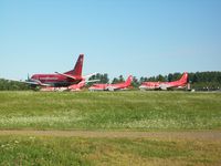
Mark Pasqualino
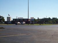
Mark Pasqualino
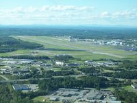
Mark Pasqualino
| FAA Information Effective | 2026-07-09 |
| Airport Identifier | BGR |
| Airport Status | Operational |
| Longitude/Latitude |
68°49'41.3000"
W /
44°48'26.8000"
N -68.828139 / 44.807444 (Estimated) |
| Elevation | 192.10 ft / 58.55 m (Surveyed) |
| Land | 2079 acres |
| From nearest city | 3 nautical miles W of Bangor, ME |
| Location | Penobscot County, ME |
| Magnetic Variation | 16W (2020) |
| Airport Use | Open to public |
| Wind indicator | Yes |
| Segmented Circle | No |
| Control Tower | ATCT-TRACON |
| Beacon Color | White-Green (lighted land airport) |
| Landing fee charge | Yes |
| Sectional chart | HALIFAX |
| Region | ANE - New England |
| Responsible ARTCC | ZBW - BOSTON |
| Tie-in FSS | BGR - BANGOR |
| FSS on Airport | No |
| FSS Toll Free | 1-800-WX-BRIEF |
| NOTAMs Facility | BGR (NOTAM-d service available) |
| Certification type/date | 1973/05 |
Runway 15/33
| Dimensions | 11440 x 200 ft (3487 x 61 m) |
| Surface | ASPH (GOOD) |
| Surface treatment | Saw-cut or plastic Grooved |
| Edge lights | High |
| 15 | 33 | |
|---|---|---|
| Alignment | 134° | 314° |
| Physical elevation | 192.10 ft | 162.90 ft |
| Coordinates | 44.818371 / -68.843931 | 44.796504 / -68.812323 |
| Traffic pattern | Left | Left |
| Runway marking | Precision instrument , Good Condition | Precision instrument , Good Condition |
| ILS type | ILS/DME | ILS/DME |
| VGSI | 4-light PAPI on left | 4-light PAPI on left |
| RVR equipment | touchdown, midfield, rollout | touchdown, midfield, rollout |
| Approach light | ALSF2 | MALSR |
| CL lights | Yes | Yes |
| TDZ lights | Yes | Yes |
Runway H1
| Dimensions | 100 x 100 ft (30 x 30 m) |
| Surface | CONC (FAIR) |
| Surface treatment |
| H1 | ||
|---|---|---|
| Physical elevation | 148.00 ft | ft |
| Coordinates | 44.805169 / -68.816328 | 0.000000 / 0.000000 |
| Traffic pattern | Left | Left |
| Runway marking | None |
- ANG: CAUTION: BASH PHASE II PERIOD SEP-NOV, APR-MAY. EXPECT INCREASED BIRD ACTIVITY. CONTACT BASE OPS/COMMAND POST/SOF FOR CURRENT BIRDWATCH COND.
- FUEL: A++ (MIL).
- SVC MIL-FLUID: OFF-BASE CONTRACTED LOX AVBL H24-RQR 24 HR NOTICE.
- ANG: OPR 1100-1930Z++ MON-FRI, CLSD WKEND AND HOL. PPR RQRD FOR ANG RAMP. CTC AFLD MGMT DSN 698-7232, C207-404-7232 FOR PPR DURG OPR HRS. PRE-COORD ALL TRNSPN RQMNTS AND HAZ CARGO WITH PPR REQ.
- ANG: PPR VALID +/- 1 HR UNLESS PRIOR CDN. 3 HR OUT CALL, 30 MIN OUT CALL 311.0 TO CFM CSTMS/AG AND TRAN SVC. COMMAND POST C207-404-7788 H24.
- ANG: TRANSIENT ACFT MAY BE DIVERTED TO CIVILIAN SIDE DURING NON-DUTY HRS & WEEKENDS. FEE REQUIRED; NO ANG TRANSIENT ALERT.
- TFC PAT: RWY 33 LEFT TFC, TURBO JET TFC 2000' MSL UNLESS OTHERWISE INSTR.
- MISC: RWY 15-33 GROOVED.
- ARNG: OPR 1230-2100Z++ MON-FRI EXC HOL. LTD MAINT. J8. PPR MAY-OCT SVC DSN 626-1100.