Block Island State Airport (BID)
Block Island State Airport (BID)
BID
Block Island State Airport (BID)
Block Island, RI
Latest photos of Block Island State Airport (BID)
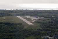
Dave G
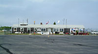
Stephen Amiaga
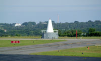
Stephen Amiaga
| FAA Information Effective | 2026-07-09 |
| Airport Identifier | BID |
| Airport Status | Operational |
| Longitude/Latitude |
71°34'40.2000"
W /
41°10'5.2000"
N -71.577833 / 41.168111 (Estimated) |
| Elevation | 107.90 ft / 32.89 m (Surveyed) |
| Land | 136 acres |
| From nearest city | 1 nautical miles W of Block Island, RI |
| Location | Washington County, RI |
| Magnetic Variation | 15W (1985) |
| Airport Use | Open to public |
| Wind indicator | Yes |
| Segmented Circle | Yes |
| Control Tower | NON-ATCT |
| Lighting Schedule | SEE RMK |
| Beacon Color | White-Green (lighted land airport) |
| Landing fee charge | Yes |
| Sectional chart | NEW YORK |
| Region | ANE - New England |
| Responsible ARTCC | ZBW - BOSTON |
| Tie-in FSS | BDR - BRIDGEPORT |
| FSS on Airport | No |
| FSS Toll Free | 1-800-WX-BRIEF |
| NOTAMs Facility | BID (NOTAM-d service available) |
Runway 10/28
| Dimensions | 2502 x 100 ft (763 x 30 m) |
| Surface | ASPH (GOOD) |
| Surface treatment | |
| Edge lights | Medium |
| 10 | 28 | |
|---|---|---|
| Alignment | 84° | 264° |
| Physical elevation | 107.70 ft | 101.40 ft |
| Coordinates | 41.167746 / -71.582358 | 41.168490 / -71.573324 |
| Traffic pattern | Left | Left |
| Runway marking | Non-precision instrument , Good Condition | Non-precision instrument , Good Condition |
| VGSI | 4-light PAPI on right | 4-light PAPI on left |
| Runway end lights | Yes | Yes |
- OBSTNS: LGTD TWRS 1 MI NE OF ARPT, 1/2 MI APART.
- DEER & BIRDS ON & INVOF ARPT.
- ARPT PRKG & SAFETY BRIEF AVBL ON LDG 122.85 MHZ OR CALL 401-466-5511.
- RWY CONDS MAY NOT BE MNT OR RPRTD WHEN AP IS UNATNDD. CTC RI AP CORPORATION OPS AT 401-691-2265.
- OVNGT PRKG FEE.
- FOR CD WHEN APCH CLSD CTC BOSTON ARTCC AT 603-879-6859.
- RWY 10/28 SAFETY AREA NOT STD SE
- +15 FT DROPOFF 130 FT FM RWY END, 150 LEFT.
- EXISTED PRIOR TO 1959.