Houghton County Meml Airport (CMX)
Houghton County Meml Airport (CMX)
CMX
Houghton County Meml Airport (CMX)
Hancock, MI
Latest photo of Houghton County Meml Airport (CMX)
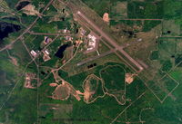
skypixs aerials
| FAA Information Effective | 2026-07-09 |
| Airport Identifier | CMX |
| Airport Status | Operational |
| Longitude/Latitude |
88°29'20.6500"
W /
47°10'6.3010"
N -88.489069 / 47.168417 (Estimated) |
| Elevation | 1095.10 ft / 333.79 m (Surveyed) |
| Land | 1996 acres |
| From nearest city | 4 nautical miles NE of Hancock, MI |
| Location | Houghton County, MI |
| Magnetic Variation | 02W (1985) |
| Airport Use | Open to public |
| Wind indicator | Yes |
| Segmented Circle | No |
| Control Tower | NON-ATCT |
| Lighting Schedule | SEE RMK |
| Beacon Color | White-Green (lighted land airport) |
| Landing fee charge | Yes |
| Sectional chart | GREEN BAY |
| Region | AGL - Great Lakes |
| Responsible ARTCC | ZMP - MINNEAPOLIS |
| Tie-in FSS | GRB - GREEN BAY |
| FSS on Airport | No |
| FSS Toll Free | 1-800-WX-BRIEF |
| NOTAMs Facility | CMX (NOTAM-d service available) |
| Certification type/date | 1973/05 |
Runway 07/25
| Dimensions | 5201 x 100 ft (1585 x 30 m) |
| Surface | ASPH (GOOD) |
| Surface treatment | Saw-cut or plastic Grooved |
| Edge lights | Medium |
| 07 | 25 | |
|---|---|---|
| Alignment | 67° | 247° |
| Physical elevation | 1058.90 ft | 1074.40 ft |
| Coordinates | 47.164279 / -88.498777 | 47.169878 / -88.479550 |
| Traffic pattern | Left | Left |
| Runway marking | Non-precision instrument , Good Condition | Non-precision instrument , Good Condition |
| VGSI | 2-light PAPI on left | 4-light PAPI on left |
| Runway end lights | Yes | Yes |
| CL lights | No | No |
| TDZ lights | No | No |
Runway 14/32
| Dimensions | 6501 x 150 ft (1982 x 46 m) |
| Surface | ASPH (GOOD) |
| Surface treatment | Saw-cut or plastic Grooved |
| Edge lights | High |
| 14 | 32 | |
|---|---|---|
| Alignment | 131° | 311° |
| Physical elevation | 1095.10 ft | 1060.70 ft |
| Coordinates | 47.175317 / -88.498878 | 47.163657 / -88.479112 |
| Traffic pattern | Left | Left |
| Runway marking | Precision instrument , Good Condition | Precision instrument , Good Condition |
| ILS type | ILS/DME | |
| VGSI | 4-light PAPI on left | 4-light PAPI on left |
| Approach light | MALSR | |
| Runway end lights | Yes | No |
| CL lights | No | No |
| TDZ lights | No | No |
- DEER & GULLS ON & INVOF ARPT.
- AIRFIELD GUIDANCE SIGNS SNOW COVD IN WINTER.
- PAEW ON ARPT MONITOR CTAF. FQT SNOW REMOVAL OPS IN PROGRESS AT VARIOUS TIMES OCT-APR MONITOR CTAF.
- PPR VIA UNICOM FOR PRKG IN FRONT OF AIRLINE TRML.
- FOR CD IF UNA TO CTC ON FSS FREQ, CTC MINNEAPOLIS ARTCC AT 651-463-5588.
- RWY CONDS UNMON DLY 0000-0500.