Jacksonville Exec At Craig Airport (CRG)
Jacksonville Exec At Craig Airport (CRG)
CRG
Jacksonville Exec At Craig Airport (CRG)
Jacksonville, FL
Latest photos of Jacksonville Exec At Craig Airport (CRG)
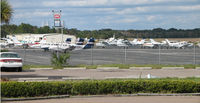
Sam Andrews
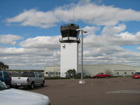
Sam Andrews
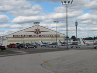
Sam Andrews
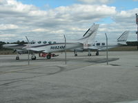
Sam Andrews
| FAA Information Effective | 2026-07-09 |
| Airport Identifier | CRG |
| Airport Status | Operational |
| Longitude/Latitude |
81°30'52.0000"
W /
30°20'10.8000"
N -81.514444 / 30.336333 (Estimated) |
| Elevation | 40.70 ft / 12.41 m (Surveyed) |
| Land | 1432 acres |
| From nearest city | 8 nautical miles E of Jacksonville, FL |
| Location | Duval County, FL |
| Magnetic Variation | 06W (2015) |
| Airport Use | Open to public |
| Wind indicator | Yes |
| Segmented Circle | Yes |
| Control Tower | ATCT |
| Lighting Schedule | SEE RMK |
| Beacon Color | White-Green (lighted land airport) |
| Landing fee charge | No |
| Sectional chart | JACKSONVILLE |
| Region | ASO - Southern |
| Responsible ARTCC | ZJX - JACKSONVILLE |
| Tie-in FSS | GNV - GAINESVILLE |
| FSS on Airport | No |
| FSS Toll Free | 1-800-WX-BRIEF |
| NOTAMs Facility | CRG (NOTAM-d service available) |
Runway 05/23
| Dimensions | 4004 x 100 ft (1220 x 30 m) |
| Surface | ASPH (FAIR) |
| Surface treatment | |
| Edge lights | Medium |
| PCN | 31 |
| 05 | 23 | |
|---|---|---|
| Alignment | 45° | 225° |
| Physical elevation | 40.10 ft | 40.30 ft |
| Coordinates | 30.328892 / -81.518936 | 30.336675 / -81.509961 |
| Traffic pattern | Left | Left |
| Runway marking | Non-precision instrument , Good Condition | Non-precision instrument , Good Condition |
| VGSI |
4-light PAPI on left *UNUSBL BYD 3.5 MILES ON FINAL DUE TO LRG TWRS LCTD ON EXTDD CNTRLN. |
4-light PAPI on left *UNUSBL BYD 8.0 DEGS LEFT AND RIGHT OF CNTRLN. |
| Runway end lights | Yes |
Runway 14/32
| Dimensions | 4008 x 100 ft (1222 x 30 m) |
| Surface | ASPH (GOOD) |
| Surface treatment | |
| Edge lights | High |
| PCN | 34 |
| 14 | 32 | |
|---|---|---|
| Alignment | 135° | 315° |
| Physical elevation | 32.00 ft | 40.30 ft |
| Coordinates | 30.343783 / -81.518956 | 30.335987 / -81.509975 |
| Traffic pattern | Left | Left |
| Runway marking | Non-precision instrument , Good Condition | Precision instrument , Good Condition |
| ILS type | ILS | |
| VGSI | 4-light PAPI on left | 4-light PAPI on left |
| Approach light | MALSR | |
| Runway end lights | Yes |
- BIRDS PERIODICALLY ON OR NEAR THE ARPT INCREASING IN ACTIVITY DURING INCLEMENT WEATHER.
- BANNER TOWING ON WEEKENDS & SPECIAL EVENTS.
- VFR NOISE ABATEMENT PROCEDURES IN EFFECT, CALL AMGR 904-641-7666. WX PERMITTING, RY 05 PREFERRED FOR APCH, RY 32 PREFERRED FOR DEP.
- WILDLIFE ON & INVOF ARPT.
- PAVEMENT ACCOMMODATES DESIGN GROUP II ACFT (UP TO 79 FT WINGSPAN) UP TO 60,000 LBS DUAL WHEEL LOADING. PPR FOR ACFT EXCEEDING THESE LTDS CTC AT 904-741-2020.
- 24 HR ADVN NOTICE OR IMT REPORTING UPON LDG FOR ACFT EQUIPPED WITH WEATHER MODIFICATION OR GEOENGINEERING EQUIP CTC ARPT OPS 904-741-2020.