Danville Regional Airport (DAN)
Danville Regional Airport (DAN)
DAN
Danville Regional Airport (DAN)
Danville, VA
Latest photos of Danville Regional Airport (DAN)
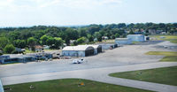
Richard T Davis
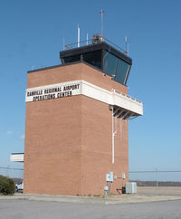
Richard T Davis
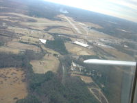
Jesse Edwards
| FAA Information Effective | 2026-09-03 |
| Airport Identifier | DAN |
| Airport Status | Operational |
| Longitude/Latitude |
79°20'10.5000"
W /
36°34'20.9000"
N -79.336250 / 36.572472 (Estimated) |
| Elevation | 571.10 ft / 174.07 m (Surveyed) |
| Land | 800 acres |
| From nearest city | 3 nautical miles E of Danville, VA |
| Location | Pittsylvania County, VA |
| Magnetic Variation | 09W (2010) |
| Airport Use | Open to public |
| Wind indicator | Yes |
| Segmented Circle | Yes |
| Control Tower | NON-ATCT |
| Lighting Schedule | SEE RMK |
| Beacon Color | White-Green (lighted land airport) |
| Landing fee charge | No |
| Sectional chart | CINCINNATI |
| Region | AEA - Eastern |
| Responsible ARTCC | ZDC - WASHINGTON |
| Tie-in FSS | DCA - LEESBURG |
| FSS Toll Free | 1-800-WX-BRIEF |
| NOTAMs Facility | DAN (NOTAM-d service available) |
Runway 02/20
| Dimensions | 5900 x 100 ft (1798 x 30 m) |
| Surface | ASPH (GOOD) |
| Surface treatment | Saw-cut or plastic Grooved |
| Edge lights | High |
| 02 | 20 | |
|---|---|---|
| Alignment | 16° | 196° |
| Physical elevation | 535.60 ft | 564.60 ft |
| Coordinates | 36.562931 / -79.341481 | 36.578483 / -79.335838 |
| Traffic pattern | Left | Left |
| Runway marking | Precision instrument , Good Condition | Non-precision instrument , Good Condition |
| ILS type | ILS | |
| VGSI | 4-light PAPI on left | 4-light PAPI on left |
| Approach light | MALSR | |
| Runway end lights | Yes |
Runway 13/31
| Dimensions | 3910 x 100 ft (1192 x 30 m) |
| Surface | ASPH (GOOD) |
| Surface treatment | |
| Edge lights | Medium |
| 13 | 31 | |
|---|---|---|
| Alignment | 125° | 305° |
| Physical elevation | 571.10 ft | 527.80 ft |
| Coordinates | 36.578187 / -79.338069 | 36.572099 / -79.327098 |
| Traffic pattern | Left | Left |
| Runway marking | Basic , Good Condition | Non-precision instrument , Good Condition |
| VGSI | 2-box on left | 2-light PAPI on left |
| Runway end lights | Yes | Yes |
- BIRDS & DEER ON & INVOF ARPT.
- RY 02 IS DESIGNATED CALM WIND RY.
- CTC ARPT ADMIN PRIOR TO CONDUCTING SPECIALIZED AERO ACTIVITIES 434-799-5110.
- TREES PENETRATING 7:1 TRANSITIONAL SURFACE, RY 31 BOTH SIDES, FIRST 1000 FT.
- FOR CD IF UNA TO CTC ON FSS FREQ, CTC WASHINGTON ARTCC AT 703-771-3587.
- VFR DAYLIGHT USE ONLY; COORDINATION WITH DANVILLE MUNI ARPT; FOLLOW-ON FAA INSPECTION.