Dubuque Regional Airport (DBQ)
Dubuque Regional Airport (DBQ)
DBQ
Dubuque Regional Airport (DBQ)
Dubuque, IA
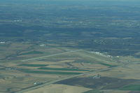
Latest photo of Dubuque Regional Airport (DBQ)
Mark Pasqualino
| FAA Information Effective | 2026-07-09 |
| Airport Identifier | DBQ |
| Airport Status | Operational |
| Longitude/Latitude |
90°42'34.1000"
W /
42°24'7.2000"
N -90.709472 / 42.402000 (Estimated) |
| Elevation | 1076.40 ft / 328.09 m (Surveyed) |
| Land | 1240 acres |
| From nearest city | 7 nautical miles SW of Dubuque, IA |
| Location | Dubuque County, IA |
| Magnetic Variation | 03E (1975) |
| Airport Use | Open to public |
| Wind indicator | Yes |
| Segmented Circle | No |
| Control Tower | ATCT |
| Lighting Schedule | SEE RMK |
| Beacon Color | White-Green (lighted land airport) |
| Landing fee charge | No |
| Sectional chart | CHICAGO |
| Region | ACE - Central |
| Responsible ARTCC | ZAU - CHICAGO |
| Tie-in FSS | FOD - FORT DODGE |
| FSS on Airport | No |
| FSS Toll Free | 1-800-WX-BRIEF |
| NOTAMs Facility | DBQ (NOTAM-d service available) |
| Certification type/date | 1973/05 |
Runway 13/31
| Dimensions | 6502 x 100 ft (1982 x 30 m) |
| Surface | CONC (GOOD) |
| Surface treatment | Saw-cut or plastic Grooved |
| Edge lights | High |
| 13 | 31 | |
|---|---|---|
| Alignment | 135° | 315° |
| Physical elevation | 1076.40 ft | 1062.20 ft |
| Coordinates | 42.409311 / -90.715517 | 42.396710 / -90.698477 |
| Traffic pattern | Left | Left |
| Runway marking | Precision instrument , Good Condition | Precision instrument , Good Condition |
| ILS type | LOC/DME | |
| VGSI | 4-light PAPI on right | 4-light PAPI on left |
| Approach light | MALS | MALSR |
Runway 18/36
| Dimensions | 6327 x 150 ft (1928 x 46 m) |
| Surface | CONC (GOOD) |
| Surface treatment | Saw-cut or plastic Grooved |
| Edge lights | High |
| 18 | 36 | |
|---|---|---|
| Alignment | 180° | 360° |
| Physical elevation | 1072.80 ft | 1033.40 ft |
| Coordinates | 42.409624 / -90.712039 | 42.392265 / -90.712016 |
| Traffic pattern | Left | Left |
| Runway marking | Precision instrument , Good Condition | Precision instrument , Good Condition |
| ILS type | ILS/DME | |
| VGSI | 4-light PAPI on left | 4-light PAPI on left |
| RVR equipment | rollout | touchdown |
| Approach light | MALSR | |
| Runway end lights | Yes |
- WATERFOWL ON & INVOF ARPT.
- 100LL SELF SERVICE FUEL STATION AVBL AT T-HGRS 24HRS. AREA NOT VSB BY TWR.
- ACFT DEPARTING RY 36, THE APCH ENDS OF RY 31 AND RY 18 ARE NOT VISIBLE FOR APRXLY THE FIRST 3000 FT OF TKOF ROLL.
- FOR CD IF UNA TO CTC ON FSS FREQ, CTC CHICAGO ARTCC AT 630-906-8921.
- DASHED TWY EDGE MARKING ADJ TO TWY A EDGE AND GA APN DEFINE THE MOVMT/NON-MOVMT AREA BNDRY. NON-MOVMT AREA BNDRY MARKING ON THE GA APNS ARE THE WINGTIP CLNC LINE - TOFA BNDRY.
- PPR FOR UNSCHD ACR OPNS CALL AMGR (563) 589-4136. ARFF INDEX B LEVEL EQUIP IS PROVIDED.