Decatur Airport (DEC)
Decatur Airport (DEC)
DEC
Decatur Airport (DEC)
Decatur, IL
Latest photos of Decatur Airport (DEC)
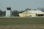
Timothy Aanerud
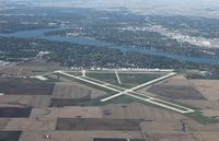
Mark Pasqualino
| FAA Information Effective | 2026-07-09 |
| Airport Identifier | DEC |
| Airport Status | Operational |
| Longitude/Latitude |
88°51'56.4810"
W /
39°50'4.4250"
N -88.865689 / 39.834562 (Estimated) |
| Elevation | 681.90 ft / 207.84 m (Surveyed) |
| Land | 2100 acres |
| From nearest city | 4 nautical miles E of Decatur, IL |
| Location | Macon County, IL |
| Magnetic Variation | 01W (2000) |
| Airport Use | Open to public |
| Wind indicator | Yes |
| Segmented Circle | No |
| Control Tower | ATCT |
| Lighting Schedule | SEE RMK |
| Beacon Color | White-Green (lighted land airport) |
| Landing fee charge | No |
| Sectional chart | ST LOUIS |
| Region | AGL - Great Lakes |
| Responsible ARTCC | ZAU - CHICAGO |
| Tie-in FSS | STL - SAINT LOUIS |
| FSS Toll Free | 1-800-WX-BRIEF |
| NOTAMs Facility | DEC (NOTAM-d service available) |
| Certification type/date | 1973/05 |
Runway 06/24
| Dimensions | 8496 x 150 ft (2590 x 46 m) |
| Surface | ASPH-CONC (GOOD) |
| Surface treatment | Saw-cut or plastic Grooved |
| Edge lights | High |
| 06 | 24 | |
|---|---|---|
| Alignment | 59° | 239° |
| Physical elevation | 672.70 ft | 681.80 ft |
| Coordinates | 39.827098 / -88.874517 | 39.839062 / -88.848552 |
| Traffic pattern | Left | Left |
| Runway marking | Precision instrument , Good Condition | Precision instrument , Fair Condition |
| ILS type | ILS/DME | |
| VGSI | 4-box on left | |
| RVR equipment | touchdown, midfield | midfield, rollout |
| Approach light | MALSR | |
| Runway end lights | No | No |
| CL lights | No | No |
| TDZ lights | No | No |
Runway 12/30
| Dimensions | 6799 x 150 ft (2072 x 46 m) |
| Surface | ASPH-CONC (GOOD) |
| Surface treatment | Saw-cut or plastic Grooved |
| Edge lights | Medium |
| 12 | 30 | |
|---|---|---|
| Alignment | 119° | 299° |
| Physical elevation | 678.30 ft | 678.00 ft |
| Coordinates | 39.841251 / -88.874801 | 39.832165 / -88.853653 |
| Traffic pattern | Left | Left |
| Runway marking | Non-precision instrument , Good Condition | Non-precision instrument , Fair Condition |
| VGSI | 4-light PAPI on left | |
| Runway end lights | No | |
| CL lights | No | No |
| TDZ lights | No | No |
Runway 18/36
| Dimensions | 5298 x 150 ft (1615 x 46 m) |
| Surface | ASPH (GOOD) |
| Surface treatment | Saw-cut or plastic Grooved |
| Edge lights | Medium |
| 18 | 36 | |
|---|---|---|
| Alignment | 179° | 359° |
| Physical elevation | 678.90 ft | 672.20 ft |
| Coordinates | 39.841451 / -88.874373 | 39.826909 / -88.874083 |
| Traffic pattern | Left | Left |
| Runway marking | Non-precision instrument , Good Condition | Non-precision instrument , Good Condition |
| VGSI | 4-light PAPI on left | 4-box on left |
| Runway end lights | No | |
| CL lights | No | No |
| TDZ lights | No | No |
- N RAMP FROM HNGR B TO HNGR G CLSD TO ACFT OVR 12500 LBS.
- WHEN ATCT CLSD BE ALERT FOR VEHICULAR TFC IN ARPT OPS AREAS.
- BIRDS & WILDLIFE ON & INVOF ARPT.
- GLIDER OPS RWY 06 & 30 ONLY, RQR WRITTEN APVL - CTC AMGR. SOD OPS NA.
- SNOW REMOVAL OPS WINTER MONTHS MNT CTAF. LNDG/DEP ACFT USE CTAF WHEN ATCT CLSD.
- FOR US CUSTOMS CALL 217-425-4803.
- RWY 12 & 18 AND RWY 06 & 36 CLOSELY ALIGNED. VFY CORRECT RWY AND COMPASS HDG PRIOR TO DEP.
- TWY A RSTRD NORTH OF TWY G TO ACFT WITH WINGSPAN OF 86FT OR LESS WITHOUT PPR - CTC AMGR.
- FOR CD IF UNA TO CTC ON FSS FREQ, CTC CHICAGO ARTCC 630-906-8921.
- 217-428-8836
- SECONDARY LAHSO 8000 FT HOLD SHORT OF RWY 18/36.