Columbia Gorge Rgnl/the Dalles Municipal Airport (DLS)
Columbia Gorge Rgnl/the Dalles Municipal Airport (DLS)
DLS
Columbia Gorge Rgnl/the Dalles Municipal Airport (DLS)
The Dalles, OR
Latest photos of Columbia Gorge Rgnl/the Dalles Municipal Airport (DLS)
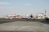
Jack Poelstra
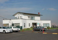
Jack Poelstra
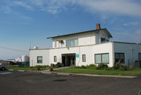
Jack Poelstra
| FAA Information Effective | 2026-07-09 |
| Airport Identifier | DLS |
| Airport Status | Operational |
| Longitude/Latitude |
121°10'5.7926"
W /
45°37'9.6786"
N -121.168276 / 45.619355 (Estimated) |
| Elevation | 246.50 ft / 75.13 m (Surveyed) |
| Land | 997 acres |
| From nearest city | 2 nautical miles NE of The Dalles, OR |
| Location | Klickitat County, WA |
| Magnetic Variation | 15E (2015) |
| Airport Use | Open to public |
| Wind indicator | Yes |
| Segmented Circle | Yes |
| Control Tower | NON-ATCT |
| Lighting Schedule | SEE RMK |
| Beacon Color | White-Green (lighted land airport) |
| Landing fee charge | No |
| Sectional chart | SEATTLE |
| Region | ANM - Northwest Mountain |
| Responsible ARTCC | ZSE - SEATTLE |
| Tie-in FSS | SEA - SEATTLE |
| FSS on Airport | No |
| FSS Toll Free | 1-800-WX-BRIEF |
| NOTAMs Facility | DLS (NOTAM-d service available) |
Runway 07/25
| Dimensions | 4647 x 100 ft (1416 x 30 m) |
| Surface | ASPH (GOOD) |
| Surface treatment | |
| Edge lights | Medium |
| 07 | 25 | |
|---|---|---|
| Alignment | 88° | 268° |
| Physical elevation | 211.10 ft | 242.70 ft |
| Coordinates | 45.620804 / -121.178018 | 45.621247 / -121.159869 |
| Traffic pattern | Left | Left |
| Runway marking | Precision instrument , Good Condition | Precision instrument , Good Condition |
| ILS type | LDA/DME |
Runway 13/31
| Dimensions | 5097 x 100 ft (1554 x 30 m) |
| Surface | ASPH (GOOD) |
| Surface treatment | |
| Edge lights | Medium |
| PCN | 32 |
| 13 | 31 | |
|---|---|---|
| Alignment | 145° | 325° |
| Physical elevation | 210.90 ft | 238.90 ft |
| Coordinates | 45.623530 / -121.173434 | 45.612134 / -121.161900 |
| Traffic pattern | Left | Left |
| Runway marking | Basic , Good Condition | Basic , Good Condition |
| Runway end lights | Yes |