Faribault Muni-liz Wall Strohfus Fld Airport (FBL)
Faribault Muni-liz Wall Strohfus Fld Airport (FBL)
FBL
Faribault Muni-liz Wall Strohfus Fld Airport (FBL)
Faribault, MN
Latest photos of Faribault Muni-liz Wall Strohfus Fld Airport (FBL)
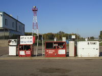
Mitch Sando
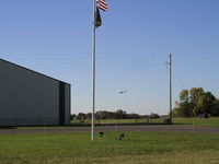
Mitch Sando
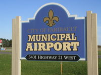
Mitch Sando
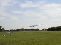
Mitch Sando
| FAA Information Effective | 2026-07-09 |
| Airport Identifier | FBL |
| Airport Status | Operational |
| Longitude/Latitude |
93°18'47.0651"
W /
44°19'44.2898"
N -93.313074 / 44.328969 (Estimated) |
| Elevation | 1060.10 ft / 323.12 m (Surveyed) |
| Land | 208 acres |
| From nearest city | 3 nautical miles NW of Faribault, MN |
| Location | Rice County, MN |
| Magnetic Variation | 02E (2000) |
| Airport Use | Open to public |
| Wind indicator | Yes |
| Segmented Circle | No |
| Control Tower | NON-ATCT |
| Lighting Schedule | SEE RMK |
| Beacon Color | White-Green (lighted land airport) |
| Landing fee charge | No |
| Sectional chart | OMAHA |
| Region | AGL - Great Lakes |
| Responsible ARTCC | ZMP - MINNEAPOLIS |
| Tie-in FSS | PNM - PRINCETON |
| FSS on Airport | No |
| FSS Toll Free | 1-800-WX-BRIEF |
| NOTAMs Facility | FBL (NOTAM-d service available) |
Runway 01/19
| Dimensions | 2300 x 175 ft (701 x 53 m) |
| Surface | TURF (FAIR) |
| Surface treatment |
| 01 | 19 | |
|---|---|---|
| Alignment | 10° | 190° |
| Physical elevation | 1051.30 ft | 1054.60 ft |
| Coordinates | 44.327767 / -93.316514 | 44.333985 / -93.315036 |
| Traffic pattern | Left | Left |
| Runway marking | Nonstandard , Fair Condition | Nonstandard , Fair Condition |
Runway 12/30
| Dimensions | 4257 x 75 ft (1298 x 23 m) |
| Surface | ASPH (FAIR) |
| Surface treatment | |
| Edge lights | Medium |
| 12 | 30 | |
|---|---|---|
| Alignment | 127° | 307° |
| Physical elevation | 1060.00 ft | 1048.40 ft |
| Coordinates | 44.331461 / -93.318101 | 44.324418 / -93.305128 |
| Traffic pattern | Left | Left |
| Runway marking | Non-precision instrument , Fair Condition | Non-precision instrument , Fair Condition |
| VGSI |
4-light PAPI on left *RY 12 PAPI OPERATE CONTINUOUSLY. |
4-light PAPI on left *RY 30 PAPI OPERATE CONTINUOUSLY. |
| Runway end lights | Yes | Yes |
- GCO AVBL ON FREQ 121.725 THRU MSP CD & FLT SVCS.
- ULTRALIGHTS & GLDRS USE TAXIWAY AND EXTENDED TAXIWAY PARALLEL TO RY 12/30. ULTRALIGHTS & GLDRS USING TAXIWAY FLY PATTERN ON 'NE' SIDE OF RY 12/30.
- WHEN LNDG ON RY 12, BE ALERT FOR TURBULENCE & POSS WINDSHEAR WHEN WINDS ARE OUT OF THE SOUTH.
- FOR CD CTC MINNEAPOLIS APCH AT 612-713-4016.
- RWY 01-19 NOT PLOWED WINTER MONTHS. OPEN FOR SKIPLANES.