Fort Lauderdale Exec Airport (FXE)
Fort Lauderdale Exec Airport (FXE)
FXE
Fort Lauderdale Exec Airport (FXE)
Fort Lauderdale, FL
Latest photos of Fort Lauderdale Exec Airport (FXE)
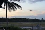
FerryPNL
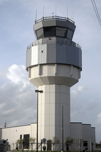
Bruce H. Solov
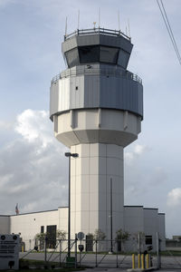
Bruce H. Solov
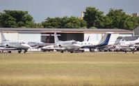
Florida Metal
| FAA Information Effective | 2026-07-09 |
| Airport Identifier | FXE |
| Airport Status | Operational |
| Longitude/Latitude |
80°10'14.5426"
W /
26°11'50.2057"
N -80.170706 / 26.197279 (Estimated) |
| Elevation | 13.40 ft / 4.08 m (Surveyed) |
| Land | 1050 acres |
| From nearest city | 5 nautical miles N of Fort Lauderdale, FL |
| Location | Broward County, FL |
| Magnetic Variation | 07W (2015) |
| Airport Use | Open to public |
| Wind indicator | Yes |
| Segmented Circle | Yes |
| Control Tower | ATCT |
| Lighting Schedule | SS-SR |
| Beacon Color | White-Green (lighted land airport) |
| Landing fee charge | No |
| Sectional chart | MIAMI |
| Region | ASO - Southern |
| Responsible ARTCC | ZMA - MIAMI |
| Tie-in FSS | MIA - MIAMI |
| FSS on Airport | No |
| FSS Toll Free | 1-800-WX-BRIEF |
| NOTAMs Facility | FXE (NOTAM-d service available) |
Runway 09/27
| Dimensions | 6002 x 100 ft (1829 x 30 m) |
| Surface | ASPH (EXCELLENT) |
| Surface treatment | Saw-cut or plastic Grooved |
| Edge lights | High |
| PCN | 18 |
| 09 | 27 | |
|---|---|---|
| Alignment | 84° | 264° |
| Physical elevation | 11.70 ft | 11.80 ft |
| Coordinates | 26.197575 / -80.180865 | 26.199363 / -80.162670 |
| Traffic pattern | Left | Left |
| Runway marking | Precision instrument , Good Condition | Precision instrument , Good Condition |
| ILS type | ILS | |
| VGSI | 4-light PAPI on left | 4-light PAPI on left |
| Approach light | MALSR | |
| Runway end lights | Yes |
Runway 13/31
| Dimensions | 4000 x 100 ft (1219 x 30 m) |
| Surface | ASPH (FAIR) |
| Surface treatment | Saw-cut or plastic Grooved |
| Edge lights | Medium |
| PCN | 26 |
| 13 | 31 | |
|---|---|---|
| Alignment | 129° | 309° |
| Physical elevation | 12.30 ft | 10.90 ft |
| Coordinates | 26.198943 / -80.173868 | 26.192049 / -80.164361 |
| Traffic pattern | Left | Left |
| Runway marking | Non-precision instrument , Good Condition | Non-precision instrument , Good Condition |
| VGSI | 2-light PAPI on left | 2-light PAPI on left |
| Runway end lights | Yes | Yes |
- REQUEST PROGRESSIVE TAXI IF UNFAMILIAR.
- MAINTENANCE ENGINE RUN-UPS PROHIBITED 1900-0700.
- RY 27 NIGHTTIME PREFERENTIAL USE RY FOR ALL ACFT DEPARTURES WHEN WINDS PERMIT.
- RY 09 NIGHTTIME PREFERENTIAL USE RY FOR ALL ACFT ARRIVALS WHEN WINDS PERMIT.
- NOISE ABATEMENT PROCEDURES IN EFFECT CALL AMGR 954-828-4955.
- US CUSTOMS RAMP CLOSED TO ARRIVING AIRCRAFT 0000-0800.
- PPR FOR ACFT IN EXCESS OF RY WEIGHT BEARING CAPACITY. CALL AMGR MON-FRI 954-828-4955.
- PORTIONS OF RY 31 RUN-UP AREA(WEST OF TWY 'B')ARE NOT VISIBLE FROM THE ATCT.
- CUSTOMS RAMP LOCATED TWY G7.
- USE CTN FOR DRONES AUTH AOB 400 FT WI CLASS D.
- 24 HR ADVN NOTICE OR IMT REPORTING UPON LDG FOR ACFT EQUIPPED WITH WEATHER MODIFICATION OR GEOENGINEERING EQUIP 954-828-4955
- FLOCKS OF BIRDS ON & INVOF ARPT.
- ALL ACFT OPERATORS AVOID OVERFLIGHTS OF RESIDENTIAL AREA ONE-HALF MILE SW OF ATCT.
- TAXILANE 'C'(SW OF TWY 'B') IS A NON-CONTROLLED OPERATIONAL AREA.