Grand Junction Regional Airport (GJT)
Grand Junction Regional Airport (GJT)
GJT
Grand Junction Regional Airport (GJT)
Grand Junction, CO
Latest photos of Grand Junction Regional Airport (GJT)
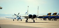
Victor Agababov
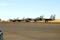
Victor Agababov
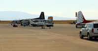
Victor Agababov
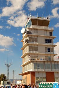
Victor Agababov
| FAA Information Effective | 2026-07-09 |
| Airport Identifier | GJT |
| Airport Status | Operational |
| Longitude/Latitude |
108°31'31.7480"
W /
39°7'17.3970"
N -108.525486 / 39.121499 (Estimated) |
| Elevation | 4861.40 ft / 1481.75 m (Surveyed) |
| Land | 2357 acres |
| From nearest city | 3 nautical miles NE of Grand Junction, CO |
| Location | Mesa County, CO |
| Magnetic Variation | 09E (2025) |
| Airport Use | Open to public |
| Wind indicator | Yes |
| Segmented Circle | Yes |
| Control Tower | ATCT |
| Lighting Schedule | SEE RMK |
| Beacon Color | White-Green (lighted land airport) |
| Landing fee charge | No |
| Sectional chart | DENVER |
| Region | ANM - Northwest Mountain |
| Responsible ARTCC | ZDV - DENVER |
| Tie-in FSS | DEN - DENVER |
| FSS on Airport | No |
| FSS Toll Free | 1-800-WX-BRIEF |
| NOTAMs Facility | GJT (NOTAM-d service available) |
| Certification type/date | 1973/05 |
Runway 04/22
| Dimensions | 5501 x 75 ft (1677 x 23 m) |
| Surface | ASPH (GOOD) |
| Surface treatment | Saw-cut or plastic Grooved |
| Edge lights | Medium |
| 04 | 22 | |
|---|---|---|
| Alignment | 54° | 234° |
| Physical elevation | 4787.60 ft | 4860.80 ft |
| Coordinates | 39.109902 / -108.529884 | 39.118681 / -108.514115 |
| Traffic pattern | Left | Left |
| Runway marking | Basic , Fair Condition | Basic , Fair Condition |
| VGSI | 4-light PAPI on left | |
| Runway end lights | Yes | Yes |
Runway 11/29
| Dimensions | 9339 x 150 ft (2847 x 46 m) |
| Surface | ASPH (EXCELLENT) |
| Surface treatment | Saw-cut or plastic Grooved |
| Edge lights | High |
| 11 | 29 | |
|---|---|---|
| Alignment | 125° | 305° |
| Physical elevation | 4827.90 ft | 4861.40 ft |
| Coordinates | 39.133129 / -108.540990 | 39.118359 / -108.514091 |
| Traffic pattern | Left | Left |
| Runway marking | Precision instrument , Fair Condition | Precision instrument , Fair Condition |
| ILS type | ILS/DME | LDA/DME |
| VGSI | 4-light PAPI on left | 4-box on left |
| RVR equipment | touchdown | rollout |
| Approach light | MALSF | |
| Runway end lights | Yes |
- TWY C1A & TWY C, 150 FT EITHER SIDE OF THE INTXN NOT VSBL FM ATCT.
- CONDITIONS NOT MONITORED 0000-0530 LOCAL TIME EXCEPT BY PPR.
- CD FONE: WHEN TWR CLSD, CTC GRAND JUNCTION APCH 303-342-1916. IFUN, CTC DENVER ARTCC 303-342-4257.
- HEL PRKG AVBL AT FBO; PPR RCMDD.
- FLOCKS OF BIRDS ON & INVOF ARPT.
- NOISE ABATEMENT PROCEDURES IN EFCT, CTC ARPT MGMT FOR DETAILS AT (970) 244-9100.
- JASU: 1(MD-3A), 1(NC-10A/A1/BC), 2(AM32A-60B).
- FLUID: SP, LHOX LOX, LHNIT, DE-ICE(MIL A-8243).
- ARPT OPS NUMBER IS 970-260-7164. PLEASE CALL FOR ANY NOTAMS OR CONCERNS.