Piedmont Triad International Airport (GSO)
Piedmont Triad International Airport (GSO)
GSO
Piedmont Triad International Airport (GSO)
Greensboro, NC
Latest photos of Piedmont Triad International Airport (GSO)
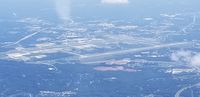
Jim Monroe
Micha Lueck
Mark Pasqualino
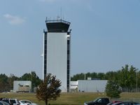
J.B. Barbour
| FAA Information Effective | 2026-07-09 |
| Airport Identifier | GSO |
| Airport Status | Operational |
| Longitude/Latitude |
79°56'28.0420"
W /
36°6'4.7760"
N -79.941123 / 36.101327 (Estimated) |
| Elevation | 925.50 ft / 282.09 m (Surveyed) |
| Land | 3770 acres |
| From nearest city | 7 nautical miles W of Greensboro, NC |
| Location | Guilford County, NC |
| Magnetic Variation | 08W (2010) |
| Airport Use | Open to public |
| Wind indicator | Yes |
| Segmented Circle | Yes |
| Control Tower | ATCT-TRACON |
| Beacon Color | White-Green (lighted land airport) |
| Landing fee charge | No |
| Sectional chart | CINCINNATI |
| Region | ASO - Southern |
| Responsible ARTCC | ZTL - ATLANTA |
| Tie-in FSS | RDU - RALEIGH |
| FSS on Airport | No |
| FSS Toll Free | 1-800-WX-BRIEF |
| NOTAMs Facility | GSO (NOTAM-d service available) |
| Certification type/date | 1973/05 |
Runway 05L/23R
| Dimensions | 9000 x 150 ft (2743 x 46 m) |
| Surface | ASPH (FAIR) |
| Surface treatment | Saw-cut or plastic Grooved |
| Edge lights | High |
| 05L | 23R | |
|---|---|---|
| Alignment | 46° | 226° |
| Physical elevation | 916.40 ft | 855.30 ft |
| Coordinates | 36.099256 / -79.959046 | 36.116433 / -79.937135 |
| Traffic pattern | Left | Left |
| Runway marking | Precision instrument , Good Condition | Precision instrument , Good Condition |
| ILS type | ILS/DME | ILS/DME |
| VGSI | 4-light PAPI on left | 4-light PAPI on left |
| RVR equipment | touchdown, midfield, rollout | touchdown, midfield, rollout |
| Approach light | ALSF2 | MALSR |
| CL lights | Yes | Yes |
| TDZ lights | Yes | Yes |
Runway 05R/23L
| Dimensions | 10001 x 150 ft (3048 x 46 m) |
| Surface | ASPH (GOOD) |
| Surface treatment | Saw-cut or plastic Grooved |
| Edge lights | High |
| 05R | 23L | |
|---|---|---|
| Alignment | 46° | 226° |
| Physical elevation | 899.50 ft | 885.80 ft |
| Coordinates | 36.091058 / -79.944658 | 36.110142 / -79.920310 |
| Traffic pattern | Left | Left |
| Runway marking | Precision instrument , Good Condition | Precision instrument , Good Condition |
| ILS type | ILS/DME | ILS |
| VGSI | 4-light PAPI on right | 4-light PAPI on left |
| RVR equipment | touchdown, midfield, rollout | touchdown, midfield, rollout |
| Approach light | MALSR | ALSF2 |
| CL lights | Yes | Yes |
| TDZ lights | No | Yes |
Runway 14/32
| Dimensions | 6380 x 150 ft (1945 x 46 m) |
| Surface | ASPH (FAIR) |
| Surface treatment | Saw-cut or plastic Grooved |
| Edge lights | High |
| 14 | 32 | |
|---|---|---|
| Alignment | 135° | 315° |
| Physical elevation | 925.40 ft | 900.00 ft |
| Coordinates | 36.099480 / -79.952445 | 36.087055 / -79.937218 |
| Traffic pattern | Left | Left |
| Runway marking | Precision instrument , Good Condition | Precision instrument , Good Condition |
| ILS type | ILS/DME | |
| VGSI | 4-light PAPI on left | |
| Runway end lights | Yes |
- ACFT WITH WINGSPAN GREATER THAN 171 FT ARE PROHIBITED FROM USING TWY E.
- DUE TO NOISE SENSITIVE AREAS, ACFT PERFORMING PRACTICE APPROACHES SHALL USE RWY 05R-23L.
- TWY E PORTIONS BETWEEN TWY J AND TWY H NOT VISIBLE FROM ATCT. TWY K NORTHEAST OF TWY K6 CLSD EXCEPT FOR CARGO ACFT.
- FOR CD CTC GREENSBORO APCH AT 743-222-6129 IF UNABL ON VHF 121.75.
- ESTAB PRIOR 1958.