Greeley-weld County Airport (GXY)
Greeley-weld County Airport (GXY)
GXY
Greeley-weld County Airport (GXY)
Greeley, CO
Latest photos of Greeley-weld County Airport (GXY)
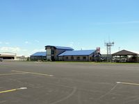
Victor Agababov
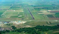
Victor Agababov
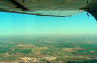
Victor Agababov
| FAA Information Effective | 2026-07-09 |
| Airport Identifier | GXY |
| Airport Status | Operational |
| Longitude/Latitude |
104°37'59.6000"
W /
40°26'14.7000"
N -104.633222 / 40.437417 (Estimated) |
| Elevation | 4696.80 ft / 1431.58 m (Surveyed) |
| Land | 1198 acres |
| From nearest city | 3 nautical miles E of Greeley, CO |
| Location | Weld County, CO |
| Magnetic Variation | 08E (2015) |
| Airport Use | Open to public |
| Wind indicator | Yes |
| Segmented Circle | Yes |
| Control Tower | NON-ATCT |
| Lighting Schedule | SEE RMK |
| Beacon Color | White-Green (lighted land airport) |
| Landing fee charge | No |
| Sectional chart | CHEYENNE |
| Region | ANM - Northwest Mountain |
| Traffic Pattern Alt | 800 ft |
| Responsible ARTCC | ZDV - DENVER |
| Tie-in FSS | DEN - DENVER |
| FSS on Airport | No |
| FSS Toll Free | 1-800-WX-BRIEF |
| NOTAMs Facility | GXY (NOTAM-d service available) |
Runway 10/28
| Dimensions | 5801 x 100 ft (1768 x 30 m) |
| Surface | ASPH (EXCELLENT) |
| Surface treatment | |
| Edge lights | Medium |
| 10 | 28 | |
|---|---|---|
| Alignment | 105° | 285° |
| Physical elevation | 4661.20 ft | 4644.80 ft |
| Coordinates | 40.430687 / -104.646116 | 40.426454 / -104.626035 |
| Traffic pattern | Left | Right |
| Runway marking | Precision instrument , Good Condition | Precision instrument , Good Condition |
| VGSI | 2-light PAPI on left | 4-box on left |
| Runway end lights | Yes | Yes |
Runway 17/35
| Dimensions | 10000 x 100 ft (3048 x 30 m) |
| Surface | ASPH (GOOD) |
| Surface treatment | |
| Edge lights | Medium |
| 17 | 35 | |
|---|---|---|
| Alignment | 177° | 357° |
| Physical elevation | 4696.80 ft | 4648.50 ft |
| Coordinates | 40.456249 / -104.632237 | 40.428826 / -104.630863 |
| Traffic pattern | Left | Left |
| Runway marking | Precision instrument , Good Condition | Precision instrument , Good Condition |
| ILS type | ILS/DME | |
| VGSI | 2-light PAPI on left | 2-light PAPI on left |
| Runway end lights | Yes | Yes |
Runway H1
| Dimensions | 20 x 20 ft (6 x 6 m) |
| Surface | CONC (GOOD) |
| Surface treatment | |
| Edge lights | PERI |
| H1 | ||
|---|---|---|
| Physical elevation | 4643.00 ft | ft |
| Coordinates | 40.427147 / -104.638033 | 0.000000 / 0.000000 |
| Traffic pattern | Left | Left |
| Runway marking | Basic , Good Condition |
Runway H2
| Dimensions | 20 x 20 ft (6 x 6 m) |
| Surface | CONC (GOOD) |
| Surface treatment | |
| Edge lights | PERI |
| H2 | ||
|---|---|---|
| Physical elevation | 4642.00 ft | ft |
| Coordinates | 40.426892 / -104.636583 | 0.000000 / 0.000000 |
| Traffic pattern | Left | Left |
| Runway marking | None , Poor Condition |
- RWY 17/35 PREFERRED USE WHEN X WIND COMPONENT EXCEEDS 12 KT ON RWY 10/28.
- RWY 35 PREFERRED USE WHEN WIND LESS THAN 5 KNOTS. RWY 35 PREFERRED FOR TGL.
- WILDLIFE & BIRDS ON & INVOF APRT.
- OIL DRILLING RIGS UP TO 120 FT ON AND INVOF ARPT.
- CTN INTENSIVE USAF STUDENT T INVOF COLORADO SPRINGS AND PUEBLO, COLORADO
- ACFT DEPG RWY 28 AVOID SB TURN PR TO XNG RWY 10 THLD.
- CTN EXTENDED TAXI DIST TO RWY 17/35 VIA TWY C1
- TWO HEL PRKG PSN (TDPC MKD) LOCATED ON WEST EDGE OF MAIN APN; NO DESIGNATED HELIPADS.
- TXY PAVEMENT STRENGTH IS LESS THAN PUBLISHED RWY PCR; TWYS CONSIST OF OLDER PAVEMENT AND HAVE NOT BEEN EVALUATED.