Gary/chicago International Airport (GYY)
Gary/chicago International Airport (GYY)
GYY
Gary/chicago International Airport (GYY)
Gary/chicago, IN
Latest photos of Gary/chicago International Airport (GYY)
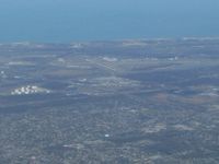
Bob Simmermon
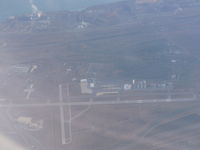
Christian Maurer
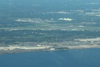
Bob Simmermon
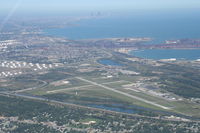
Mark Pasqualino
| FAA Information Effective | 2026-07-09 |
| Airport Identifier | GYY |
| Airport Status | Operational |
| Longitude/Latitude |
87°24'52.3000"
W /
41°37'2.1000"
N -87.414528 / 41.617250 (Estimated) |
| Elevation | 596.80 ft / 181.90 m (Surveyed) |
| Land | 763 acres |
| From nearest city | 3 nautical miles NW of Gary/chicago, IN |
| Location | Lake County, IN |
| Magnetic Variation | 02W (1990) |
| Airport Use | Open to public |
| Wind indicator | Yes |
| Segmented Circle | No |
| Control Tower | ATCT |
| Lighting Schedule | SEE RMK |
| Beacon Color | White-Green (lighted land airport) |
| Landing fee charge | Yes |
| Sectional chart | CHICAGO |
| Region | AGL - Great Lakes |
| Responsible ARTCC | ZAU - CHICAGO |
| Tie-in FSS | HUF - TERRE HAUTE |
| FSS on Airport | No |
| FSS Toll Free | 1-800-WX-BRIEF |
| NOTAMs Facility | GYY (NOTAM-d service available) |
| Certification type/date | 1981/08 |
Runway 02/20
| Dimensions | 3604 x 100 ft (1098 x 30 m) |
| Surface | ASPH (FAIR) |
| Surface treatment | |
| Edge lights | Medium |
| 02 | 20 | |
|---|---|---|
| Alignment | 21° | 201° |
| Physical elevation | 589.10 ft | 589.30 ft |
| Coordinates | 41.612282 / -87.418415 | 41.621504 / -87.413653 |
| Traffic pattern | Left | Left |
| Runway marking | Non-precision instrument , Good Condition | Non-precision instrument , Good Condition |
| VGSI | 2-light PAPI on left | 2-light PAPI on left |
| Runway end lights | Yes | Yes |
| CL lights | No | No |
| TDZ lights | No | No |
Runway 12/30
| Dimensions | 8859 x 150 ft (2700 x 46 m) |
| Surface | CONC (GOOD) |
| Surface treatment | Saw-cut or plastic Grooved |
| Edge lights | High |
| 12 | 30 | |
|---|---|---|
| Alignment | 124° | 304° |
| Physical elevation | 596.80 ft | 591.30 ft |
| Coordinates | 41.624205 / -87.427322 | 41.610554 / -87.400513 |
| Traffic pattern | Left | Left |
| Runway marking | Precision instrument , Good Condition | Precision instrument , Good Condition |
| ILS type | ILS/DME | |
| VGSI | 4-light PAPI on left | 4-light PAPI on left |
| RVR equipment | rollout | touchdown |
| Approach light | MALSR | |
| Runway end lights | Yes | No |
| CL lights | Yes | Yes |
| TDZ lights | No | No |
- BIRDS & WILDLIFE ON & INVOF ARPT.
- UNCTLD VEHICLES N SIDE RAMPS.
- TWY A, A1-A8 & C NORTH OF RWY 12/30 AVBL TO ACR MORE THAN 9 PAX SEATS.
- TWY F MIL USE ONLY.
- LINE OF SIGHT NA BTN INTERSECTING RWY ENDS.
- ARNG: OPS 1230Z-2330Z++ TUES-FRI. MIL F/W OR R/W PRKG OR SVC ON ARNG RAMP 24 HR PPR - 219-977-2017.
- FOR CD WHEN ATCT IS CLSD CTC CHICAGO APCH AT 847-289-0926.