Brookhaven Airport (HWV)
Brookhaven Airport (HWV)
HWV
Brookhaven Airport (HWV)
Shirley, NY
Latest photos of Brookhaven Airport (HWV)
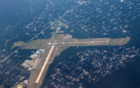
Pete Hughes
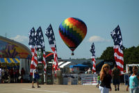
Stephen Amiaga
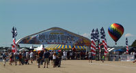
Stephen Amiaga
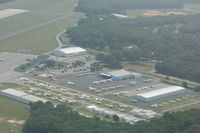
Mark Pasqualino
| FAA Information Effective | 2026-07-09 |
| Airport Identifier | HWV |
| Airport Status | Operational |
| Longitude/Latitude |
72°52'0.8660"
W /
40°49'19.0350"
N -72.866907 / 40.821954 (Estimated) |
| Elevation | 81.30 ft / 24.78 m (Surveyed) |
| Land | 630 acres |
| From nearest city | 1 nautical miles N of Shirley, NY |
| Location | Suffolk County, NY |
| Magnetic Variation | 14W (2000) |
| Airport Use | Open to public |
| Wind indicator | Yes |
| Segmented Circle | Yes |
| Control Tower | NON-ATCT |
| Lighting Schedule | SEE RMK |
| Beacon Color | White-Green (lighted land airport) |
| Landing fee charge | Yes |
| Sectional chart | NEW YORK |
| Region | AEA - Eastern |
| Responsible ARTCC | ZNY - NEW YORK |
| Tie-in FSS | ISP - NEW YORK |
| FSS on Airport | No |
| FSS Toll Free | 1-800-WX-BRIEF |
| NOTAMs Facility | HWV (NOTAM-d service available) |
Runway 06/24
| Dimensions | 4201 x 100 ft (1280 x 30 m) |
| Surface | ASPH (GOOD) |
| Surface treatment | |
| Edge lights | Medium |
| 06 | 24 | |
|---|---|---|
| Alignment | 45° | 225° |
| Physical elevation | 70.00 ft | 81.20 ft |
| Coordinates | 40.821603 / -72.872917 | 40.829756 / -72.862184 |
| Traffic pattern | Left | Left |
| Runway marking | Precision instrument , Fair Condition | Basic , Fair Condition |
| ILS type | ILS | |
| VGSI | 4-box on left | |
| Approach light | MALSR | |
| Runway end lights | No | Yes |
| CL lights | No | No |
| TDZ lights | No | No |
Runway 15/33
| Dimensions | 4222 x 150 ft (1287 x 46 m) |
| Surface | ASPH-CONC (GOOD) |
| Surface treatment | |
| Edge lights | Medium |
| 15 | 33 | |
|---|---|---|
| Alignment | 135° | 315° |
| Physical elevation | 69.40 ft | 60.30 ft |
| Coordinates | 40.822344 / -72.871660 | 40.814150 / -72.860874 |
| Traffic pattern | Left | Left |
| Runway marking | Non-precision instrument , Good Condition | Non-precision instrument , Good Condition |
| VGSI | 2-light PAPI on left | 2-light PAPI on left |
| Runway end lights | Yes | Yes |
| CL lights | No | No |
| TDZ lights | No | No |
- GLIDER OPNS DALGT HOURS.
- OVERNIGHT RAMP PARKING $5.00.
- EXTENSIVE PARACHUTE JUMPING ACTIVITY INVOF ARPT.
- ALL TWY LIGHTS OPR.
- FOR CD CTC NEW YORK APCH AT 516-683-2449 OR 133.2
- TGL ON HOL, WKENDS & NON-DALGT HRS NOT RCMDD.
- RELOCATED THRESHOLD IS TAXIWAY Z1
- DINER/LUNCHEONETTE OPN 7 DAYS/WEEK 0700-1600.
- GLIDERS USE RIGHT TRAFFIC PATTERN FOR RYS 24 & 33; GLIDERS USE LEFT TRAFFIC PATTERN FOR RYS 06 & 15
- UPPER AIR OBSERVATION BALLOONS LAUNCHED 3 MI NORTH OF ARPT 0600 & 1800.
- PILOTS BE AWARE WHEN CONDUCTING PRACTICE ILS APCHS: EXTENSIVE LIGHT ACFT TRAINING ON & INVOF ARPT ALL HRS.
- DEER ALL AREAS OF ARPT ESPECIALLY AT NIGHT.