Lincoln County Regional Airport (IPJ)
Lincoln County Regional Airport (IPJ)
IPJ
Lincoln County Regional Airport (IPJ)
Lincolnton, NC
Latest photos of Lincoln County Regional Airport (IPJ)
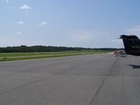
J.B. Barbour

J.B. Barbour
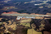
Jamin
| FAA Information Effective | 2026-07-09 |
| Airport Identifier | IPJ |
| Airport Status | Operational |
| Longitude/Latitude |
81°9'41.4200"
W /
35°28'59.3100"
N -81.161506 / 35.483142 (Estimated) |
| Elevation | 877.90 ft / 267.58 m (Surveyed) |
| Land | 453 acres |
| From nearest city | 5 nautical miles E of Lincolnton, NC |
| Location | Lincoln County, NC |
| Magnetic Variation | 06W (1995) |
| Airport Use | Open to public |
| Wind indicator | Yes |
| Segmented Circle | Yes |
| Control Tower | NON-ATCT |
| Lighting Schedule | SEE RMK |
| Beacon Color | White-Green (lighted land airport) |
| Landing fee charge | No |
| Sectional chart | CHARLOTTE |
| Region | ASO - Southern |
| Responsible ARTCC | ZTL - ATLANTA |
| Tie-in FSS | RDU - RALEIGH |
| FSS on Airport | No |
| FSS Toll Free | 1-800-WX-BRIEF |
| NOTAMs Facility | IPJ (NOTAM-d service available) |
Runway 05/23
| Dimensions | 5700 x 100 ft (1737 x 30 m) |
| Surface | ASPH (EXCELLENT) |
| Surface treatment | |
| Edge lights | Medium |
| 05 | 23 | |
|---|---|---|
| Alignment | 47° | 227° |
| Physical elevation | 877.90 ft | 863.10 ft |
| Coordinates | 35.477817 / -81.168525 | 35.488465 / -81.154486 |
| Traffic pattern | Left | Left |
| Runway marking | Precision instrument , Good Condition | Precision instrument , Good Condition |
| ILS type | ILS/DME | |
| VGSI | 2-light PAPI on left | 2-light PAPI on left |
| Runway end lights | Yes | Yes |
- RWY 23 HAS A 90 FT DROP-OFF 100 FT FM PVMT END AND 90 FT DROP-OFF FIRST 200 FT 160 FT BOTH SIDES OF CNTRLN.
- FOR CD IF UNA VIA GCO CTC CHARLOTTE APCH AT 704-359-0241.
- GCO AVBL ON FREQ 124.900 THRU CHARLOTTE APCH; KEY MIKE 4 TIMES SLOWLY, WAIT FOR DIAL TONE AND RING.
- ARPT PHONE NR 704-735-0602.
- DEER, COYOTE & BIRDS ON & INVOF ARPT.