Jacksonville International Airport (JAX)
Jacksonville International Airport (JAX)
JAX
Jacksonville International Airport (JAX)
Jacksonville, FL
Latest photos of Jacksonville International Airport (JAX)
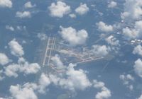
Florida Metal
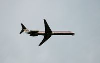
scotch-canadian
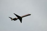
scotch-canadian
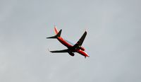
scotch-canadian
| FAA Information Effective | 2026-07-09 |
| Airport Identifier | JAX |
| Airport Status | Operational |
| Longitude/Latitude |
81°41'16.2480"
W /
30°29'38.5640"
N -81.687847 / 30.494046 (Estimated) |
| Elevation | 29.60 ft / 9.02 m (Surveyed) |
| Land | 7911 acres |
| From nearest city | 9 nautical miles N of Jacksonville, FL |
| Location | Duval County, FL |
| Magnetic Variation | 06W (2010) |
| Airport Use | Open to public |
| Wind indicator | Yes |
| Segmented Circle | Yes |
| Control Tower | ATCT-TRACON |
| Lighting Schedule | SS-SR |
| Beacon Color | White-Green (lighted land airport) |
| Landing fee charge | No |
| Sectional chart | JACKSONVILLE |
| Region | ASO - Southern |
| Responsible ARTCC | ZJX - JACKSONVILLE |
| Tie-in FSS | GNV - GAINESVILLE |
| FSS on Airport | No |
| FSS Toll Free | 1-800-WX-BRIEF |
| NOTAMs Facility | JAX (NOTAM-d service available) |
| Certification type/date | 1973/05 |
Runway 08/26
| Dimensions | 10000 x 150 ft (3048 x 46 m) |
| Surface | CONC (GOOD) |
| Surface treatment | Saw-cut or plastic Grooved |
| Edge lights | High |
| 08 | 26 | |
|---|---|---|
| Alignment | 71° | 251° |
| Physical elevation | 29.40 ft | 26.40 ft |
| Coordinates | 30.496216 / -81.699965 | 30.505372 / -81.670027 |
| Traffic pattern | Left | Left |
| Runway marking | Precision instrument , Fair Condition | Precision instrument , Fair Condition |
| ILS type | ILS | ILS |
| VGSI | 4-light PAPI on left | 4-light PAPI on right |
| RVR equipment | touchdown, midfield, rollout | touchdown, midfield, rollout |
| Approach light | ALSF2 | MALSR |
| Runway end lights | No | |
| CL lights | Yes | Yes |
| TDZ lights | Yes | Yes |
Runway 14/32
| Dimensions | 7701 x 150 ft (2347 x 46 m) |
| Surface | CONC (GOOD) |
| Surface treatment | Saw-cut or plastic Grooved |
| Edge lights | High |
| 14 | 32 | |
|---|---|---|
| Alignment | 131° | 311° |
| Physical elevation | 26.90 ft | 24.00 ft |
| Coordinates | 30.492162 / -81.700837 | 30.478400 / -81.682258 |
| Traffic pattern | Left | Left |
| Runway marking | Precision instrument , Good Condition | Precision instrument , Good Condition |
| ILS type | ILS/DME | |
| VGSI | 4-light PAPI on left | 4-light PAPI on left |
| Approach light | MALSR | |
| Runway end lights | Yes | |
| CL lights | Yes | Yes |
| TDZ lights | Yes |
- BIRD ACTIVITY INVOF ARPT, WILDLIFE PRESENTLY ON AIRFIELD.
- NON-LOAD BEARING ASPHALT ON WEST AIR CARRIER RAMP BTWN OUTER HIGH MAST LIGHTS AND TERMINAL. AIRCRAFT RQRD TO MAINTAIN TAXI OPS OVER CTRLN ON THE AIR CARRIER RAMP.
- PPR FOR HIGH POWER JET ENGINE RUN UPS CTC APT OPS AT 904-741-2020.
- MILITARY: ANG: OPR DAYS VARY. BASE OPS 1130-2100Z++. OFFL BUS ONLY. PPR FOR ALL TRAN AFCT (CALL FANG OPS) DSN 641-7122/40/25,C 904-741-7122/40/25. PPR NEEDED TO PROCD ON TWY M1, M2, M3 FANG MAIN RAMP AND ALERT RAMP. PPR NO RESTRD TO ONLY 1 HR EARLIER OR LTR THAN APVL TIME, BFR/AFT THOSE TIMES THE NO IS NOT VALID. TRAN SVCS UNAVBL. FOR CURRENT BWC CTC SOF (FANG OPS) 251.25. BASH PHASE II 1 NOV THRU 31 MAR FOR MIGRATORY BIRD ACT. FOR MORE DTLD INFO SEE AP/1.
- ARPT CLSD TO ACFT WINGSPAN MORE THAN 171 FT EXC 6 HR PPR 904-741-2020.
- 24 HR PPR FOR ACFT EQUIPPED WITH WEATHER MODIFICATION OR GEOENGINEERING EQPT 904-741-2020.
- PILOTS CONDUCTING EFVS OPS; BE AWARE LED ALS IN USE RWY 14.
- BAK-14 CABLE RAISED FOR TAILHOOK ENGAGEMENT BY TWR ON PILOT REQ ONLY, 1537 FT FM AER 08 AND 1612 FT FM AER 26.
- ARPT CLSD TO INTL GEN AVIATION ARR EXE 6HR PPR ARPT OPS AT 904-741-2020 & CTC U. S. CUSTOMS & SERVICING FBO FOR PROCESSING & INSTRUCTIONS.
- RADIO CONTROLLED ACFT ACTIVITY 3.5 NM 'NNW' OF ARPT.
- SMALL PORTION OF TERMINAL RAMP NOT VISIBLE FM TWR. TWR UNABLE TO DETERMINE IF RAMP IS CLEAR.