Lincoln Airport (LNK)
Lincoln Airport (LNK)
LNK
Lincoln Airport (LNK)
Lincoln, NE
Latest photos of Lincoln Airport (LNK)
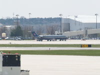
Gary Schenaman
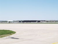
Gary Schenaman
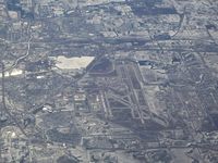
Mark Pasqualino
| FAA Information Effective | 2026-07-09 |
| Airport Identifier | LNK |
| Airport Status | Operational |
| Longitude/Latitude |
96°45'32.8360"
W /
40°51'3.2090"
N -96.759121 / 40.850891 (Estimated) |
| Elevation | 1218.70 ft / 371.46 m (Surveyed) |
| Land | 5000 acres |
| From nearest city | 4 nautical miles NW of Lincoln, NE |
| Location | Lancaster County, NE |
| Magnetic Variation | 03E (2015) |
| Airport Use | Open to public |
| Wind indicator | Yes |
| Segmented Circle | No |
| Control Tower | ATCT |
| Lighting Schedule | SEE RMK |
| Beacon Color | White-Green (lighted land airport) |
| Landing fee charge | No |
| Sectional chart | OMAHA |
| Region | ACE - Central |
| Responsible ARTCC | ZMP - MINNEAPOLIS |
| Tie-in FSS | OLU - COLUMBUS |
| FSS on Airport | No |
| FSS Toll Free | 1-800-WX-BRIEF |
| NOTAMs Facility | LNK (NOTAM-d service available) |
| Certification type/date | 1973/05 |
Runway 14/32
| Dimensions | 8649 x 150 ft (2636 x 46 m) |
| Surface | ASPH (FAIR) |
| Surface treatment | Saw-cut or plastic Grooved |
| Edge lights | Medium |
| 14 | 32 | |
|---|---|---|
| Alignment | 145° | 325° |
| Physical elevation | 1198.90 ft | 1177.70 ft |
| Coordinates | 40.867305 / -96.769676 | 40.847851 / -96.751759 |
| Traffic pattern | Left | Left |
| Runway marking | Non-precision instrument , Good Condition | Non-precision instrument , Good Condition |
| VGSI | 4-light PAPI on left |
4-box on left *VASI UNUSBL BYD 8 DEGS LEFT OF CNTRLN AND 6 DEGS RIGHT OF CNTRLN. |
| Runway end lights | Yes |
Runway 17/35
| Dimensions | 5801 x 100 ft (1768 x 30 m) |
| Surface | ASPH (GOOD) |
| Surface treatment | Saw-cut or plastic Grooved |
| Edge lights | Medium |
| 17 | 35 | |
|---|---|---|
| Alignment | 180° | 360° |
| Physical elevation | 1218.70 ft | 1173.00 ft |
| Coordinates | 40.861342 / -96.750754 | 40.845423 / -96.750857 |
| Traffic pattern | Left | Right |
| Runway marking | Non-precision instrument , Good Condition | Non-precision instrument , Good Condition |
| VGSI | 4-light PAPI on left | 4-light PAPI on left |
| Approach light | ODALS | |
| Runway end lights | Yes | No |
Runway 18/36
| Dimensions | 12901 x 200 ft (3932 x 61 m) |
| Surface | ASPH-CONC (FAIR) |
| Surface treatment | Saw-cut or plastic Grooved |
| Edge lights | High |
| 18 | 36 | |
|---|---|---|
| Alignment | 180° | 360° |
| Physical elevation | 1195.20 ft | 1174.70 ft |
| Coordinates | 40.862992 / -96.761676 | 40.827584 / -96.761905 |
| Traffic pattern | Right | Left |
| Runway marking | Precision instrument , Good Condition | Precision instrument , Good Condition |
| ILS type | ILS | ILS |
| VGSI | 4-light PAPI on left | 4-light PAPI on left |
| RVR equipment | touchdown, rollout | touchdown, rollout |
| Approach light | MALSR | MALSR |
- BIRDS INVOF ARPT.
- ANG: CTC AM OPS 234.65 20 MIN PRIOR TO LDG.
- ANG: PROVISIONAL PORT OF ENTRY: US CUSTOMS AVBL ONLY WITH 24 HR NOTICE AND ONLY FOR DOD AIRCREW AND DOD DUTY PAX ON TRAVEL ORDERS. CTC COMD POST. SPACE-A US CUSTOMS ENTRY TO THE US AT THIS ARPT LIMITED TO ACTIVE DUTY MILITARY PERSONNEL ON LEAVE (NO DEPENDENTS).
- ARNG: OPR 1300-2100Z++ TUE-FRI, LTD TRAN MAINT.
- ARNG: RAMP IS OFFL BUS/PPR TO PRK ARNG RAMP CTC FLT OPS DSN 279-1844, C402-309-1844.
- ENSURE CORRECT RWY LINEUP. RWY 17/35 IS THE SHRTR, PARL RWY ON E SIDE OF ARPT.
- ANG: AM OPS DSN 279-1293; C402-309-1293.
- PPR 24 HRS FOR ACFT PARKING ON THE WEST RAMP - CTC ARPT 402-458-2480.
- ANG: CTC AM OPS 234.65 FOR BWC.
- FOR CD WHEN ATCT IS CLSD CTC OMAHA APCH AT 402-682-4395.
- AF: USAF TMPRY OPS ON WEST RAMP FR APRX SPRING 2021 TO FALL 2022.
- PPR TO PARK ON ANG RAMP.