Lewistown Municipal Airport (LWT)
Lewistown Municipal Airport (LWT)
LWT
Lewistown Municipal Airport (LWT)
Lewistown, MT
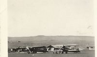
Latest photo of Lewistown Municipal Airport (LWT)
Daniel Ihde
| FAA Information Effective | 2026-07-09 |
| Airport Identifier | LWT |
| Airport Status | Operational |
| Longitude/Latitude |
109°28'0.1000"
W /
47°2'57.3000"
N -109.466694 / 47.049250 (Estimated) |
| Elevation | 4170.40 ft / 1271.14 m (Surveyed) |
| Land | 2200 acres |
| From nearest city | 2 nautical miles SW of Lewistown, MT |
| Location | Fergus County, MT |
| Magnetic Variation | 11E (2020) |
| Airport Use | Open to public |
| Wind indicator | Yes |
| Segmented Circle | Yes |
| Control Tower | NON-ATCT |
| Lighting Schedule | SEE RMK |
| Beacon Color | White-Green (lighted land airport) |
| Landing fee charge | No |
| Sectional chart | GREAT FALLS |
| Region | ANM - Northwest Mountain |
| Responsible ARTCC | ZLC - SALT LAKE CITY |
| Tie-in FSS | GTF - GREAT FALLS |
| FSS Toll Free | 1-800-WX-BRIEF |
| NOTAMs Facility | LWT (NOTAM-d service available) |
Runway 03/21
| Dimensions | 5600 x 101 ft (1707 x 31 m) |
| Surface | ASPH-GRVL (POOR) |
| Surface treatment | |
| PCN | 14 |
| 03 | 21 | |
|---|---|---|
| Alignment | 38° | 218° |
| Physical elevation | 4170.40 ft | 4130.50 ft |
| Coordinates | 47.040375 / -109.480939 | 47.052479 / -109.467129 |
| Traffic pattern | Left | Left |
| Runway marking | Basic , Poor Condition | Basic , Poor Condition |
Runway 08/26
| Dimensions | 6100 x 100 ft (1859 x 30 m) |
| Surface | ASPH (GOOD) |
| Surface treatment | |
| Edge lights | Medium |
| PCN | 18 |
| 08 | 26 | |
|---|---|---|
| Alignment | 90° | 270° |
| Physical elevation | 4127.70 ft | 4111.80 ft |
| Coordinates | 47.053002 / -109.469556 | 47.052997 / -109.445091 |
| Traffic pattern | Left | Left |
| Runway marking | Precision instrument , Good Condition | Precision instrument , Good Condition |
| VGSI | 2-light PAPI on left | 4-box on left |
| Runway end lights | Yes | Yes |
Runway 13/31
| Dimensions | 4102 x 62 ft (1250 x 19 m) |
| Surface | ASPH (GOOD) |
| Surface treatment | |
| Edge lights | Medium |
| PCN | 12 |
| 13 | 31 | |
|---|---|---|
| Alignment | 140° | 320° |
| Physical elevation | 4131.70 ft | 4162.60 ft |
| Coordinates | 47.051822 / -109.475900 | 47.043214 / -109.465318 |
| Traffic pattern | Left | Left |
| Runway marking | Basic , Good Condition | Basic , Good Condition |
- ALL TWYS HAVE REFLECTORS EXCEPT TWY C, E, AND HALF OF A, WHICH ARE LGTD.
- RY 03/21 DAY USE ONLY.
- RWY 03/21 NOT MNTND IN WINTER; RWY 13/31 PLOWED AS NEEDED.
- ARPT SFC CONDS NOT MNTD 1700-0500.
- BIRDS ON AND INVOF AIRPORT.
- FOR CD IF UNA TO CTC ON FSS FREQ, CTC SALT LAKE ARTCC AT 801-320-2568.
- PVD ALL ULTRALIGHTS FLY AT 300'AGL OR LESS WHEN IN CTLZ; AND MAINT A DSTC OF 500' OR GREATER FM THE CL OF ANY ACTV TXY/RWY, EXTD 2 MI FM THE ARPT & TO THE GND ON ANY ACTV RWY; ALL ULTRALIGHTS OPER OFF THE CLSD TXY TO RWY 11/29 ON S END. A LTR OF AGRMT IS FORMULATED BTN ARPT MGR & ZLC.