Mc Clellan Airfield Airport (MCC)
Mc Clellan Airfield Airport (MCC)
MCC
Mc Clellan Airfield Airport (MCC)
Sacramento, CA
Latest photos of Mc Clellan Airfield Airport (MCC)
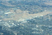
Timothy Aanerud
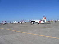
Steve Nation
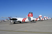
Steve Nation
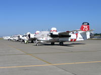
Steve Nation
| FAA Information Effective | 2026-07-09 |
| Airport Identifier | MCC |
| Airport Status | Operational |
| Longitude/Latitude |
121°24'2.2000"
W /
38°40'3.5000"
N -121.400611 / 38.667639 (Estimated) |
| Elevation | 76.80 ft / 23.41 m (Surveyed) |
| From nearest city | 6 nautical miles NE of Sacramento, CA |
| Location | Sacramento County, CA |
| Magnetic Variation | 17E (1975) |
| Airport Use | Open to public |
| Wind indicator | Yes |
| Segmented Circle | Yes |
| Control Tower | NON-ATCT |
| Lighting Schedule | SEE RMK |
| Beacon Color | White-Green (lighted land airport) |
| Landing fee charge | No |
| Sectional chart | SAN FRANCISCO |
| Region | AWP - Western-Pacific |
| Traffic Pattern Alt | 1076 ft |
| Responsible ARTCC | ZOA - OAKLAND |
| Tie-in FSS | RIU - RANCHO MURIETA |
| FSS on Airport | No |
| FSS Toll Free | 1-800-WX-BRIEF |
| NOTAMs Facility | MCC (NOTAM-d service available) |
Runway 16/34
| Dimensions | 10599 x 150 ft (3231 x 46 m) |
| Surface | CONC (GOOD) |
| Surface treatment | Saw-cut or plastic Grooved |
| Edge lights | High |
| 16 | 34 | |
|---|---|---|
| Alignment | 180° | ° |
| Physical elevation | 76.80 ft | 69.90 ft |
| Coordinates | 38.682188 / -121.400577 | 38.653086 / -121.400623 |
| Traffic pattern | Right | Left |
| Runway marking | Precision instrument , Good Condition | Precision instrument , Good Condition |
| ILS type | ILS | ILS |
| VGSI | 4-light PAPI on left | 4-light PAPI on left |
| Approach light | MALSR | |
| Runway end lights | No | No |
| CL lights | No | No |
| TDZ lights | No | No |
Runway H1
| Dimensions | 57 x 57 ft (17 x 17 m) |
| Surface | CONC |
| Surface treatment |
| H1 | ||
|---|---|---|
| Physical elevation | 76.00 ft | ft |
| Coordinates | 38.663064 / -121.397153 | 0.000000 / 0.000000 |
| Traffic pattern | Left | Left |
| Runway marking | Nonstandard |
Runway H2
| Dimensions | 57 x 57 ft (17 x 17 m) |
| Surface | CONC |
| Surface treatment |
| H2 | ||
|---|---|---|
| Physical elevation | 67.00 ft | ft |
| Coordinates | 38.662855 / -121.404376 | 0.000000 / 0.000000 |
| Traffic pattern | Left | Left |
Runway H3
| Dimensions | 57 x 57 ft (17 x 17 m) |
| Surface | ASPH |
| Surface treatment |
| H3 | ||
|---|---|---|
| Physical elevation | 67.00 ft | ft |
| Coordinates | 38.657711 / -121.403883 | 0.000000 / 0.000000 |
| Traffic pattern | Left | Left |
Runway H4
| Dimensions | 57 x 57 ft (17 x 17 m) |
| Surface | CONC |
| Surface treatment |
| H4 | ||
|---|---|---|
| Physical elevation | 68.00 ft | ft |
| Coordinates | 38.652581 / -121.402519 | 0.000000 / 0.000000 |
| Traffic pattern | Left | Left |
- 900 FT ASPH OVRN SE END RY 16 & 1000 FT ASPH OVRN NW END RY 34.
- MILITARY USE: TRAN ACFT PPR FOR USCG RAMP C916-643-7659, WITH CREW LIST FOR ARR/DEP PAX.
- RY 16 CALM WIND RWY.
- TWYS E,F,G NSTD TWY EDGE LGTG.
- FOR CD CTC NORCAL APCH AT 916-361-6874.
- FLD CONDS-RWY, TWY & APRON GOOD.
- STRICT ADHERENCE TO PUBLD TFC PATS RCMD FOR NS ABTMT PURPOSES.
- TOUCH/GO LNDG FOR C5 PROHIBITED.
- DURG INCREASED BIRD CONDITIONS THE POTENTIAL FOR BIRD CONGESTION EXIST AT BOTH ARR/DEP ENDS RY 16/34.
- ALL ACFT EXIT RY TO THE EAST. SELF SRV 100LL W SIDE TW KILO.
- MILITARY USE: FUEL - A+ (MCCLELLAN JET SVC, C916-641-8970.)