Baldwin County Regional Airport (MLJ)
Baldwin County Regional Airport (MLJ)
MLJ
Baldwin County Regional Airport (MLJ)
Milledgeville, GA
Latest photos of Baldwin County Regional Airport (MLJ)
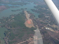
Bob Simmermon
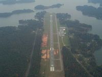
Michael Martin
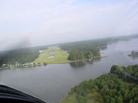
Michael Martin
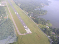
Michael Martin
| FAA Information Effective | 2026-07-09 |
| Airport Identifier | MLJ |
| Airport Status | Operational |
| Longitude/Latitude |
83°14'29.0670"
W /
33°9'15.2120"
N -83.241407 / 33.154226 (Estimated) |
| Elevation | 384.90 ft / 117.32 m (Surveyed) |
| Land | 200 acres |
| From nearest city | 4 nautical miles N of Milledgeville, GA |
| Location | Baldwin County, GA |
| Magnetic Variation | 04W (2000) |
| Airport Use | Open to public |
| Wind indicator | Yes |
| Segmented Circle | Yes |
| Control Tower | NON-ATCT |
| Lighting Schedule | SEE RMK |
| Beacon Color | White-Green (lighted land airport) |
| Landing fee charge | No |
| Sectional chart | ATLANTA |
| Region | ASO - Southern |
| Responsible ARTCC | ZTL - ATLANTA |
| Tie-in FSS | MCN - MACON |
| FSS on Airport | No |
| FSS Toll Free | 1-800-WX-BRIEF |
| NOTAMs Facility | MCN (NOTAM-d service available) |
Runway 10/28
| Dimensions | 5506 x 100 ft (1678 x 30 m) |
| Surface | ASPH (EXCELLENT) |
| Surface treatment | |
| Edge lights | Medium |
| 10 | 28 | |
|---|---|---|
| Alignment | 92° | 272° |
| Physical elevation | 384.90 ft | 358.70 ft |
| Coordinates | 33.154488 / -83.250397 | 33.153963 / -83.232419 |
| Traffic pattern | Left | Left |
| Runway marking | Non-precision instrument , Good Condition | Non-precision instrument , Good Condition |
| VGSI | 2-light PAPI on left | 2-light PAPI on left |
| Approach light | MALSF | |
| Runway end lights | No | Yes |
| CL lights | No | No |
| TDZ lights | No | No |
- DEER, GEESE, COYOTES, AND BIRDS ON AND INVOF ARPT.
- RT - REFER TO FBO FOR PRKG.
- ALL FIXED WING ACFT SHALL LVE PRKG BRAKE OFF IN CASE OF TOWING.
- NO PUB PRKG AT W RAMP AND HNGRS.
- FOR CD CTC ATLANTA APCH AT 678-364-6132, WHEN APCH CLSD CTC ATLANTA ARTCC AT 770-210-7692.
- NO FIXED WING ACFT PRKG WI 100 FT OF FUEL TANK.
- EXTSV FLT TRNG ON AND INVOF ARPT.
- FLW FBO INSTRN FOR PRKG DUE TO TIGHT RAMP AREA.
- BEARS RPRTD W OF RWY, USE CTN.
- EXTSV BIRD ACT NEAR AER 10/28 FEB TO OCT DRG DALGT HRS.
- TPA - LIGHT ACFT 1400 MSL, HEAVY ACFT 1900 MSL.
- AMEL - EXP MARSHALLER UPON ENTERING MAIN RAMP.