Mc Minnville Municipal Airport (MMV)
Mc Minnville Municipal Airport (MMV)
MMV
Mc Minnville Municipal Airport (MMV)
Mc Minnville, OR
Latest photos of Mc Minnville Municipal Airport (MMV)
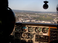
Mike Springs
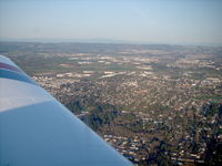
Mike Springs
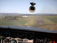
Mike Springs
| FAA Information Effective | 2026-07-09 |
| Airport Identifier | MMV |
| Airport Status | Operational |
| Longitude/Latitude |
123°8'9.8440"
W /
45°11'40.3730"
N -123.136068 / 45.194548 (Estimated) |
| Elevation | 162.60 ft / 49.56 m (Surveyed) |
| Land | 650 acres |
| From nearest city | 3 nautical miles SE of Mc Minnville, OR |
| Location | Yamhill County, OR |
| Magnetic Variation | 19E (1990) |
| Airport Use | Open to public |
| Wind indicator | Yes |
| Segmented Circle | Yes |
| Control Tower | NON-ATCT |
| Lighting Schedule | SEE RMK |
| Beacon Color | White-Green (lighted land airport) |
| Landing fee charge | No |
| Sectional chart | SEATTLE |
| Region | ANM - Northwest Mountain |
| Responsible ARTCC | ZSE - SEATTLE |
| Tie-in FSS | MMV - MC MINNVILLE |
| FSS on Airport | No |
| FSS Toll Free | 1-800-WX-BRIEF |
| NOTAMs Facility | MMV (NOTAM-d service available) |
Runway 04/22
| Dimensions | 5420 x 100 ft (1652 x 30 m) |
| Surface | ASPH (EXCELLENT) |
| Surface treatment | |
| Edge lights | High |
| PCN | 35 |
| 04 | 22 | |
|---|---|---|
| Alignment | 57° | 237° |
| Physical elevation | 160.60 ft | 160.70 ft |
| Coordinates | 45.191758 / -123.148180 | 45.199809 / -123.130509 |
| Traffic pattern | Left | Left |
| Runway marking | Non-precision instrument , Good Condition | Precision instrument , Good Condition |
| ILS type | ILS | |
| VGSI | 4-light PAPI on left | 4-light PAPI on left |
| Approach light | MALSR | |
| Runway end lights | Yes |
Runway 17/35
| Dimensions | 4340 x 75 ft (1323 x 23 m) |
| Surface | ASPH (EXCELLENT) |
| Surface treatment |
| 17 | 35 | |
|---|---|---|
| Alignment | 186° | 6° |
| Physical elevation | 160.70 ft | 162.60 ft |
| Coordinates | 45.198923 / -123.131112 | 45.187085 / -123.132837 |
| Traffic pattern | Left | Left |
| Runway marking | Basic , Poor Condition | Basic , Poor Condition |
- NOISE ABATEMENT PROCS IN EFCT. NOISE SENSITIVE AREAS BDR ARPT NORTH ALG HWY 18. AVOID LOW-LEVEL & CONS OVR FLTS OF RESIDENTIAL AREAS SRNDG ARPT WHENEVER PSBL. NIGHTIME TGL OPS DISCOURAGED 0600-1400Z.
- ARPT CLSD AFT HVY SNOW. ARPT COND UNMNT 0100-1600Z DAILY.
- BIRD HAZ: MIGRATORY FLOCKS OF GEESE OCT-MAY. WATERFOWL, DEER, AND OTHER WILDLIFE MAY BE PRESENT ON & INVOF ARPT YEAR AROUND.
- FQT F/W & R/W TRNG ON & INVOF ARPT, INCL R/W ARR AND DEP FM TWY A & TWY D.
- GLIDER OPS RWY 17/35; DALGT WI 8 NM BLW 8000 FT FEB - NOV.
- AFT HRS CALL OUT LIST POSTED ON FBO DOOR & VOICEMAIL.
- FOR CD CTC PORTLAND APCH AT 503-493-7545.
- ESTABD PRIOR TO 1959.