Ocala Intl-jim Taylor Fld Airport (OCF)
Ocala Intl-jim Taylor Fld Airport (OCF)
OCF
Ocala Intl-jim Taylor Fld Airport (OCF)
Ocala, FL
Latest photos of Ocala Intl-jim Taylor Fld Airport (OCF)
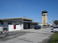
Jack Poelstra

scotch-canadian
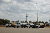
scotch-canadian
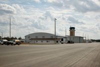
scotch-canadian
| FAA Information Effective | 2026-07-09 |
| Airport Identifier | OCF |
| Airport Status | Operational |
| Longitude/Latitude |
82°13'26.8120"
W /
29°10'18.7550"
N -82.224114 / 29.171876 (Estimated) |
| Elevation | 90.10 ft / 27.46 m (Surveyed) |
| Land | 1532 acres |
| From nearest city | 4 nautical miles W of Ocala, FL |
| Location | Marion County, FL |
| Magnetic Variation | 04W (2000) |
| Airport Use | Open to public |
| Wind indicator | Yes |
| Segmented Circle | Yes |
| Control Tower | ATCT |
| Lighting Schedule | SEE RMK |
| Beacon Color | White-Green (lighted land airport) |
| Landing fee charge | No |
| Sectional chart | JACKSONVILLE |
| Region | ASO - Southern |
| Responsible ARTCC | ZJX - JACKSONVILLE |
| Tie-in FSS | GNV - GAINESVILLE |
| FSS on Airport | No |
| FSS Toll Free | 1-800-WX-BRIEF |
| NOTAMs Facility | OCF (NOTAM-d service available) |
| Certification type/date | 1984/11 |
Runway 08/26
| Dimensions | 3010 x 50 ft (917 x 15 m) |
| Surface | ASPH (GOOD) |
| Surface treatment |
| 08 | 26 | |
|---|---|---|
| Alignment | 80° | 260° |
| Physical elevation | 87.10 ft | 88.00 ft |
| Coordinates | 29.179396 / -82.231404 | 29.180843 / -82.222120 |
| Traffic pattern | Left | Left |
| Runway marking | Basic , Fair Condition | Basic , Fair Condition |
Runway 18/36
| Dimensions | 7468 x 150 ft (2276 x 46 m) |
| Surface | ASPH (GOOD) |
| Surface treatment | Saw-cut or plastic Grooved |
| Edge lights | High |
| 18 | 36 | |
|---|---|---|
| Alignment | 180° | 360° |
| Physical elevation | 80.10 ft | 75.90 ft |
| Coordinates | 29.178822 / -82.223061 | 29.158287 / -82.223034 |
| Traffic pattern | Left | Left |
| Runway marking | Precision instrument , Fair Condition | Precision instrument , Fair Condition |
| ILS type | ILS | |
| VGSI | 4-light PAPI on left | 4-light PAPI on left |
| Approach light | MALSR |
- TWY A1 RSTRD TO ACFT WITH WINGSPAN 60 FT OR LESS.
- OBJECT 2.5 FT AGL LCTD 39 FT NORTH OF TWY A1 CNTRLN.
- RWY 36 RTHL NOT STD.
- RWY 18/36 REDL NOT STD.
- RWY 18 RENL NOT STD.
- RWY 18/36 SAFETY AREA NONSTD IRG SFC FM ONGOING WILDLIFE BURROW MITIGATATION.
- RWY 08/26 SAFETY AREA NONSTD IREG SFC FM ONGOING WILDLIFE BURROW MITIGATATION.
- RWY 18/36 EDGE MARKINGS E SIDE NOT STD BTN TWY A2 AND TWY A6.
- 24 HR PPR FOR ACFT EQUIPPED WITH WEATHER MODIFICATION OR GEOENGINEERING EQPT 352-629-8377.
- ACFT DEP RWY 18 MNTN RWY HDG TO 800 FT AGL OR TIL RCHG END OF RWY WHICHEVER OCRS LTR BFR MAKING LEFT TURNS.
- TWY A1, A8, A9 & A12 E OF TWY A; TWY A NORTH OF TWY A2; CLSD TO ACR.
- CUSTOM SVC UNAVBL.
- SFC CONDS NOT RPRTD 1700-0700L.
- FOR CD IF UNA TO CTC ON FSS FREQ, CTC JACKSONVILLE APCH AT 904-741-0284.