L O Simenstad Municipal Airport (OEO)
L O Simenstad Municipal Airport (OEO)
OEO
L O Simenstad Municipal Airport (OEO)
Osceola, WI
Latest photos of L O Simenstad Municipal Airport (OEO)
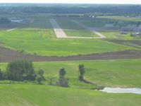
Bob Simmermon
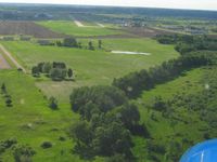
Bob Simmermon
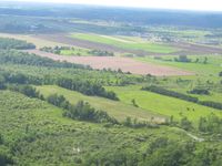
Bob Simmermon
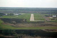
Timothy Aanerud
| FAA Information Effective | 2026-09-03 |
| Airport Identifier | OEO |
| Airport Status | Operational |
| Longitude/Latitude |
92°41'23.6730"
W /
45°18'33.7980"
N -92.689909 / 45.309388 (Estimated) |
| Elevation | 905.60 ft / 276.03 m (Surveyed) |
| Land | 389 acres |
| Location | Polk County, WI |
| Magnetic Variation | 01E (2000) |
| Airport Use | Open to public |
| Wind indicator | Yes |
| Segmented Circle | Yes |
| Control Tower | NON-ATCT |
| Lighting Schedule | SEE RMK |
| Beacon Color | White-Green (lighted land airport) |
| Landing fee charge | No |
| Sectional chart | GREEN BAY |
| Region | AGL - Great Lakes |
| Responsible ARTCC | ZMP - MINNEAPOLIS |
| Tie-in FSS | GRB - GREEN BAY |
| FSS on Airport | No |
| FSS Toll Free | 1-800-WX-BRIEF |
| NOTAMs Facility | OEO (NOTAM-d service available) |
Runway 04/22
| Dimensions | 2065 x 150 ft (629 x 46 m) |
| Surface | TURF (FAIR) |
| Surface treatment |
| 04 | 22 | |
|---|---|---|
| Alignment | 45° | 225° |
| Physical elevation | 882.40 ft | 881.00 ft |
| Coordinates | 45.310209 / -92.697531 | 45.314256 / -92.691920 |
| Traffic pattern | Left | Left |
| Runway end lights | No | No |
| CL lights | No | No |
| TDZ lights | No | No |
Runway 10/28
| Dimensions | 5006 x 75 ft (1526 x 23 m) |
| Surface | ASPH (GOOD) |
| Surface treatment | |
| Edge lights | Medium |
| 10 | 28 | |
|---|---|---|
| Alignment | 104° | 284° |
| Physical elevation | 884.20 ft | 905.40 ft |
| Coordinates | 45.309849 / -92.697371 | 45.306580 / -92.678476 |
| Traffic pattern | Left | Left |
| Runway marking | Non-precision instrument , Good Condition | Non-precision instrument , Good Condition |
| VGSI | 2-light PAPI on left | 4-light PAPI on left |
| Runway end lights | No | Yes |
| CL lights | No | No |
| TDZ lights | No | No |
- RWY 04/22 CLSD TO WHEELED ACFT WHEN COVERED WITH SNOW OR ICE; OPEN TO SKI EQUIPPED ACFT WINTER MONTHS. CTC AMGR 612-308-0647.
- GLIDER & ULTRALIGHT ACTIVITY ON & INVOF ARPT.
- DEER & BIRDS ON & INVOF ARPT.
- FOR CD CTC MINNEAPOLIS APCH AT 612-713-4016.
- GCO AVBL ON FREQ 121.725 MSP CD & FLT SVCS.
- AVOID OVERFLIGHT OF ST CROIX RIVER NATIONAL SCENIC BI-WAY BLW 2000 FT AGL EXC ON TAKEOFF OR LDG.