Ohio State University Airport (OSU)
Ohio State University Airport (OSU)
OSU
Ohio State University Airport (OSU)
Columbus, OH
Latest photos of Ohio State University Airport (OSU)
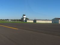
Bob Simmermon
Bob Simmermon
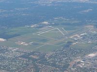
Bob Simmermon
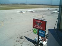
IndyPilot63
| FAA Information Effective | 2026-07-09 |
| Airport Identifier | OSU |
| Airport Status | Operational |
| Longitude/Latitude |
83°4'23.5660"
W /
40°4'46.2560"
N -83.073213 / 40.079516 (Estimated) |
| Elevation | 905.50 ft / 276.00 m (Surveyed) |
| Land | 1080 acres |
| From nearest city | 10 nautical miles NW of Columbus, OH |
| Location | Franklin County, OH |
| Magnetic Variation | 05W (1990) |
| Airport Use | Open to public |
| Wind indicator | Yes |
| Segmented Circle | Yes |
| Control Tower | ATCT |
| Lighting Schedule | SEE RMK |
| Beacon Color | White-Green (lighted land airport) |
| Landing fee charge | No |
| Sectional chart | DETROIT |
| Region | AGL - Great Lakes |
| Responsible ARTCC | ZID - INDIANAPOLIS |
| Tie-in FSS | DAY - DAYTON |
| FSS on Airport | No |
| FSS Toll Free | 1-800-WX-BRIEF |
| NOTAMs Facility | OSU (NOTAM-d service available) |
| Certification type/date | 1975/09 |
Runway 05/23
| Dimensions | 3562 x 100 ft (1086 x 30 m) |
| Surface | ASPH (GOOD) |
| Surface treatment |
| 05 | 23 | |
|---|---|---|
| Alignment | 49° | 229° |
| Physical elevation | 903.10 ft | 892.70 ft |
| Coordinates | 40.076278 / -83.078461 | 40.082725 / -83.068892 |
| Traffic pattern | Left | Left |
| Runway marking | Basic , Good Condition | Basic , Good Condition |
Runway 09L/27R
| Dimensions | 2994 x 100 ft (913 x 30 m) |
| Surface | ASPH (FAIR) |
| Surface treatment | |
| Edge lights | Medium |
| 09L | 27R | |
|---|---|---|
| Alignment | 87° | 267° |
| Physical elevation | 904.30 ft | 891.50 ft |
| Coordinates | 40.082696 / -83.078902 | 40.083114 / -83.068219 |
| Traffic pattern | Left | Left |
| Runway marking | Basic , Good Condition | Basic , Good Condition |
| VGSI | 2-box on left | 2-box on left |
Runway 09R/27L
| Dimensions | 5004 x 100 ft (1525 x 30 m) |
| Surface | ASPH (GOOD) |
| Surface treatment | Saw-cut or plastic Grooved |
| Edge lights | High |
| 09R | 27L | |
|---|---|---|
| Alignment | 87° | 267° |
| Physical elevation | 901.30 ft | 889.60 ft |
| Coordinates | 40.077147 / -83.081603 | 40.077848 / -83.063746 |
| Traffic pattern | Left | Left |
| Runway marking | Precision instrument , Good Condition | Non-precision instrument , Good Condition |
| ILS type | ILS | |
| VGSI | 4-light PAPI on left | 4-light PAPI on left |
| Approach light | MALSR | |
| Runway end lights | Yes |
Runway H1
| Dimensions | 40 x 40 ft (12 x 12 m) |
| Surface | ASPH (GOOD) |
| Surface treatment |
| H1 | ||
|---|---|---|
| Physical elevation | 890.00 ft | ft |
| Coordinates | 40.084797 / -83.068497 | 0.000000 / 0.000000 |
| Traffic pattern | Left | Left |
- NOISE SENSITIVE AREA WITHIN 4 MILES TO THE NORTH AND NORTHEAST. NOISE ABATEMENT RSTRNS: NO TGL OR RPTD TKOF/LNDG 2300-0700 DLY.
- CLSD TO PART 121 SKEDD ACR OPS GTR THAN 9 PAX SEATS; 90 DAY PPR FOR UNSKED ACR OPS GTR THAN 30 PAX SEATS - CALL AMGR.
- BIRDS & DEER ON & INVOF ARPT.
- ALL TWYS NORTH OF RWY 09R/27L CLSD TO UNSKED ACR OPS GTR THAN 30 PAX SEATS.
- SNOW REMOVAL OPERATING PROCEDURES: WHEN TWR CLSD ANNOUNCE ARRS/DEPS ON FREQ 118.8.
- HELIPORT (UNLIT) LOCATED NORTH SIDE AIRFIELD, ADJACENT AIR GUARD RAMP, TWY G.
- HELICOPTER LNDGS/TKFS PROHIBITED ON TWY A AND ALL RAMP AREA SOUTH OF TWY A. HELICOPTERS GROUND TAXI IF CAPABLE ON TWY A ABEAM RAMP.
- SFC CONDS UNMON 2300-0700.
- CLSD RAMP NORTH OF TWY G 24 HR PPR FOR USE (614) 292-5617.
- RWY 05/23 CLSD DLY SS-SR.