St Pete-clearwater International Airport (PIE)
St Pete-clearwater International Airport (PIE)
PIE
St Pete-clearwater International Airport (PIE)
St Petersburg-clearwater, FL
Latest photos of St Pete-clearwater International Airport (PIE)
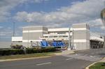
Suncoast Spotter
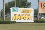
Suncoast Spotter
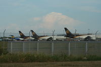
Florida Metal
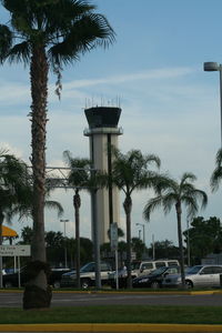
Florida Metal
| FAA Information Effective | 2026-07-09 |
| Airport Identifier | PIE |
| Airport Status | Operational |
| Longitude/Latitude |
82°41'11.4360"
W /
27°54'31.0810"
N -82.686510 / 27.908634 (Estimated) |
| Elevation | 10.70 ft / 3.26 m (Surveyed) |
| Land | 1900 acres |
| From nearest city | 8 nautical miles N of St Petersburg-clearwater, FL |
| Location | Pinellas County, FL |
| Magnetic Variation | 05W (2010) |
| Airport Use | Open to public |
| Wind indicator | Yes |
| Segmented Circle | No |
| Control Tower | ATCT |
| Lighting Schedule | SEE RMK |
| Beacon Color | White-Green (lighted land airport) |
| Landing fee charge | No |
| Sectional chart | MIAMI |
| Region | ASO - Southern |
| Responsible ARTCC | ZMA - MIAMI |
| Tie-in FSS | PIE - SAINT PETERSBURG |
| FSS on Airport | No |
| FSS Toll Free | 1-800-WX-BRIEF |
| NOTAMs Facility | PIE (NOTAM-d service available) |
| Certification type/date | 1974/11 |
Runway 04/22
| Dimensions | 6000 x 150 ft (1829 x 46 m) |
| Surface | ASPH (FAIR) |
| Surface treatment | Saw-cut or plastic Grooved |
| Edge lights | Medium |
| 04 | 22 | |
|---|---|---|
| Alignment | 40° | 220° |
| Physical elevation | 10.70 ft | 5.10 ft |
| Coordinates | 27.899768 / -82.689334 | 27.912460 / -82.677462 |
| Traffic pattern | Left | Left |
| Runway marking | Non-precision instrument , Good Condition | Non-precision instrument , Good Condition |
| VGSI | 4-light PAPI on left | 4-light PAPI on left |
| Runway end lights | Yes | Yes |
Runway 18/36
| Dimensions | 9730 x 150 ft (2966 x 46 m) |
| Surface | ASPH (EXCELLENT) |
| Surface treatment | Saw-cut or plastic Grooved |
| Edge lights | High |
| 18 | 36 | |
|---|---|---|
| Alignment | 171° | 351° |
| Physical elevation | 6.60 ft | 9.80 ft |
| Coordinates | 27.923415 / -82.690705 | 27.896959 / -82.686153 |
| Traffic pattern | Left | Left |
| Runway marking | Precision instrument , Fair Condition | Precision instrument , Fair Condition |
| ILS type | ILS/DME | ILS/DME |
| VGSI | 4-light PAPI on left | 4-light PAPI on left |
| RVR equipment | touchdown, midfield, rollout | touchdown, midfield, rollout |
| Approach light | MALSR | |
| Runway end lights | No | No |
| CL lights | Yes | Yes |
| TDZ lights | Yes | No |
- BANNER TOWING NA.
- BIRDS ON & INVOF ARPT.
- FOR CD IF UNA TO CTC ON FSS FREQ, CTC TAMPA APCH AT 813-878-2528.
- PPR RQRD FOR ALL TRANS ACFT REQUESTING TO PRK ON CLEARWATER USAR MIL RAMP/APRON. MUST CTC CLEARWATER ARMY SUPPORT FAC OPS AT (910)-771-3046 OR ASF MACDILL AT (813)-828-3183/3180 UP TO 7 DAYS BFR ARR. MIN NOTICE IS 24 HOURS BFR ARR. 1000Z-0300Z M-TH OR FRI 1000Z-1830Z EXCLUDING HOLIDAYS & WEEKENDS.
- NOISE SENSITIVE AREA 5 MI N EXTDG 1 MI E & W OF LOC SB TO SHORELINE.
- MILITARY: CONTRACT AVOIL O-128 AVBL.
- TBJT LNDG RWY 18 & DEP RWY 36 USE PUBLD NOISE ABATEMENT PROC.
- LGTS ON HWY N OF ARPT MAY BE MISTAKEN FOR RWY LGTS.