Pueblo Meml Airport (PUB)
Pueblo Meml Airport (PUB)
PUB
Pueblo Meml Airport (PUB)
Pueblo, CO
Latest photos of Pueblo Meml Airport (PUB)
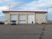
olivier Cortot
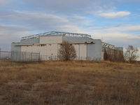
olivier Cortot
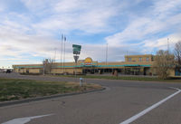
olivier Cortot
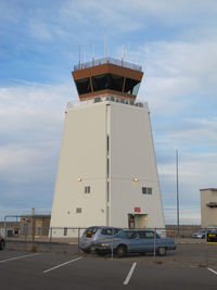
olivier Cortot
| FAA Information Effective | 2026-07-09 |
| Airport Identifier | PUB |
| Airport Status | Operational |
| Longitude/Latitude |
104°29'52.9010"
W /
38°17'23.8110"
N -104.498028 / 38.289947 (Estimated) |
| Elevation | 4729.30 ft / 1441.49 m (Surveyed) |
| Land | 3872 acres |
| From nearest city | 5 nautical miles E of Pueblo, CO |
| Location | Pueblo County, CO |
| Magnetic Variation | 08E (2015) |
| Airport Use | Open to public |
| Wind indicator | Yes |
| Segmented Circle | Yes |
| Control Tower | ATCT |
| Lighting Schedule | SEE RMK |
| Beacon Color | White-Green (lighted land airport) |
| Landing fee charge | No |
| Sectional chart | DENVER |
| Region | ANM - Northwest Mountain |
| Responsible ARTCC | ZDV - DENVER |
| Tie-in FSS | DEN - DENVER |
| FSS on Airport | No |
| FSS Toll Free | 1-800-WX-BRIEF |
| NOTAMs Facility | PUB (NOTAM-d service available) |
| Certification type/date | 1973/05 |
Runway 08L/26R
| Dimensions | 4690 x 75 ft (1430 x 23 m) |
| Surface | ASPH (GOOD) |
| Surface treatment | Saw-cut or plastic Grooved |
| Edge lights | Medium |
| 08L | 26R | |
|---|---|---|
| Alignment | 88° | 268° |
| Physical elevation | 4681.20 ft | 4677.00 ft |
| Coordinates | 38.290086 / -104.510179 | 38.290473 / -104.493851 |
| Traffic pattern | Left | Left |
| Runway marking | Basic , Good Condition | Basic , Good Condition |
| VGSI | 4-light PAPI on left | 4-light PAPI on left |
| Runway end lights | Yes | Yes |
Runway 08R/26L
| Dimensions | 10498 x 150 ft (3200 x 46 m) |
| Surface | ASPH (GOOD) |
| Surface treatment | Saw-cut or plastic Grooved |
| Edge lights | High |
| 08R | 26L | |
|---|---|---|
| Alignment | 88° | 268° |
| Physical elevation | 4669.40 ft | 4648.80 ft |
| Coordinates | 38.287121 / -104.510067 | 38.287987 / -104.473517 |
| Traffic pattern | Right | Left |
| Runway marking | Precision instrument , Good Condition | Precision instrument , Good Condition |
| ILS type | ILS | ILS |
| VGSI | 4-light PAPI on left | 4-light PAPI on left |
| Approach light | MALSR | |
| Runway end lights | No | Yes |
Runway 17/35
| Dimensions | 8310 x 150 ft (2533 x 46 m) |
| Surface | ASPH (GOOD) |
| Surface treatment | Saw-cut or plastic Grooved |
| Edge lights | Medium |
| 17 | 35 | |
|---|---|---|
| Alignment | 178° | 358° |
| Physical elevation | 4729.30 ft | 4648.10 ft |
| Coordinates | 38.304184 / -104.504082 | 38.281381 / -104.503232 |
| Traffic pattern | Left | Left |
| Runway marking | Non-precision instrument , Good Condition | Non-precision instrument , Good Condition |
| VGSI | 4-light PAPI on left | 4-light PAPI on left |
| Runway end lights | Yes | Yes |
- SEE FLIP AP/1 SUPPLEMENTARY ARPT INFO.
- CONDS NOT MNT 2200L-0600L.
- TWY A BTN TWY D AND A6 50 FT WID.
- FOR CD WHEN ATCT CLSD CTC DENVER APCH AT 303-342-1916, WHEN APCH CLSD CTC DENVER ARTCC AT 303-651-4257.
- TXL E 30 FT WIDE BTN TWY E6 AND TWY E7.
- RPD RFL AVBL F/W, R/W DUR FBO HR 0700L-2200L. CTC FBO 719-948-1310 24 HR PN & FREQ 122.95 PRIOR TO LNDG. ADZ ATC FOR RPD RFL OPS & PROCD TO WEST RAMP.
- HIGH VOLUME TRNG DA-20 ACFT SR-SS MON-FRI. OVERHEAD PATTERN DURG TRNG. EXTENSIVE USE OF TRNG AREA 12-28 DME N-SW OF ARPT 500 FT AGL-8500 FT MSL.
- BE ALERT; INTENSIVE USAF STUDENT TRAINING IN VICINITY OF COLORADO SPRINGS & PUEBLO COLORADO.