Riverside Airport (RAL)
Riverside Airport (RAL)
RAL
Riverside Airport (RAL)
Riverside, CA
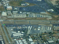
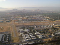
Latest photos of Riverside Airport (RAL)
COOL LAST SAMURAI
Mark Wheeler
Mark Pasqualino
Mark Pasqualino
| FAA Information Effective | 2026-09-03 |
| Airport Identifier | RAL |
| Airport Status | Operational |
| Longitude/Latitude |
117°26'42.4000"
W /
33°57'6.8000"
N -117.445111 / 33.951889 (Estimated) |
| Elevation | 818.90 ft / 249.60 m (Surveyed) |
| Land | 525 acres |
| From nearest city | 4 nautical miles SW of Riverside, CA |
| Location | Riverside County, CA |
| Magnetic Variation | 14E (2000) |
| Airport Use | Open to public |
| Wind indicator | Yes |
| Segmented Circle | Yes |
| Control Tower | ATCT |
| Lighting Schedule | SEE RMK |
| Beacon Color | White-Green (lighted land airport) |
| Landing fee charge | No |
| Sectional chart | LOS ANGELES |
| Region | AWP - Western-Pacific |
| Responsible ARTCC | ZLA - LOS ANGELES |
| Tie-in FSS | RAL - RIVERSIDE |
| FSS on Airport | No |
| FSS Toll Free | 1-800-WX-BRIEF |
| NOTAMs Facility | RAL (NOTAM-d service available) |
Runway 09/27
| Dimensions | 5401 x 100 ft (1646 x 30 m) |
| Surface | ASPH (GOOD) |
| Surface treatment | |
| Edge lights | Medium |
| 09 | 27 | |
|---|---|---|
| Alignment | 103° | 283° |
| Physical elevation | 760.40 ft | 818.60 ft |
| Coordinates | 33.953887 / -117.451969 | 33.950537 / -117.434623 |
| Traffic pattern | Left | Left |
| Runway marking | Precision instrument , Good Condition | Non-precision instrument , Good Condition |
| ILS type | ILS | |
| VGSI | 4-light PAPI on left | 4-light PAPI on left |
| Runway end lights | No | No |
| CL lights | No | No |
| TDZ lights | No | No |
Runway 16/34
| Dimensions | 2850 x 50 ft (869 x 15 m) |
| Surface | ASPH (FAIR) |
| Surface treatment | |
| Edge lights | Medium |
| 16 | 34 | |
|---|---|---|
| Alignment | 179° | 359° |
| Physical elevation | 774.50 ft | 750.60 ft |
| Coordinates | 33.955155 / -117.448638 | 33.947326 / -117.448400 |
| Traffic pattern | Right | Left |
| Runway marking | Basic , Good Condition | Basic , Good Condition |
| VGSI | 2-light PAPI on left | |
| Runway end lights | No | No |
| CL lights | No | No |
| TDZ lights | No | No |
Runway H1
| Dimensions | 60 x 60 ft (18 x 18 m) |
| Surface | ASPH (GOOD) |
| Surface treatment | |
| Edge lights | PERI |
| H1 | ||
|---|---|---|
| Physical elevation | 766.00 ft | ft |
| Coordinates | 33.951756 / -117.447617 | 0.000000 / 0.000000 |
| Traffic pattern | Left | Left |
- ACFT DEP RYS 09 & 27 NOT VSBL TO ACFT AT OTHER END OF RY.
- NUMEROUS POWER LINES 1,780 - 2,887 FEET NORTH OF RY 16 THLD AT OR BLO 80 FEET AGL.
- S 1,400 FT OF RWY 34 & TWY J AND S 500 FT OF TWY B NOT VSB FM TWR.
- TWY E STEEP SLOPE
- TWY L NOT VSB FM TWR.
- FOR CD WHEN ATCT CLSD CTC SOCAL APCH AT 800-448-3724.
- TURBINE ENG ACFT: PREFERRED ROLLING TKOF FOR NOISE MGMT.
- RWY 27 DEP: FOR NOISE MGMT, AFTER DEP TURN RIGHT 10 DEGS; ASSUME CRS AFTER RCHG 1500 MSL.
- NO HIGH PWR ENG MAINT RUNS BTN 2200-0700 LCL.
- FOR NOISE MGMT: NO TURNS BFR ARPT BDRY AND 1500 MSL.
- RWY 27: -20 FT DITCH 50 FT FM RWY 27 THLD.
- POWER PLANT 3,000 FT NORTH OF RY 16 THLD PRODUCING THERMAL PLUME, AVOIDANCE ADZD,