South Bend International Airport (SBN)
South Bend International Airport (SBN)
SBN
South Bend International Airport (SBN)
South Bend, IN
Latest photos of South Bend International Airport (SBN)
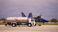
Travis Rader 269-591-0263
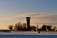
Travis Rader 269-591-0263
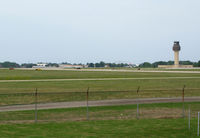
olivier Cortot
Bob Simmermon
| FAA Information Effective | 2026-07-09 |
| Airport Identifier | SBN |
| Airport Status | Operational |
| Longitude/Latitude |
86°19'2.4150"
W /
41°42'29.6060"
N -86.317337 / 41.708224 (Estimated) |
| Elevation | 798.40 ft / 243.35 m (Surveyed) |
| Land | 2200 acres |
| From nearest city | 3 nautical miles NW of South Bend, IN |
| Location | St Joseph County, IN |
| Magnetic Variation | 05W (2025) |
| Airport Use | Open to public |
| Wind indicator | Yes |
| Segmented Circle | No |
| Control Tower | ATCT-TRACON |
| Lighting Schedule | SEE RMK |
| Beacon Color | White-Green (lighted land airport) |
| Sectional chart | CHICAGO |
| Region | AGL - Great Lakes |
| Responsible ARTCC | ZAU - CHICAGO |
| Tie-in FSS | HUF - TERRE HAUTE |
| FSS on Airport | No |
| FSS Toll Free | 1-800-WX-BRIEF |
| NOTAMs Facility | SBN (NOTAM-d service available) |
| Certification type/date | 1973/05 |
Runway 09L/27R
| Dimensions | 4300 x 75 ft (1311 x 23 m) |
| Surface | ASPH (GOOD) |
| Surface treatment | |
| Edge lights | Medium |
| 09L | 27R | |
|---|---|---|
| Alignment | 89° | 269° |
| Physical elevation | 788.00 ft | 780.20 ft |
| Coordinates | 41.713942 / -86.328778 | 41.714193 / -86.313034 |
| Traffic pattern | Left | Left |
| Runway marking | Non-precision instrument , Good Condition | Non-precision instrument , Good Condition |
| VGSI | 2-light PAPI on left | 2-light PAPI on left |
Runway 09R/27L
| Dimensions | 8412 x 150 ft (2564 x 46 m) |
| Surface | ASPH (GOOD) |
| Surface treatment | Saw-cut or plastic Grooved |
| Edge lights | High |
| 09R | 27L | |
|---|---|---|
| Alignment | 89° | 269° |
| Physical elevation | 789.90 ft | 769.00 ft |
| Coordinates | 41.704328 / -86.329416 | 41.704811 / -86.298618 |
| Traffic pattern | Left | Left |
| Runway marking | Precision instrument , Good Condition | Precision instrument , Good Condition |
| ILS type | ILS | ILS |
| VGSI | 4-light PAPI on left | 4-light PAPI on left |
| RVR equipment | touchdown | touchdown, rollout |
| Approach light | MALSF | MALSR |
| Runway end lights | No | No |
| CL lights | No | No |
| TDZ lights | No | No |
Runway 18/36
| Dimensions | 7101 x 150 ft (2164 x 46 m) |
| Surface | ASPH (GOOD) |
| Surface treatment | Saw-cut or plastic Grooved |
| Edge lights | Medium |
| 18 | 36 | |
|---|---|---|
| Alignment | 179° | 359° |
| Physical elevation | 798.40 ft | 759.40 ft |
| Coordinates | 41.718754 / -86.319396 | 41.699272 / -86.318826 |
| Traffic pattern | Left | Left |
| Runway marking | Non-precision instrument , Good Condition | Non-precision instrument , Good Condition |
| VGSI | 4-light PAPI on left | 4-light PAPI on left |
| Runway end lights | No | No |
| CL lights | No | No |
| TDZ lights | No | No |
- BIRDS ON & INVOF ARPT.
- FOR FUEL & SVCS - 122.95 OR 131.7.
- FOR CD CTC SOUTH BEND APCH AT 574-251-2609. WHEN SOUTH BEND APCH CLSD, FOR CD CTC CHICAGO ARTCC AT 630-906-8921.
- ACR RAMP RSTRD TO SKED COML & WINGSPAN GTR THAN 100 FT; ALL OTR 24 HR PPR.
- INDEX C AVAILABLE UPON REQ
- TWYS J, J1 & J2 CLSD INDEF.
- TWY T NOT AVBL TO ACR OPNS WITH MORE THAN 9 PAX SEATS OR UNSKED ACR AT LEAST 31 PAX SEATS.
- LINE OF SIGHT BTN RWY INTS RSTRD.