San Luis Obispo County Regional Airport (SBP)
San Luis Obispo County Regional Airport (SBP)
SBP
San Luis Obispo County Regional Airport (SBP)
San Luis Obispo, CA
Latest photos of San Luis Obispo County Regional Airport (SBP)
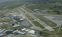
Ken Freeze
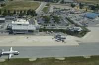
Ken Freeze
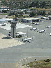
Ken Freeze
| FAA Information Effective | 2026-07-09 |
| Airport Identifier | SBP |
| Airport Status | Operational |
| Longitude/Latitude |
120°38'33.3700"
W /
35°14'14.1810"
N -120.642603 / 35.237273 (Estimated) |
| Elevation | 212.30 ft / 64.71 m (Surveyed) |
| Land | 340 acres |
| From nearest city | 3 nautical miles S of San Luis Obispo, CA |
| Location | San Luis Obispo County, CA |
| Magnetic Variation | 15E (1980) |
| Airport Use | Open to public |
| Wind indicator | Yes |
| Segmented Circle | Yes |
| Control Tower | ATCT |
| Lighting Schedule | SEE RMK |
| Beacon Color | White-Green (lighted land airport) |
| Landing fee charge | No |
| Sectional chart | LOS ANGELES |
| Region | AWP - Western-Pacific |
| Responsible ARTCC | ZLA - LOS ANGELES |
| Tie-in FSS | HHR - HAWTHORNE |
| FSS on Airport | No |
| FSS Toll Free | 1-800-WX-BRIEF |
| NOTAMs Facility | SBP (NOTAM-d service available) |
| Certification type/date | 1980/02 |
Runway 07/25
| Dimensions | 2500 x 100 ft (762 x 30 m) |
| Surface | ASPH (GOOD) |
| Surface treatment |
| 07 | 25 | |
|---|---|---|
| Alignment | 90° | 270° |
| Physical elevation | 162.00 ft | 189.00 ft |
| Coordinates | 35.236861 / -120.650269 | 35.236887 / -120.641899 |
| Traffic pattern | Left | Left |
| Runway marking | Basic , Good Condition | Basic , Good Condition |
| Runway end lights | No | No |
| CL lights | No | No |
| TDZ lights | No | No |
Runway 11/29
| Dimensions | 6101 x 150 ft (1860 x 46 m) |
| Surface | ASPH (GOOD) |
| Surface treatment | Saw-cut or plastic Grooved |
| Edge lights | High |
| 11 | 29 | |
|---|---|---|
| Alignment | 125° | 305° |
| Physical elevation | 161.80 ft | 212.20 ft |
| Coordinates | 35.242215 / -120.649567 | 35.232656 / -120.632787 |
| Traffic pattern | Left | Left |
| Runway marking | Precision instrument , Good Condition | Non-precision instrument , Good Condition |
| ILS type | ILS | |
| VGSI |
4-box on left *RWY 11 VASI UNUSBL BYD 5 DEGS RIGHT OF RWY CNTRLN. |
4-box on left |
| Approach light | MALSR | |
| Runway end lights | No | Yes |
| CL lights | No | No |
| TDZ lights | No | No |
- RECURRING FLOCKS OF WATERFOWL ON AND IN VICINITY OF ARPT DURG WINTER MONTHS.
- TWY A BTN TWYS C AND F WILL BE PDCLY RSTRD FOR ACFT WITH WINGSPAN OF 79 FT OR GTR DRG OPNS ON RWY 11/29.
- TAXILANE WIDTHS LESS THAN STANDARD.
- NOISE SENSITIVE ARPT; TCH 50 FT; FOR NOISE ABATEMENT INFO CTC AMGR (805) 781-5205.
- RY 29 DESIGNATED CALM WIND RY.
- ATCT UNABLE TO SEE ACFT IN HOLDING BAY AT NW END OF TWY A. MOVEMENT FM HOLDING BAY REQUIRES ATCT APVL DURG ATCT HRS.
- TRANSIENT PARKING EXCEEDING 2 HRS CTC FBO EXCEPT FOR AIR CARRIERS.
- PUSHBACK FM TRML GATES AT PILOT'S DISCRETION. DO NOT CALL GND CTL FOR PUSHBACK.
- TWY A RUN-UP AREA FOR RWY 29, JETS USE MNM BREAKAWAY PWR.
- PRIOR TO 15 MAY 1959.