Freeman Municipal Airport (SER)
Freeman Municipal Airport (SER)
SER
Freeman Municipal Airport (SER)
Seymour, IN
Latest photos of Freeman Municipal Airport (SER)
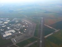
Bob Simmermon
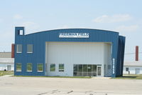
Mark Pasqualino
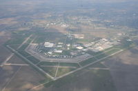
Mark Pasqualino
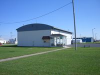
IndyPilot63
| FAA Information Effective | 2026-07-09 |
| Airport Identifier | SER |
| Airport Status | Operational |
| Longitude/Latitude |
85°54'34.9941"
W /
38°55'27.3232"
N -85.909721 / 38.924256 (Estimated) |
| Elevation | 582.70 ft / 177.61 m (Surveyed) |
| Land | 2100 acres |
| From nearest city | 2 nautical miles SW of Seymour, IN |
| Location | Jackson County, IN |
| Magnetic Variation | 02W (1985) |
| Airport Use | Open to public |
| Wind indicator | Yes |
| Segmented Circle | Yes |
| Control Tower | NON-ATCT |
| Lighting Schedule | SEE RMK |
| Beacon Color | White-Green (lighted land airport) |
| Landing fee charge | No |
| Sectional chart | ST LOUIS |
| Region | AGL - Great Lakes |
| Responsible ARTCC | ZID - INDIANAPOLIS |
| Tie-in FSS | HUF - TERRE HAUTE |
| FSS on Airport | No |
| FSS Toll Free | 1-800-WX-BRIEF |
| NOTAMs Facility | HUF (NOTAM-d service available) |
Runway 05/23
| Dimensions | 6001 x 100 ft (1829 x 30 m) |
| Surface | ASPH (GOOD) |
| Surface treatment | Saw-cut or plastic Grooved |
| Edge lights | Medium |
| 05 | 23 | |
|---|---|---|
| Alignment | 44° | 224° |
| Physical elevation | 568.30 ft | 577.70 ft |
| Coordinates | 38.915266 / -85.911071 | 38.927102 / -85.896397 |
| Traffic pattern | Left | Left |
| Runway marking | Non-precision instrument , Good Condition | Non-precision instrument , Good Condition |
| VGSI | 2-light PAPI on left | 2-light PAPI on left |
| Approach light | ODALS | ODALS |
| Runway end lights | Yes | Yes |
| CL lights | No | No |
| TDZ lights | No | No |
Runway 09U/27U
| Dimensions | 1104 x 100 ft (336 x 30 m) |
| Surface | TURF (GOOD) |
| Surface treatment |
| 09U | 27U | |
|---|---|---|
| Alignment | 90° | 270° |
| Physical elevation | 569.30 ft | 565.40 ft |
| Coordinates | 38.935103 / -85.916317 | 38.935142 / -85.912437 |
| Traffic pattern | Left | Left |
Runway 14/32
| Dimensions | 5502 x 100 ft (1677 x 30 m) |
| Surface | ASPH (GOOD) |
| Surface treatment | Saw-cut or plastic Grooved |
| Edge lights | Medium |
| 14 | 32 | |
|---|---|---|
| Alignment | 134° | 314° |
| Physical elevation | 582.70 ft | 570.30 ft |
| Coordinates | 38.928715 / -85.920958 | 38.918202 / -85.907070 |
| Traffic pattern | Left | Left |
| Runway marking | Non-precision instrument , Good Condition | Non-precision instrument , Good Condition |
| VGSI | 2-light PAPI on left | 2-light PAPI on left |
| Runway end lights | Yes | Yes |
| CL lights | No | No |
| TDZ lights | No | No |
Runway 18U/36U
| Dimensions | 1215 x 100 ft (370 x 30 m) |
| Surface | TURF (FAIR) |
| Surface treatment |
| 18U | 36U | |
|---|---|---|
| Alignment | 180° | ° |
| Physical elevation | 569.50 ft | 573.10 ft |
| Coordinates | 38.934826 / -85.915651 | 38.931489 / -85.915582 |
| Traffic pattern | Left | Right |